Property Record
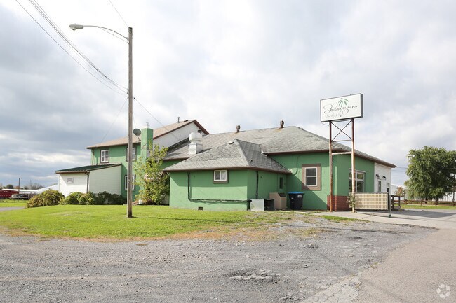
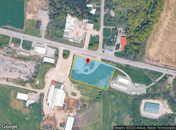
3853 State Route 5 And 20, Canandaigua, NY 14424

NEARBY LISTINGS FOR SALE OR LEASE
-
-
View all Canandaigua listings for sale on LoopNet.com
Property Detail
3853 State Route 5 And 20
Rochester, NY
Ontario
323400-099-000-0002-036-100
New York
Bartavern
36.100
2025
2.38 AC
2024
Outlying Ontario County
051200
Rochester
4,575 SF
DEMOGRAPHICS near 3853 State Route 5 And 20
1 Mile
3 Mile
5 Mile
2024 Total Population
1,049
4,305
20,952
2029 Population
1,017
4,299
21,118
Pop Growth 2024-2029
(3.05%)
(0.14%)
+ 0.79%
Average Age
39
45
46
2024 Total Households
343
1,683
9,051
HH Growth 2024-2029
(4.08%)
+ 0.06%
+ 0.92%
Median Household Inc
$57,173
$76,663
$71,427
Avg Household Size
2.20
2.20
2.10
2024 Avg HH Vehicles
2.00
2.00
2.00
Median Home Value
$95,967
$202,107
$224,447
Median Year Built
1985
1984
1976
Nearby Places
- Restaurants
- Banks
- Shops
- Fitness
- Groceries
PUBLIC TRANSPORTATION
AIRPORT
Frederick Douglass/Greater Rochester International
DRIVE
WALK
Distance
Frederick Douglass/Greater Rochester International
49 min
34.3 mi
Freight Ports
Albany, NY Port
DRIVE
WALK
Distance
Albany, NY Port
250 min
205.9 mi
SALE & LEASE HISTORY
LISTING DATE
SALE/LEASE

Sep 24, 2016
For Sale
Oct 19, 2018
For Sale
Nearby Properties
Address
Land Use
TOTAL SIZE
Lot Size
Zoning
Address
Land Use
TOTAL SIZE
Lot Size
Zoning
Address
Land Use
TOTAL SIZE
Lot Size
Zoning
97.20 AC
R1
Address
Land Use
TOTAL SIZE
Lot Size
Zoning
100,758 SF
5.80 AC
PUD
Address
Land Use
TOTAL SIZE
Lot Size
Zoning
130,803 SF
7.20 AC
C1
Address
Land Use
TOTAL SIZE
Lot Size
Zoning
194,786 SF
17.90 AC
C1
Address
Land Use
TOTAL SIZE
Lot Size
Zoning
3,716 SF
6.60 AC
PR
Address
Land Use
TOTAL SIZE
Lot Size
Zoning
90.40 AC
AG
Address
Land Use
TOTAL SIZE
Lot Size
Zoning
114,533 SF
16.90 AC
C3
Address
Land Use
TOTAL SIZE
Lot Size
Zoning
196,012 SF
17.80 AC
CC
Address
Land Use
TOTAL SIZE
Lot Size
Zoning
135,054 SF
11.80 AC
C1
Address
Land Use
TOTAL SIZE
Lot Size
Zoning
40.30 AC
HDR
Address
Land Use
TOTAL SIZE
Lot Size
Zoning
Address
Land Use
TOTAL SIZE
Lot Size
Zoning
31,442 SF
5.20 AC
C3
Address
Land Use
TOTAL SIZE
Lot Size
Zoning
92,532 SF
10.30 AC
PUD
Address
Land Use
TOTAL SIZE
Lot Size
Zoning
46,480 SF
3.50 AC
CC
Address
Land Use
TOTAL SIZE
Lot Size
Zoning
0.69 AC
IND
Address
Land Use
TOTAL SIZE
Lot Size
Zoning
84,381 SF
7.50 AC
C3
Address
Land Use
TOTAL SIZE
Lot Size
Zoning
6.90 AC
PUD
Address
Land Use
TOTAL SIZE
Lot Size
Zoning
92,494 SF
13.30 AC
C1
Address
Land Use
TOTAL SIZE
Lot Size
Zoning
5,921 SF
6.31 AC
PUD
Address
Land Use
TOTAL SIZE
Lot Size
Zoning
6,760 SF
4.20 AC
C1
Address
Land Use
TOTAL SIZE
Lot Size
Zoning
57,875 SF
6.50 AC
CC
Address
Land Use
TOTAL SIZE
Lot Size
Zoning
10,264 SF
28.30 AC
MUO
Address
Land Use
TOTAL SIZE
Lot Size
Zoning
23,000 SF
1.90 AC
CC
Address
Land Use
TOTAL SIZE
Lot Size
Zoning
48,000 SF
7 AC
R1
Address
Land Use
TOTAL SIZE
Lot Size
Zoning
4,843 SF
18.40 AC
CC M
Address
Land Use
TOTAL SIZE
Lot Size
Zoning
Address
Land Use
TOTAL SIZE
Lot Size
Zoning
44,856 SF
5 AC
C1
Address
Land Use
TOTAL SIZE
Lot Size
Zoning
53,172 SF
5.60 AC
C1
Address
Land Use
TOTAL SIZE
Lot Size
Zoning
3,500 SF
2.10 AC
C3
The World's #1 Commercial Real Estate Marketplace
Connect with us
© 2025 CoStar Group
The information above has been obtained from sources believed reliable. While we do not doubt its accuracy we have not verified it and make no guarantee, warranty or representation about it. It is your responsibility to independently confirm its accuracy and completeness. Any projections, opinions, assumptions, or estimates used are for example only and do not represent the current or future performance of the property. The value of this transaction to you depends on tax and other factors which should be evaluated by your tax, financial, and legal advisors. You and your advisors should conduct a careful, independent investigation of the property to determine to your satisfaction the suitability of the property for your needs.