Property Record
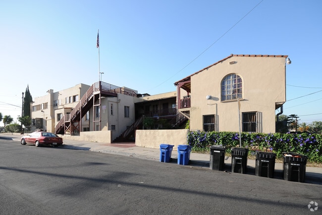
3860 Eagle St, Los Angeles, CA 90063


NEARBY LISTINGS FOR SALE OR LEASE
Property Detail
3860 Eagle St
Los Angeles-Long Beach-Glendale, CA
Ilona Heights Tract
5238-005-001
ILONA HEIGHTS TRACT LOT 38 BLK A
Multifamilydwelling
Los Angeles
X
California
06037C1643F
38
2024
0.18 AC
2025
East Los Angeles
531201
Los Angeles
7,664 SF
DEMOGRAPHICS near 3860 Eagle St
1 Mile
3 Mile
5 Mile
2024 Total Population
45,159
241,346
780,913
2029 Population
43,099
230,355
747,834
Pop Growth 2024-2029
(4.56%)
(4.55%)
(4.24%)
Average Age
36
37
38
2024 Total Households
11,586
67,258
244,558
HH Growth 2024-2029
(4.86%)
(4.76%)
(4.02%)
Median Household Inc
$53,763
$58,021
$59,087
Avg Household Size
3.80
3.40
3.00
2024 Avg HH Vehicles
2.00
2.00
2.00
Median Home Value
$627,536
$663,712
$690,519
Median Year Built
1948
1950
1958
Nearby Places
Map Layers
Map Styles
 Street
 Aerial
- Restaurants
- Banks
- Shops
- Fitness
- Groceries
PUBLIC TRANSPORTATION
TRANSIT/SUBWAY
Indiana (Gold Line - Los Angeles County Metropolitan Transportation Authority (Metro))
DRIVE
WALK
Distance
Indiana (Gold Line - Los Angeles County Metropolitan Transportation Authority (Metro))
2 min
13 min
0.7 mi
COMMUTER RAIL
Union Station (91 Line - Southern California Regional Rail Authority (Metrolink), Antelope Valley Line - Southern California Regional Rail Authority (Metrolink), Orange County Line - Southern California Regional Rail Authority (Metrolink), Riverside Line - Southern California Regional Rail Authority (Metrolink), San Bernardino Line - Southern California Regional Rail Authority (Metrolink), Ventura County Line - Southern California Regional Rail Authority (Metrolink))
DRIVE
WALK
Distance
Union Station (91 Line - Southern California Regional Rail Authority (Metrolink), Antelope Valley Line - Southern California Regional Rail Authority (Metrolink), Orange County Line - Southern California Regional Rail Authority (Metrolink), Riverside Line - Southern California Regional Rail Authority (Metrolink), San Bernardino Line - Southern California Regional Rail Authority (Metrolink), Ventura County Line - Southern California Regional Rail Authority (Metrolink))
11 min
4.1 mi
Cal State La Metrolink Station (Metrolink San Bernardino Line - Metrolink Trains)
DRIVE
WALK
Distance
Cal State La Metrolink Station (Metrolink San Bernardino Line - Metrolink Trains)
13 min
7.9 mi
AIRPORT
Long Beach (Daugherty Field)
DRIVE
WALK
Distance
Long Beach (Daugherty Field)
28 min
17.8 mi
Bob Hope
DRIVE
WALK
Distance
Bob Hope
28 min
19.3 mi
Los Angeles International
DRIVE
WALK
Distance
Los Angeles International
31 min
19.7 mi
Freight Ports
Port of Long Beach
DRIVE
WALK
Distance
Port of Long Beach
30 min
20.6 mi
SALE & LEASE HISTORY
LISTING DATE
SALE/LEASE

Apr 30, 2024
For Sale
Nearby Properties
Address
Land Use
TOTAL SIZE
Lot Size
Zoning
Address
Land Use
TOTAL SIZE
Lot Size
Zoning
635,233 SF
12.02 AC
LAR5
Address
Land Use
TOTAL SIZE
Lot Size
Zoning
513,825 SF
4.28 AC
LAC2
Address
Land Use
TOTAL SIZE
Lot Size
Zoning
444,139 SF
3.63 AC
LAM3
Address
Land Use
TOTAL SIZE
Lot Size
Zoning
534,225 SF
Address
Land Use
TOTAL SIZE
Lot Size
Zoning
479,272 SF
16.14 AC
LAM3
Address
Land Use
TOTAL SIZE
Lot Size
Zoning
1,088,170 SF
15.98 AC
LAM3
Address
Land Use
TOTAL SIZE
Lot Size
Zoning
535,949 SF
5.85 AC
LAM3
Address
Land Use
TOTAL SIZE
Lot Size
Zoning
327,061 SF
2.18 AC
LAM3
Address
Land Use
TOTAL SIZE
Lot Size
Zoning
328,737 SF
7.92 AC
LAC2
Address
Land Use
TOTAL SIZE
Lot Size
Zoning
271,020 SF
18.93 AC
CMM2*
Address
Land Use
TOTAL SIZE
Lot Size
Zoning
354,299 SF
2.18 AC
LAC2
Address
Land Use
TOTAL SIZE
Lot Size
Zoning
150,608 SF
0.88 AC
LAC2
Address
Land Use
TOTAL SIZE
Lot Size
Zoning
693,282 SF
30.34 AC
CMM2*
Address
Land Use
TOTAL SIZE
Lot Size
Zoning
397,866 SF
3.51 AC
LAM3
Address
Land Use
TOTAL SIZE
Lot Size
Zoning
527,173 SF
12.36 AC
CMM2*
Address
Land Use
TOTAL SIZE
Lot Size
Zoning
557,445 SF
14.08 AC
CMM2YY
Address
Land Use
TOTAL SIZE
Lot Size
Zoning
326,472 SF
14.53 AC
VEM*
Address
Land Use
TOTAL SIZE
Lot Size
Zoning
252,559 SF
2.87 AC
LAC2
Address
Land Use
TOTAL SIZE
Lot Size
Zoning
188,319 SF
11.25 AC
VEM&MS1*
Address
Land Use
TOTAL SIZE
Lot Size
Zoning
621,121 SF
13.07 AC
CMM2*
Address
Land Use
TOTAL SIZE
Lot Size
Zoning
172,072 SF
1.82 AC
LAC2
Address
Land Use
TOTAL SIZE
Lot Size
Zoning
841,076 SF
23.77 AC
CMM2*
Address
Land Use
TOTAL SIZE
Lot Size
Zoning
330,904 SF
12.09 AC
VEM*
Address
Land Use
TOTAL SIZE
Lot Size
Zoning
260,714 SF
9.99 AC
VEM*
Address
Land Use
TOTAL SIZE
Lot Size
Zoning
75,589 SF
0.98 AC
LAC2
Address
Land Use
TOTAL SIZE
Lot Size
Zoning
372,634 SF
10.83 AC
VEM*
Address
Land Use
TOTAL SIZE
Lot Size
Zoning
303,030 SF
7.14 AC
CMM2-M1*
Address
Land Use
TOTAL SIZE
Lot Size
Zoning
198,958 SF
7.50 AC
LCM2*
Address
Land Use
TOTAL SIZE
Lot Size
Zoning
500,495 SF
16.23 AC
CMM2*
Address
Land Use
TOTAL SIZE
Lot Size
Zoning
116,109 SF
0.92 AC
LACM
The World's #1 Commercial Real Estate Marketplace
Connect with us
© 2026 CoStar Group
The information above has been obtained from sources believed reliable. While we do not doubt its accuracy we have not verified it and make no guarantee, warranty or representation about it. It is your responsibility to independently confirm its accuracy and completeness. Any projections, opinions, assumptions, or estimates used are for example only and do not represent the current or future performance of the property. The value of this transaction to you depends on tax and other factors which should be evaluated by your tax, financial, and legal advisors. You and your advisors should conduct a careful, independent investigation of the property to determine to your satisfaction the suitability of the property for your needs.