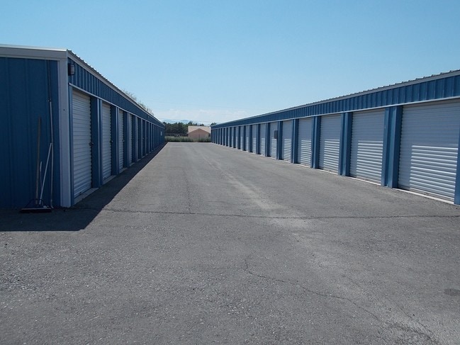
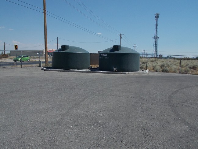
Property Record
3860 Homestead Rd, Pahrump, NV 89048

NEARBY LISTINGS FOR SALE OR LEASE
Property Detail
3860 Homestead Rd
Pahrump, NV
Calvada Valley U.2
041-222-31
T20S R53E S36 P.1 F# 968498 3.32 AC CALVADA VALLEY U.2
Commercialnec
Nye
2024
Nevada
2025
3.32 AC
960409
Carson City/Nevada Area
31,860 SF
Other Market Areas
DEMOGRAPHICS near 3860 Homestead Rd
1 Mile
3 Mile
5 Mile
2024 Total Population
1,480
16,347
29,765
2029 Population
1,696
19,108
34,855
Pop Growth 2024-2029
+ 14.59%
+ 16.89%
+ 17.10%
Average Age
48
49
50
2024 Total Households
582
7,038
12,917
HH Growth 2024-2029
+ 14.78%
+ 17.01%
+ 17.24%
Median Household Inc
$71,699
$58,905
$60,045
Avg Household Size
2.40
2.30
2.20
2024 Avg HH Vehicles
2.00
2.00
2.00
Median Home Value
$322,078
$297,705
$288,702
Median Year Built
2001
2000
2000
Nearby Places
Map Layers
Map Styles
 Street
 Aerial
- Restaurants
- Banks
- Shops
- Fitness
- Groceries
SALE & LEASE HISTORY
LISTING DATE
SALE/LEASE

Jul 24, 2017
For Sale
Nearby Properties
Address
Land Use
TOTAL SIZE
Lot Size
Zoning
Address
Land Use
TOTAL SIZE
Lot Size
Zoning
45,264 SF
280.67 AC
Address
Land Use
TOTAL SIZE
Lot Size
Zoning
16,945 SF
210.63 AC
Address
Land Use
TOTAL SIZE
Lot Size
Zoning
57,213 SF
6.88 AC
GC
Address
Land Use
TOTAL SIZE
Lot Size
Zoning
54,979 SF
11.54 AC
SP
Address
Land Use
TOTAL SIZE
Lot Size
Zoning
25,729 SF
32.26 AC
GC
Address
Land Use
TOTAL SIZE
Lot Size
Zoning
77,352 SF
3.17 AC
GC
Address
Land Use
TOTAL SIZE
Lot Size
Zoning
0.50 AC
VR-20
Address
Land Use
TOTAL SIZE
Lot Size
Zoning
53,707 SF
4.55 AC
Address
Land Use
TOTAL SIZE
Lot Size
Zoning
37,163 SF
3.66 AC
GC
Address
Land Use
TOTAL SIZE
Lot Size
Zoning
0.46 AC
VR-8
Address
Land Use
TOTAL SIZE
Lot Size
Zoning
20,398 SF
4.02 AC
SP
Address
Land Use
TOTAL SIZE
Lot Size
Zoning
16,466 SF
2.15 AC
GC
Address
Land Use
TOTAL SIZE
Lot Size
Zoning
5,806 SF
15.50 AC
SO
Address
Land Use
TOTAL SIZE
Lot Size
Zoning
33,199 SF
4.40 AC
Address
Land Use
TOTAL SIZE
Lot Size
Zoning
12,806 SF
5.39 AC
SP
Address
Land Use
TOTAL SIZE
Lot Size
Zoning
9,590 SF
4.87 AC
GC
Address
Land Use
TOTAL SIZE
Lot Size
Zoning
10,733 SF
33.04 AC
TC
Address
Land Use
TOTAL SIZE
Lot Size
Zoning
14,770 SF
1.10 AC
MU
Address
Land Use
TOTAL SIZE
Lot Size
Zoning
6,300 SF
10.99 AC
CF
Address
Land Use
TOTAL SIZE
Lot Size
Zoning
25,000 SF
4.23 AC
GC
Address
Land Use
TOTAL SIZE
Lot Size
Zoning
10 SF
1.08 AC
SP
Address
Land Use
TOTAL SIZE
Lot Size
Zoning
12.06 AC
GC
Address
Land Use
TOTAL SIZE
Lot Size
Zoning
31,890 SF
10.58 AC
VR-20
Address
Land Use
TOTAL SIZE
Lot Size
Zoning
17,771 SF
2.20 AC
GC
Address
Land Use
TOTAL SIZE
Lot Size
Zoning
11,953 SF
3.83 AC
CF
Address
Land Use
TOTAL SIZE
Lot Size
Zoning
41,448 SF
4.25 AC
GC
Address
Land Use
TOTAL SIZE
Lot Size
Zoning
18,858 SF
4.72 AC
NC
Address
Land Use
TOTAL SIZE
Lot Size
Zoning
24,856 SF
2.19 AC
GC
Address
Land Use
TOTAL SIZE
Lot Size
Zoning
8,737 SF
1.10 AC
MU
The World's #1 Commercial Real Estate Marketplace
Connect with us
© 2025 CoStar Group
The information above has been obtained from sources believed reliable. While we do not doubt its accuracy we have not verified it and make no guarantee, warranty or representation about it. It is your responsibility to independently confirm its accuracy and completeness. Any projections, opinions, assumptions, or estimates used are for example only and do not represent the current or future performance of the property. The value of this transaction to you depends on tax and other factors which should be evaluated by your tax, financial, and legal advisors. You and your advisors should conduct a careful, independent investigation of the property to determine to your satisfaction the suitability of the property for your needs.