Property Record
3865 Liberty Rd S, Salem, OR 97302


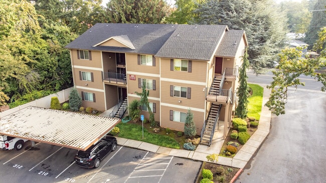

Property Detail
3865 Liberty Rd S
572961
EWALD FRUIT FARMS LOT FR 68,69 ACRES .95
Multifamilydwelling
Marion
RM2
Oregon
B and X Area of moderate flood hazard, usually the area between the limits of the 100-year and 500-year floods.
68,69
2024
0.95 AC
2025
South Salem
002202
Portland
18,339 SF
Salem, OR
NEARBY LISTINGS FOR SALE OR LEASE
DEMOGRAPHICS near 3865 Liberty Rd S
1 mile
3 mile
5 mile
2024 Total Population
14,599
76,871
166,532
2029 Population
14,651
77,755
168,417
Pop Growth 2024-2029
+ 0.36%
+ 1.15%
+ 1.13%
Average Age
41
40
40
2024 Total Households
6,096
30,368
61,383
HH Growth 2024-2029
+ 0.51%
+ 1.23%
+ 1.18%
Median Household Inc
$73,275
$81,345
$74,872
Avg Household Size
2.40
2.40
2.50
2024 Avg HH Vehicles
2.00
2.00
2.00
Median Home Value
$451,096
$461,684
$440,240
Median Year Built
1970
1978
1978
Nearby Places
Map Layers
Map Styles
 Street
 Aerial
Transit
 Traffic
 Biking
Places
Listings with unknown addresses are not visible on the map
- Restaurants
- Banks
- Shops
- Fitness
- Groceries
PUBLIC TRANSPORTATION
COMMUTER RAIL
Salem (Amtrak Cascades - Amtrak, Coast Starlight - Amtrak)
Drive
Walk
Distance
Salem (Amtrak Cascades - Amtrak, Coast Starlight - Amtrak)
6 min
3.2 mi
Freight Ports
Port of Portland
Drive
Walk
Distance
Port of Portland
71 min
54.9 mi
SALE & LEASE HISTORY
LISTING DATE
SALE/LEASE

Sep 23, 2016
For Sale
Oct 04, 2016
For Sale
Nov 09, 2021
For Sale
Nearby Properties
Address
Land Use
TOTAL SIZE
Lot Size
Zoning
Address
Land Use
TOTAL SIZE
Lot Size
Zoning
978,999 SF
25.74 AC
PE
Address
Land Use
TOTAL SIZE
Lot Size
Zoning
120,642 SF
4 AC
CB
Address
Land Use
TOTAL SIZE
Lot Size
Zoning
166,344 SF
1.70 AC
PM
Address
Land Use
TOTAL SIZE
Lot Size
Zoning
183,400 SF
7.17 AC
PE; CB
Address
Land Use
TOTAL SIZE
Lot Size
Zoning
137,002 SF
6.27 AC
PE
Address
Land Use
TOTAL SIZE
Lot Size
Zoning
158,880 SF
8.80 AC
RM2; RM1;
Address
Land Use
TOTAL SIZE
Lot Size
Zoning
122,333 SF
0.48 AC
CB
Address
Land Use
TOTAL SIZE
Lot Size
Zoning
98,733 SF
1.13 AC
CB
Address
Land Use
TOTAL SIZE
Lot Size
Zoning
77,198 SF
1.71 AC
PM
Address
Land Use
TOTAL SIZE
Lot Size
Zoning
209,780 SF
19.85 AC
IC
Address
Land Use
TOTAL SIZE
Lot Size
Zoning
170,756 SF
2.65 AC
PS
Address
Land Use
TOTAL SIZE
Lot Size
Zoning
62,708 SF
30.21 AC
PH
Address
Land Use
TOTAL SIZE
Lot Size
Zoning
114,647 SF
5.72 AC
RM2; RM1
Address
Land Use
TOTAL SIZE
Lot Size
Zoning
102,124 SF
10.53 AC
CR
Address
Land Use
TOTAL SIZE
Lot Size
Zoning
1,769,016 SF
20.58 AC
CR
Address
Land Use
TOTAL SIZE
Lot Size
Zoning
108,723 SF
7.12 AC
IC
Address
Land Use
TOTAL SIZE
Lot Size
Zoning
204,178 SF
10.43 AC
RM2; PA
Address
Land Use
TOTAL SIZE
Lot Size
Zoning
514,875 SF
28.02 AC
IG
Address
Land Use
TOTAL SIZE
Lot Size
Zoning
144,782 SF
1.24 AC
CB
Address
Land Use
TOTAL SIZE
Lot Size
Zoning
322,533 SF
12.91 AC
RH
Address
Land Use
TOTAL SIZE
Lot Size
Zoning
140,505 SF
5.84 AC
RM2; RS
Address
Land Use
TOTAL SIZE
Lot Size
Zoning
74,710 SF
9.83 AC
PS
Address
Land Use
TOTAL SIZE
Lot Size
Zoning
72,325 SF
7.79 AC
IBC
Address
Land Use
TOTAL SIZE
Lot Size
Zoning
92,268 SF
1.41 AC
CB
Address
Land Use
TOTAL SIZE
Lot Size
Zoning
0.78 AC
PS
Address
Land Use
TOTAL SIZE
Lot Size
Zoning
143,684 SF
9.43 AC
CR; RS
Address
Land Use
TOTAL SIZE
Lot Size
Zoning
140,000 SF
1.13 AC
CB
Address
Land Use
TOTAL SIZE
Lot Size
Zoning
51,478 SF
1.08 AC
CR
Address
Land Use
TOTAL SIZE
Lot Size
Zoning
120,648 SF
16.05 AC
CR
The World's #1 Commercial Real Estate Marketplace
Connect with us
© 2026 CoStar Group
The information above has been obtained from sources believed reliable. While we do not doubt its accuracy we have not verified it and make no guarantee, warranty or representation about it. It is your responsibility to independently confirm its accuracy and completeness. Any projections, opinions, assumptions, or estimates used are for example only and do not represent the current or future performance of the property. The value of this transaction to you depends on tax and other factors which should be evaluated by your tax, financial, and legal advisors. You and your advisors should conduct a careful, independent investigation of the property to determine to your satisfaction the suitability of the property for your needs.