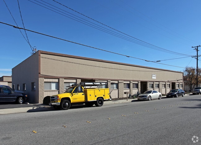
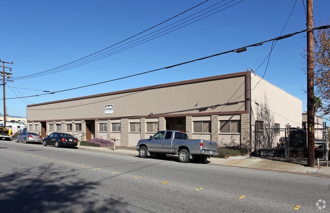
Property Record
388 Dawson Dr, Camarillo, CA 93012

NEARBY LISTINGS FOR SALE OR LEASE
Property Detail
388 Dawson Dr
Oxnard-Thousand Oaks-Ventura, CA
1185
229-0-063-035
TRACT: 118500 LOT: 9 REF: 028MR 032
Industrialgeneral
Ventura
X
California
06111C0933F
9
2024
0.96 AC
2025
Central Ventura
005602
Los Angeles
14,640 SF
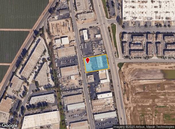
DEMOGRAPHICS near 388 Dawson Dr
1 Mile
3 Mile
5 Mile
2024 Total Population
8,640
64,525
89,277
2029 Population
8,474
63,558
88,010
Pop Growth 2024-2029
(1.92%)
(1.50%)
(1.42%)
Average Age
38
42
43
2024 Total Households
3,058
23,744
32,677
HH Growth 2024-2029
(2.13%)
(1.61%)
(1.51%)
Median Household Inc
$101,622
$107,012
$113,506
Avg Household Size
2.70
2.60
2.60
2024 Avg HH Vehicles
2.00
2.00
2.00
Median Home Value
$716,000
$738,404
$782,816
Median Year Built
1997
1978
1981
Nearby Places
Map Layers
Map Styles
 Street
 Aerial
- Restaurants
- Banks
- Shops
- Fitness
- Groceries
PUBLIC TRANSPORTATION
TRANSIT/SUBWAY
Camarillo (Ventura County Line - Southern California Regional Rail Authority (Metrolink))
DRIVE
WALK
Distance
Camarillo (Ventura County Line - Southern California Regional Rail Authority (Metrolink))
1 min
11 min
0.6 mi
COMMUTER RAIL
Camarillo (Ventura County Line - Southern California Regional Rail Authority (Metrolink))
DRIVE
WALK
Distance
Camarillo (Ventura County Line - Southern California Regional Rail Authority (Metrolink))
2 min
11 min
0.6 mi
Oxnard (Ventura County Line - Southern California Regional Rail Authority (Metrolink))
DRIVE
WALK
Distance
Oxnard (Ventura County Line - Southern California Regional Rail Authority (Metrolink))
15 min
8.9 mi
Freight Ports
The Port of Hueneme
DRIVE
WALK
Distance
The Port of Hueneme
19 min
11.3 mi
SALE & LEASE HISTORY
LISTING DATE
SALE/LEASE

Mar 15, 2023
For Lease
Nearby Properties
Address
Land Use
TOTAL SIZE
Lot Size
Zoning
Address
Land Use
TOTAL SIZE
Lot Size
Zoning
15.13 AC
Address
Land Use
TOTAL SIZE
Lot Size
Zoning
9.66 AC
PO
Address
Land Use
TOTAL SIZE
Lot Size
Zoning
19,288 SF
24.55 AC
CPD
Address
Land Use
TOTAL SIZE
Lot Size
Zoning
10.59 AC
Address
Land Use
TOTAL SIZE
Lot Size
Zoning
72,165 SF
24.05 AC
L-M
Address
Land Use
TOTAL SIZE
Lot Size
Zoning
33,261 SF
36.25 AC
Address
Land Use
TOTAL SIZE
Lot Size
Zoning
67,766 SF
19.31 AC
M2
Address
Land Use
TOTAL SIZE
Lot Size
Zoning
Address
Land Use
TOTAL SIZE
Lot Size
Zoning
45,587 SF
18.30 AC
Address
Land Use
TOTAL SIZE
Lot Size
Zoning
150,320 SF
6.22 AC
Address
Land Use
TOTAL SIZE
Lot Size
Zoning
123,752 SF
5.98 AC
RPD
Address
Land Use
TOTAL SIZE
Lot Size
Zoning
3.31 AC
Address
Land Use
TOTAL SIZE
Lot Size
Zoning
191,193 SF
31.89 AC
M1
Address
Land Use
TOTAL SIZE
Lot Size
Zoning
98,344 SF
7.40 AC
RPD3
Address
Land Use
TOTAL SIZE
Lot Size
Zoning
3.12 AC
Address
Land Use
TOTAL SIZE
Lot Size
Zoning
13.99 AC
Address
Land Use
TOTAL SIZE
Lot Size
Zoning
9.76 AC
Address
Land Use
TOTAL SIZE
Lot Size
Zoning
69,560 SF
3.47 AC
Address
Land Use
TOTAL SIZE
Lot Size
Zoning
39,607 SF
10.81 AC
LM
Address
Land Use
TOTAL SIZE
Lot Size
Zoning
19.69 AC
Address
Land Use
TOTAL SIZE
Lot Size
Zoning
84,518 SF
4.71 AC
RPD
Address
Land Use
TOTAL SIZE
Lot Size
Zoning
48,546 SF
4.01 AC
M1
Address
Land Use
TOTAL SIZE
Lot Size
Zoning
77,837 SF
6.46 AC
Address
Land Use
TOTAL SIZE
Lot Size
Zoning
60,511 SF
2.95 AC
RPD30
Address
Land Use
TOTAL SIZE
Lot Size
Zoning
2.66 AC
Address
Land Use
TOTAL SIZE
Lot Size
Zoning
66,715 SF
4.07 AC
Address
Land Use
TOTAL SIZE
Lot Size
Zoning
120,688 SF
6.44 AC
Address
Land Use
TOTAL SIZE
Lot Size
Zoning
3.08 AC
Address
Land Use
TOTAL SIZE
Lot Size
Zoning
66,716 SF
1.79 AC
Address
Land Use
TOTAL SIZE
Lot Size
Zoning
117,342 SF
7.20 AC
The World's #1 Commercial Real Estate Marketplace
Connect with us
© 2025 CoStar Group
The information above has been obtained from sources believed reliable. While we do not doubt its accuracy we have not verified it and make no guarantee, warranty or representation about it. It is your responsibility to independently confirm its accuracy and completeness. Any projections, opinions, assumptions, or estimates used are for example only and do not represent the current or future performance of the property. The value of this transaction to you depends on tax and other factors which should be evaluated by your tax, financial, and legal advisors. You and your advisors should conduct a careful, independent investigation of the property to determine to your satisfaction the suitability of the property for your needs.