Property Record
387 Perkins Extended Ext, Memphis, TN 38117
NEARBY LISTINGS FOR SALE OR LEASE
Property Detail
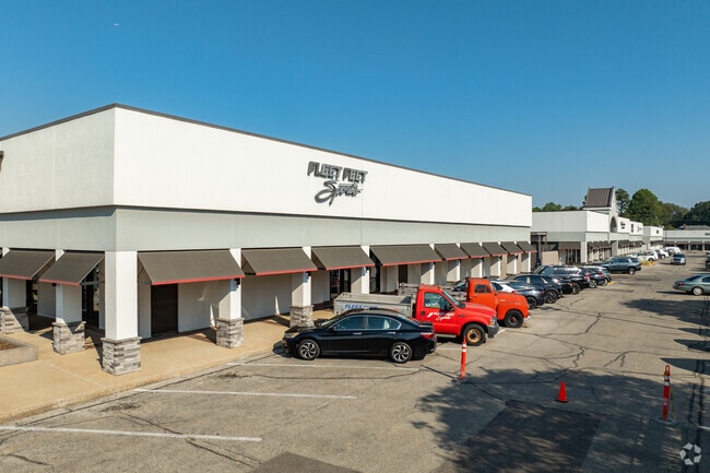
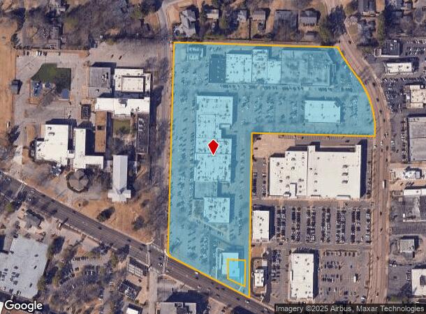
387 Perkins Extended Ext
05-7018-0-0012C
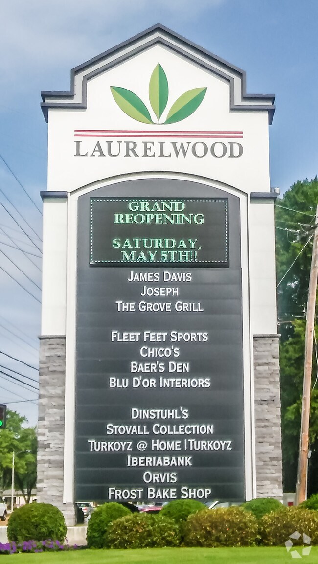
Laurelwood Shopping Center Ph 4
Regionalshoppingcenterormallwithanchorstore
WS PERKINS EXTENDED; NS POPLAR AVE NS COR GROVE PARK (NE)
X
Shelby
47157C0435F
Tennessee
2024
13.64 AC
2025
East
008500
Memphis
230,115 SF
Memphis, TN-MS-AR
DEMOGRAPHICS near 387 Perkins Extended Ext
1 Mile
3 Mile
5 Mile
2024 Total Population
5,652
86,597
231,828
2029 Population
5,516
84,958
229,848
Pop Growth 2024-2029
(2.41%)
(1.89%)
(0.85%)
Average Age
45
38
37
2024 Total Households
2,481
36,973
93,698
HH Growth 2024-2029
(2.54%)
(2.01%)
(0.98%)
Median Household Inc
$115,942
$60,225
$48,338
Avg Household Size
2.20
2.30
2.40
2024 Avg HH Vehicles
2.00
2.00
2.00
Median Home Value
$475,892
$260,854
$203,942
Median Year Built
1963
1957
1962
Nearby Places
Map Layers
Map Styles
 Street
 Aerial
- Restaurants
- Banks
- Shops
- Fitness
- Groceries
PUBLIC TRANSPORTATION
AIRPORT
Memphis International
DRIVE
WALK
Distance
Memphis International
19 min
10.6 mi
Freight Ports
Port of Shreveport
DRIVE
WALK
Distance
Port of Shreveport
1 min
286.3 mi
SALE & LEASE HISTORY
LISTING DATE
SALE/LEASE

Dec 11, 2017
For Lease
Nearby Properties
Address
Land Use
TOTAL SIZE
Lot Size
Zoning
Address
Land Use
TOTAL SIZE
Lot Size
Zoning
218,327 SF
4.89 AC
R-6
Address
Land Use
TOTAL SIZE
Lot Size
Zoning
85,062 SF
8.43 AC
CA
Address
Land Use
TOTAL SIZE
Lot Size
Zoning
101,654 SF
6.61 AC
R-15
Address
Land Use
TOTAL SIZE
Lot Size
Zoning
286,167 SF
18.91 AC
R-10
Address
Land Use
TOTAL SIZE
Lot Size
Zoning
190,263 SF
6.59 AC
R-10
Address
Land Use
TOTAL SIZE
Lot Size
Zoning
45.85 AC
CA
Address
Land Use
TOTAL SIZE
Lot Size
Zoning
118,073 SF
4.75 AC
CMU-1
Address
Land Use
TOTAL SIZE
Lot Size
Zoning
24.72 AC
R-10
Address
Land Use
TOTAL SIZE
Lot Size
Zoning
114,326 SF
1.99 AC
R-6
Address
Land Use
TOTAL SIZE
Lot Size
Zoning
109,774 SF
8.80 AC
CMU-1
Address
Land Use
TOTAL SIZE
Lot Size
Zoning
66,067 SF
3.01 AC
CMU-3
Address
Land Use
TOTAL SIZE
Lot Size
Zoning
145,980 SF
16.50 AC
RU-3
Address
Land Use
TOTAL SIZE
Lot Size
Zoning
104.22 AC
R-15
Address
Land Use
TOTAL SIZE
Lot Size
Zoning
109,308 SF
7.13 AC
OG
Address
Land Use
TOTAL SIZE
Lot Size
Zoning
116,745 SF
10.46 AC
CA
Address
Land Use
TOTAL SIZE
Lot Size
Zoning
123,976 SF
10.31 AC
CMU-3
Address
Land Use
TOTAL SIZE
Lot Size
Zoning
103,252 SF
4.55 AC
OG
Address
Land Use
TOTAL SIZE
Lot Size
Zoning
87,283 SF
2.14 AC
CMU-1
Address
Land Use
TOTAL SIZE
Lot Size
Zoning
76,115 SF
4.94 AC
CMU-3
Address
Land Use
TOTAL SIZE
Lot Size
Zoning
100,182 SF
9.39 AC
CMU-3
Address
Land Use
TOTAL SIZE
Lot Size
Zoning
31.54 AC
CA
Address
Land Use
TOTAL SIZE
Lot Size
Zoning
190,456 SF
13.71 AC
CMU-1
Address
Land Use
TOTAL SIZE
Lot Size
Zoning
105,629 SF
7.67 AC
R-15
Address
Land Use
TOTAL SIZE
Lot Size
Zoning
129 AC
CMP-1
Address
Land Use
TOTAL SIZE
Lot Size
Zoning
181.02 AC
R-15
Address
Land Use
TOTAL SIZE
Lot Size
Zoning
200,040 SF
12 AC
R-10
Address
Land Use
TOTAL SIZE
Lot Size
Zoning
274,100 SF
7.79 AC
CMU-3
Address
Land Use
TOTAL SIZE
Lot Size
Zoning
81,516 SF
2.76 AC
RU-3
Address
Land Use
TOTAL SIZE
Lot Size
Zoning
170,800 SF
4.39 AC
OG
The World's #1 Commercial Real Estate Marketplace
Connect with us
© 2026 CoStar Group
The information above has been obtained from sources believed reliable. While we do not doubt its accuracy we have not verified it and make no guarantee, warranty or representation about it. It is your responsibility to independently confirm its accuracy and completeness. Any projections, opinions, assumptions, or estimates used are for example only and do not represent the current or future performance of the property. The value of this transaction to you depends on tax and other factors which should be evaluated by your tax, financial, and legal advisors. You and your advisors should conduct a careful, independent investigation of the property to determine to your satisfaction the suitability of the property for your needs.