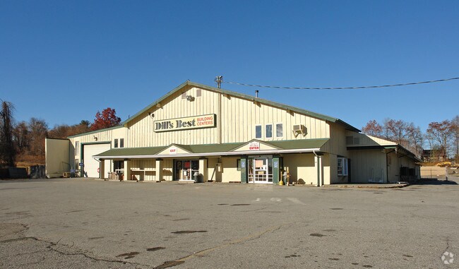
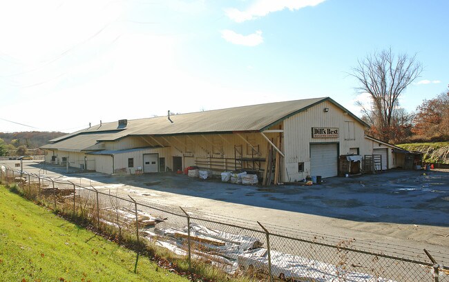
Property Record
387 Route 52, Carmel, NY 10512


NEARBY LISTINGS FOR SALE OR LEASE
Property Detail
387 Route 52
372200-033-018-0001-014-000-0000
Irving Cummings, Nelli Ecummings And Mar
Religious
Putnam
X
New York
36079C0133E
14.00
2024
4.09 AC
2024
Carmel
010400
Westchester/So Connecticut
39,460 SF
Dutchess County-Putnam County, NY
DEMOGRAPHICS near 387 Route 52
1 Mile
3 Mile
5 Mile
2024 Total Population
4,332
18,194
40,279
2029 Population
4,346
18,316
40,415
Pop Growth 2024-2029
+ 0.32%
+ 0.67%
+ 0.34%
Average Age
43
44
43
2024 Total Households
1,660
6,914
14,764
HH Growth 2024-2029
+ 0.36%
+ 0.67%
+ 0.35%
Median Household Inc
$86,718
$87,158
$101,427
Avg Household Size
2.60
2.60
2.70
2024 Avg HH Vehicles
2.00
2.00
2.00
Median Home Value
$335,143
$355,067
$380,917
Median Year Built
1962
1970
1970
Nearby Places
Map Layers
Map Styles
 Street
 Aerial
- Restaurants
- Banks
- Shops
- Fitness
- Groceries
PUBLIC TRANSPORTATION
COMMUTER RAIL
Brewster Station (Harlem Line - Metro-North Commuter Railroad Company (Metro-North))
DRIVE
WALK
Distance
Brewster Station (Harlem Line - Metro-North Commuter Railroad Company (Metro-North))
12 min
6.5 mi
Southeast Station (Harlem Line - Metro-North Commuter Railroad Company (Metro-North))
DRIVE
WALK
Distance
Southeast Station (Harlem Line - Metro-North Commuter Railroad Company (Metro-North))
15 min
6.6 mi
AIRPORT
New York Stewart International
DRIVE
WALK
Distance
New York Stewart International
46 min
32.6 mi
Westchester County
DRIVE
WALK
Distance
Westchester County
45 min
34.1 mi
Freight Ports
Port of New Haven
DRIVE
WALK
Distance
Port of New Haven
78 min
53.8 mi
Nearby Properties
Address
Land Use
TOTAL SIZE
Lot Size
Zoning
Address
Land Use
TOTAL SIZE
Lot Size
Zoning
159,857 SF
12.34 AC
R
Address
Land Use
TOTAL SIZE
Lot Size
Zoning
223,335 SF
27.56 AC
OP2
Address
Land Use
TOTAL SIZE
Lot Size
Zoning
194,344 SF
17.77 AC
CBP
Address
Land Use
TOTAL SIZE
Lot Size
Zoning
150,100 SF
7.52 AC
C
Address
Land Use
TOTAL SIZE
Lot Size
Zoning
Address
Land Use
TOTAL SIZE
Lot Size
Zoning
Address
Land Use
TOTAL SIZE
Lot Size
Zoning
164.46 AC
OP3
Address
Land Use
TOTAL SIZE
Lot Size
Zoning
144,300 SF
25.97 AC
C
Address
Land Use
TOTAL SIZE
Lot Size
Zoning
0.01 AC
OP3
Address
Land Use
TOTAL SIZE
Lot Size
Zoning
Address
Land Use
TOTAL SIZE
Lot Size
Zoning
36,877 SF
65.72 AC
R10
Address
Land Use
TOTAL SIZE
Lot Size
Zoning
69,500 SF
12 AC
CBP
Address
Land Use
TOTAL SIZE
Lot Size
Zoning
116,349 SF
14.49 AC
R4
Address
Land Use
TOTAL SIZE
Lot Size
Zoning
43,175 SF
0.83 AC
C
Address
Land Use
TOTAL SIZE
Lot Size
Zoning
51,648 SF
40 AC
CBP
Address
Land Use
TOTAL SIZE
Lot Size
Zoning
Address
Land Use
TOTAL SIZE
Lot Size
Zoning
64.48 AC
OP3
Address
Land Use
TOTAL SIZE
Lot Size
Zoning
111,450 SF
25.75 AC
CBP
Address
Land Use
TOTAL SIZE
Lot Size
Zoning
40,613 SF
49.91 AC
I
Address
Land Use
TOTAL SIZE
Lot Size
Zoning
49,578 SF
7 AC
SP Z
Address
Land Use
TOTAL SIZE
Lot Size
Zoning
72,040 SF
9.87 AC
I
Address
Land Use
TOTAL SIZE
Lot Size
Zoning
57,311 SF
5.70 AC
C
Address
Land Use
TOTAL SIZE
Lot Size
Zoning
40,000 SF
11.15 AC
CBP
Address
Land Use
TOTAL SIZE
Lot Size
Zoning
49,057 SF
4.70 AC
C
Address
Land Use
TOTAL SIZE
Lot Size
Zoning
150,893 SF
8.77 AC
CBP
Address
Land Use
TOTAL SIZE
Lot Size
Zoning
91,776 SF
34.10 AC
C
Address
Land Use
TOTAL SIZE
Lot Size
Zoning
51,048 SF
32.65 AC
R40
Address
Land Use
TOTAL SIZE
Lot Size
Zoning
48,560 SF
11.83 AC
OP2
Address
Land Use
TOTAL SIZE
Lot Size
Zoning
515.36 AC
NW
Address
Land Use
TOTAL SIZE
Lot Size
Zoning
46,940 SF
4.64 AC
OP1
The World's #1 Commercial Real Estate Marketplace
Connect with us
© 2025 CoStar Group
The information above has been obtained from sources believed reliable. While we do not doubt its accuracy we have not verified it and make no guarantee, warranty or representation about it. It is your responsibility to independently confirm its accuracy and completeness. Any projections, opinions, assumptions, or estimates used are for example only and do not represent the current or future performance of the property. The value of this transaction to you depends on tax and other factors which should be evaluated by your tax, financial, and legal advisors. You and your advisors should conduct a careful, independent investigation of the property to determine to your satisfaction the suitability of the property for your needs.