Property Record
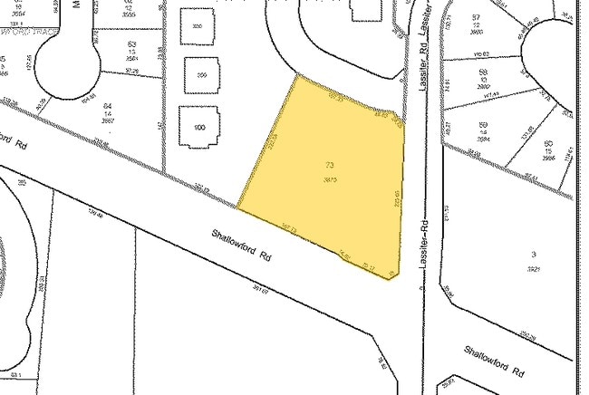
3875 Shallowford Rd, Marietta, GA 30062


NEARBY LISTINGS FOR SALE OR LEASE
Property Detail
3875 Shallowford Rd
Atlanta-Sandy Springs-Roswell, GA
Lassiter Falls
16-0401-0-073-0
UNIT 1 BLDG 100UNIT 2 BLDG 200
Daycare
Cobb
X
Georgia
13057C0375E
778
2025
1.13 AC
2025
East Cobb
030342
Atlanta
20,216 SF
DEMOGRAPHICS near 3875 Shallowford Rd
1 Mile
3 Mile
5 Mile
2024 Total Population
7,705
64,059
173,643
2029 Population
7,750
64,536
178,297
Pop Growth 2024-2029
+ 0.58%
+ 0.74%
+ 2.68%
Average Age
43
41
42
2024 Total Households
2,738
21,451
61,768
HH Growth 2024-2029
+ 0.55%
+ 0.76%
+ 2.91%
Median Household Inc
$153,346
$158,213
$137,138
Avg Household Size
2.80
2.90
2.80
2024 Avg HH Vehicles
2.00
2.00
2.00
Median Home Value
$446,717
$477,215
$444,792
Median Year Built
1984
1985
1986
Nearby Places
Map Layers
Map Styles
 Street
 Aerial
- Restaurants
- Banks
- Shops
- Fitness
- Groceries
PUBLIC TRANSPORTATION
AIRPORT
Hartsfield - Jackson Atlanta International
DRIVE
WALK
Distance
Hartsfield - Jackson Atlanta International
53 min
33.9 mi
Nearby Properties
Address
Land Use
TOTAL SIZE
Lot Size
Zoning
Address
Land Use
TOTAL SIZE
Lot Size
Zoning
118,464 SF
15.73 AC
CRC
Address
Land Use
TOTAL SIZE
Lot Size
Zoning
139,694 SF
16.35 AC
GC/WS
Address
Land Use
TOTAL SIZE
Lot Size
Zoning
113,274 SF
14.30 AC
NRC
Address
Land Use
TOTAL SIZE
Lot Size
Zoning
96,575 SF
14.19 AC
CRC
Address
Land Use
TOTAL SIZE
Lot Size
Zoning
9,840 SF
9.76 AC
CRC
Address
Land Use
TOTAL SIZE
Lot Size
Zoning
41,268 SF
13.78 AC
Address
Land Use
TOTAL SIZE
Lot Size
Zoning
138,200 SF
17.70 AC
CRC/WS
Address
Land Use
TOTAL SIZE
Lot Size
Zoning
90,942 SF
1.33 AC
NRC/WS
Address
Land Use
TOTAL SIZE
Lot Size
Zoning
121,844 SF
17.61 AC
CRC/WS
Address
Land Use
TOTAL SIZE
Lot Size
Zoning
56,868 SF
6.41 AC
CRC
Address
Land Use
TOTAL SIZE
Lot Size
Zoning
105,216 SF
10.42 AC
GC
Address
Land Use
TOTAL SIZE
Lot Size
Zoning
109,792 SF
2.56 AC
CRC
Address
Land Use
TOTAL SIZE
Lot Size
Zoning
33,410 SF
4.54 AC
GC/WS
Address
Land Use
TOTAL SIZE
Lot Size
Zoning
79,905 SF
3.39 AC
NRC
Address
Land Use
TOTAL SIZE
Lot Size
Zoning
56,899 SF
13.85 AC
NRC/R-15
Address
Land Use
TOTAL SIZE
Lot Size
Zoning
2.78 AC
OI
Address
Land Use
TOTAL SIZE
Lot Size
Zoning
46,029 SF
8.10 AC
R-30
Address
Land Use
TOTAL SIZE
Lot Size
Zoning
33.26 AC
R20
Address
Land Use
TOTAL SIZE
Lot Size
Zoning
41,749 SF
3.61 AC
LRC
Address
Land Use
TOTAL SIZE
Lot Size
Zoning
78,906 SF
5.39 AC
CRC
Address
Land Use
TOTAL SIZE
Lot Size
Zoning
90,812 SF
3.10 AC
NRC
Address
Land Use
TOTAL SIZE
Lot Size
Zoning
15,927 SF
2.36 AC
NRC
Address
Land Use
TOTAL SIZE
Lot Size
Zoning
66,166 SF
6.37 AC
Address
Land Use
TOTAL SIZE
Lot Size
Zoning
45.80 AC
R30
Address
Land Use
TOTAL SIZE
Lot Size
Zoning
1,515 SF
13.89 AC
Address
Land Use
TOTAL SIZE
Lot Size
Zoning
190,648 SF
5.10 AC
GC/WS
Address
Land Use
TOTAL SIZE
Lot Size
Zoning
53,622 SF
20.03 AC
E2
Address
Land Use
TOTAL SIZE
Lot Size
Zoning
63,620 SF
9.70 AC
PSC/NS
Address
Land Use
TOTAL SIZE
Lot Size
Zoning
41,366 SF
6.11 AC
E2
Address
Land Use
TOTAL SIZE
Lot Size
Zoning
2,813 SF
18.99 AC
RS87
The World's #1 Commercial Real Estate Marketplace
Connect with us
© 2025 CoStar Group
The information above has been obtained from sources believed reliable. While we do not doubt its accuracy we have not verified it and make no guarantee, warranty or representation about it. It is your responsibility to independently confirm its accuracy and completeness. Any projections, opinions, assumptions, or estimates used are for example only and do not represent the current or future performance of the property. The value of this transaction to you depends on tax and other factors which should be evaluated by your tax, financial, and legal advisors. You and your advisors should conduct a careful, independent investigation of the property to determine to your satisfaction the suitability of the property for your needs.