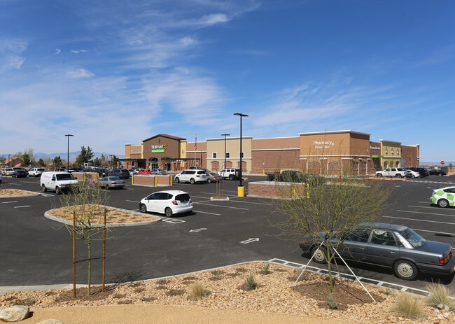
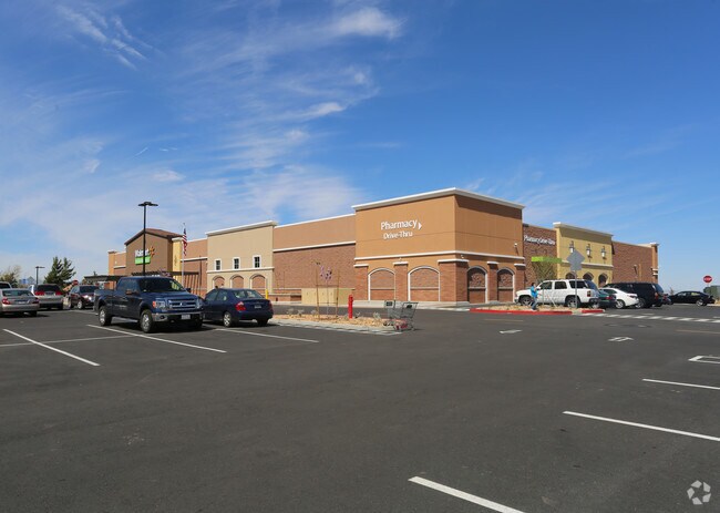
Property Record
3875 W Rancho Vista Blvd, Palmdale, CA 93551

NEARBY LISTINGS FOR SALE OR LEASE
Property Detail
3875 W Rancho Vista Blvd
3001-089-084
P M 377-58-59 LOT 4
Supermarket
Los Angeles
X
California
06037C0652F
4
2024
4.76 AC
2025
Antelope Valley
910216
Los Angeles
41,356 SF
Los Angeles-Long Beach-Glendale, CA
DEMOGRAPHICS near 3875 W Rancho Vista Blvd
1 Mile
3 Mile
5 Mile
2024 Total Population
10,608
46,056
116,990
2029 Population
10,201
44,540
113,503
Pop Growth 2024-2029
(3.84%)
(3.29%)
(2.98%)
Average Age
39
40
39
2024 Total Households
3,250
14,354
38,195
HH Growth 2024-2029
(4.12%)
(3.55%)
(3.20%)
Median Household Inc
$116,683
$105,686
$87,313
Avg Household Size
3.20
3.10
3.00
2024 Avg HH Vehicles
3.00
3.00
2.00
Median Home Value
$463,681
$455,965
$440,097
Median Year Built
1998
1991
1989
Nearby Places
Map Layers
Map Styles
 Street
 Aerial
- Restaurants
- Banks
- Shops
- Fitness
- Groceries
PUBLIC TRANSPORTATION
COMMUTER RAIL
Palmdale (Antelope Valley Line - Southern California Regional Rail Authority (Metrolink))
DRIVE
WALK
Distance
Palmdale (Antelope Valley Line - Southern California Regional Rail Authority (Metrolink))
10 min
5.8 mi
Lancaster (Antelope Valley Line - Southern California Regional Rail Authority (Metrolink))
DRIVE
WALK
Distance
Lancaster (Antelope Valley Line - Southern California Regional Rail Authority (Metrolink))
16 min
9.4 mi
Freight Ports
Port of Long Beach
DRIVE
WALK
Distance
Port of Long Beach
106 min
90.1 mi
Nearby Properties
Address
Land Use
TOTAL SIZE
Lot Size
Zoning
Address
Land Use
TOTAL SIZE
Lot Size
Zoning
449,135 SF
29.76 AC
PDRA
Address
Land Use
TOTAL SIZE
Lot Size
Zoning
66,526 SF
9.12 AC
LAWC
Address
Land Use
TOTAL SIZE
Lot Size
Zoning
69,157 SF
PDSP*
Address
Land Use
TOTAL SIZE
Lot Size
Zoning
57,382 SF
2.52 AC
PDC4*
Address
Land Use
TOTAL SIZE
Lot Size
Zoning
58,043 SF
5.94 AC
PDC3
Address
Land Use
TOTAL SIZE
Lot Size
Zoning
147,297 SF
10.57 AC
POC4
Address
Land Use
TOTAL SIZE
Lot Size
Zoning
68,943 SF
2.72 AC
POC4
Address
Land Use
TOTAL SIZE
Lot Size
Zoning
115,684 SF
10.46 AC
PDRA
Address
Land Use
TOTAL SIZE
Lot Size
Zoning
57,416 SF
10.11 AC
PDA12 1/2*
Address
Land Use
TOTAL SIZE
Lot Size
Zoning
56,101 SF
5.81 AC
PDC2
Address
Land Use
TOTAL SIZE
Lot Size
Zoning
113,847 SF
8.72 AC
PDRA
Address
Land Use
TOTAL SIZE
Lot Size
Zoning
76,512 SF
5.74 AC
PDRA
Address
Land Use
TOTAL SIZE
Lot Size
Zoning
189,762 SF
4.58 AC
PDR3-C1*
Address
Land Use
TOTAL SIZE
Lot Size
Zoning
117,879 SF
9.20 AC
PDRA
Address
Land Use
TOTAL SIZE
Lot Size
Zoning
62,739 SF
18.53 AC
LRA22
Address
Land Use
TOTAL SIZE
Lot Size
Zoning
12.70 AC
PDR4
Address
Land Use
TOTAL SIZE
Lot Size
Zoning
187.05 AC
PDR1-20000
Address
Land Use
TOTAL SIZE
Lot Size
Zoning
13,565 SF
1.14 AC
PDLCC
Address
Land Use
TOTAL SIZE
Lot Size
Zoning
15,040 SF
1.75 AC
PDRA
Address
Land Use
TOTAL SIZE
Lot Size
Zoning
8,366 SF
1.26 AC
POC4
Address
Land Use
TOTAL SIZE
Lot Size
Zoning
23,581 SF
4.81 AC
LRA22*
Address
Land Use
TOTAL SIZE
Lot Size
Zoning
6,540 SF
1 AC
POC4
Address
Land Use
TOTAL SIZE
Lot Size
Zoning
8,383 SF
1.12 AC
PDRA
Address
Land Use
TOTAL SIZE
Lot Size
Zoning
14,180 SF
1.62 AC
PDC4*
Address
Land Use
TOTAL SIZE
Lot Size
Zoning
9,189 SF
1.25 AC
PDRA
Address
Land Use
TOTAL SIZE
Lot Size
Zoning
10,000 SF
1.48 AC
LCC2
Address
Land Use
TOTAL SIZE
Lot Size
Zoning
Address
Land Use
TOTAL SIZE
Lot Size
Zoning
27,564 SF
2.08 AC
PDC2
The World's #1 Commercial Real Estate Marketplace
Connect with us
© 2026 CoStar Group
The information above has been obtained from sources believed reliable. While we do not doubt its accuracy we have not verified it and make no guarantee, warranty or representation about it. It is your responsibility to independently confirm its accuracy and completeness. Any projections, opinions, assumptions, or estimates used are for example only and do not represent the current or future performance of the property. The value of this transaction to you depends on tax and other factors which should be evaluated by your tax, financial, and legal advisors. You and your advisors should conduct a careful, independent investigation of the property to determine to your satisfaction the suitability of the property for your needs.