Property Record
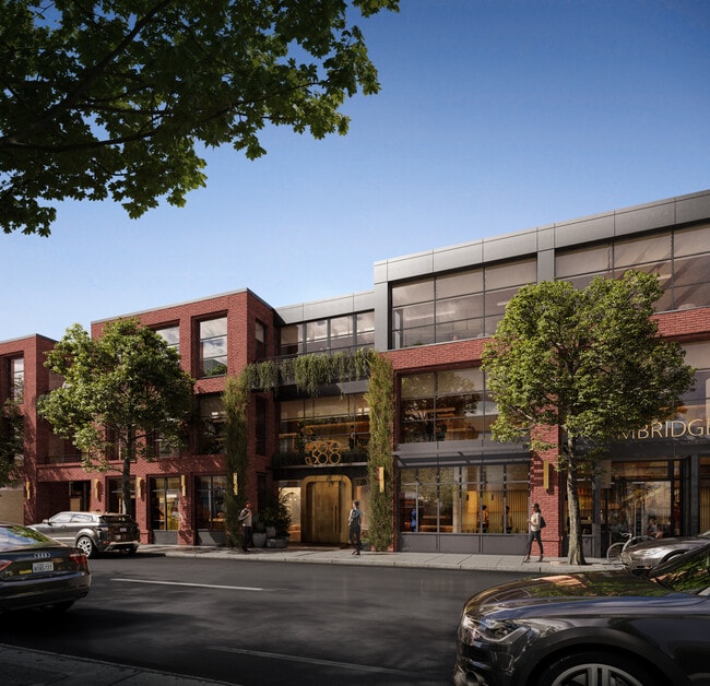
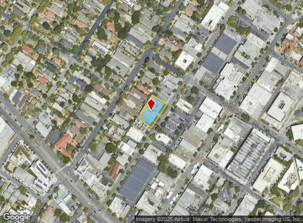
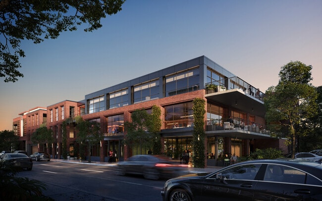
378 Cambridge Ave, Palo Alto, CA 94306

Current Lease Availabilities
NEARBY LISTINGS FOR SALE OR LEASE
Property Detail
378 Cambridge Ave
124-32-073
Evergreen Park
Financialbuilding
Santa Clara
X
California
06081C0320E
0.40 AC
2024
Palo Alto
2025
South Bay/San Jose
511501
San Jose-Sunnyvale-Santa Clara, CA
DEMOGRAPHICS near 378 Cambridge Ave
1 Mile
3 Mile
5 Mile
2024 Total Population
26,577
149,938
281,107
2029 Population
25,952
145,273
271,872
Pop Growth 2024-2029
(2.35%)
(3.11%)
(3.29%)
Average Age
36
39
39
2024 Total Households
9,149
52,949
100,708
HH Growth 2024-2029
(1.99%)
(3.04%)
(3.24%)
Median Household Inc
$127,947
$170,108
$166,477
Avg Household Size
2.30
2.50
2.60
2024 Avg HH Vehicles
1.00
2.00
2.00
Median Home Value
$1,142,873
$1,138,527
$1,134,226
Median Year Built
1973
1967
1968
Nearby Places
Map Layers
Map Styles
 Street
 Aerial
- Restaurants
- Banks
- Shops
- Fitness
- Groceries
PUBLIC TRANSPORTATION
COMMUTER RAIL
DRIVE
WALK
Distance
1 min
6 min
0.3 mi
California Avenue (Caltrain - Caltrain (Caltrain))
DRIVE
WALK
Distance
California Avenue (Caltrain - Caltrain (Caltrain))
2 min
7 min
0.3 mi
AIRPORT
Norman Y Mineta San Jose International
DRIVE
WALK
Distance
Norman Y Mineta San Jose International
23 min
15.0 mi
San Francisco International
DRIVE
WALK
Distance
San Francisco International
33 min
22.9 mi
Metro Oakland International
DRIVE
WALK
Distance
Metro Oakland International
46 min
31.7 mi
Freight Ports
Port of Redwood City
DRIVE
WALK
Distance
Port of Redwood City
18 min
9.8 mi
Nearby Properties
Address
Land Use
TOTAL SIZE
Lot Size
Zoning
Address
Land Use
TOTAL SIZE
Lot Size
Zoning
450,575 SF
3.73 AC
P(9)
Address
Land Use
TOTAL SIZE
Lot Size
Zoning
1,395,540 SF
51.72 AC
C3
Address
Land Use
TOTAL SIZE
Lot Size
Zoning
Address
Land Use
TOTAL SIZE
Lot Size
Zoning
78,277 SF
16.31 AC
RP
Address
Land Use
TOTAL SIZE
Lot Size
Zoning
265,341 SF
13.53 AC
RP
Address
Land Use
TOTAL SIZE
Lot Size
Zoning
918,926 SF
17.54 AC
PC442
Address
Land Use
TOTAL SIZE
Lot Size
Zoning
584,389 SF
5.25 AC
P(40)
Address
Land Use
TOTAL SIZE
Lot Size
Zoning
675,100 SF
52.78 AC
RP5
Address
Land Use
TOTAL SIZE
Lot Size
Zoning
233,124 SF
9.18 AC
P(7)
Address
Land Use
TOTAL SIZE
Lot Size
Zoning
4.13 AC
P39
Address
Land Use
TOTAL SIZE
Lot Size
Zoning
Address
Land Use
TOTAL SIZE
Lot Size
Zoning
458,842 SF
26.64 AC
RP5
Address
Land Use
TOTAL SIZE
Lot Size
Zoning
372,859 SF
4.71 AC
P
Address
Land Use
TOTAL SIZE
Lot Size
Zoning
521,754 SF
46.72 AC
RP
Address
Land Use
TOTAL SIZE
Lot Size
Zoning
322,264 SF
3.92 AC
P
Address
Land Use
TOTAL SIZE
Lot Size
Zoning
212,924 SF
1.83 AC
Address
Land Use
TOTAL SIZE
Lot Size
Zoning
164,853 SF
3.89 AC
Address
Land Use
TOTAL SIZE
Lot Size
Zoning
110,384 SF
10.17 AC
RP
Address
Land Use
TOTAL SIZE
Lot Size
Zoning
145,617 SF
8.24 AC
EA00C1
Address
Land Use
TOTAL SIZE
Lot Size
Zoning
89,237 SF
5.51 AC
P(9)
Address
Land Use
TOTAL SIZE
Lot Size
Zoning
328,024 SF
10.64 AC
Address
Land Use
TOTAL SIZE
Lot Size
Zoning
652,964 SF
14.99 AC
GM
Address
Land Use
TOTAL SIZE
Lot Size
Zoning
516,963 SF
36.46 AC
RP
Address
Land Use
TOTAL SIZE
Lot Size
Zoning
143,429 SF
2.12 AC
Address
Land Use
TOTAL SIZE
Lot Size
Zoning
149,700 SF
2.28 AC
Address
Land Use
TOTAL SIZE
Lot Size
Zoning
113,964 SF
6.28 AC
RP
Address
Land Use
TOTAL SIZE
Lot Size
Zoning
184,142 SF
10.29 AC
RP
Address
Land Use
TOTAL SIZE
Lot Size
Zoning
190,000 SF
3.37 AC
Address
Land Use
TOTAL SIZE
Lot Size
Zoning
129,678 SF
7.17 AC
LMS
Address
Land Use
TOTAL SIZE
Lot Size
Zoning
35,926 SF
6.50 AC
RP5
The World's #1 Commercial Real Estate Marketplace
Connect with us
© 2025 CoStar Group
The information above has been obtained from sources believed reliable. While we do not doubt its accuracy we have not verified it and make no guarantee, warranty or representation about it. It is your responsibility to independently confirm its accuracy and completeness. Any projections, opinions, assumptions, or estimates used are for example only and do not represent the current or future performance of the property. The value of this transaction to you depends on tax and other factors which should be evaluated by your tax, financial, and legal advisors. You and your advisors should conduct a careful, independent investigation of the property to determine to your satisfaction the suitability of the property for your needs.