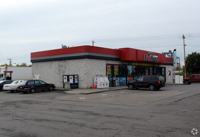
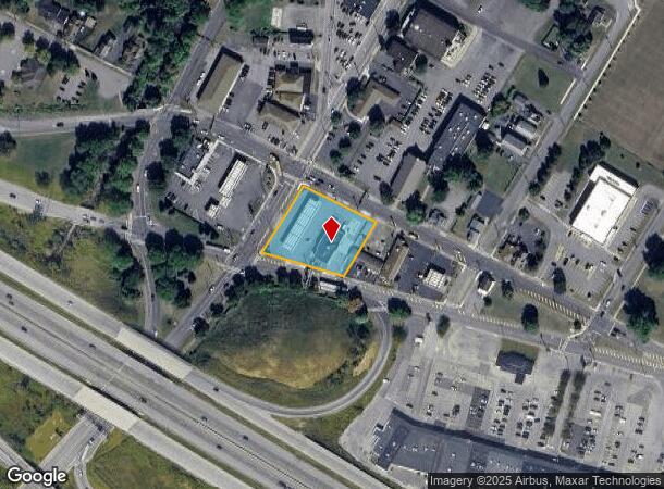
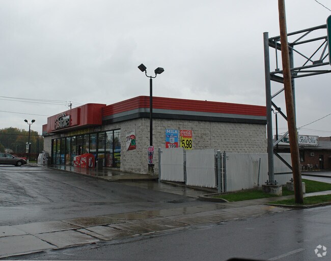
Property Record
388 N Genesee St, Utica, NY 13502
NEARBY LISTINGS FOR SALE OR LEASE
Property Detail
388 N Genesee St
307-013-0002-050-000-0000
7-11- -033 208X200 307.013-0002-050.000/0000
Servicestation
Oneida
X
New York
36065C0752F
50.000
2025
0.96 AC
2024
Utica
980002
Utica/Rome
3,600 SF
Utica-Rome, NY
DEMOGRAPHICS near 388 N Genesee St
1 Mile
3 Mile
5 Mile
2024 Total Population
5,222
58,067
89,429
2029 Population
5,185
56,761
87,573
Pop Growth 2024-2029
(0.71%)
(2.25%)
(2.08%)
Average Age
46
38
40
2024 Total Households
2,490
22,764
36,426
HH Growth 2024-2029
(0.76%)
(2.14%)
(2.05%)
Median Household Inc
$68,578
$41,550
$50,057
Avg Household Size
2.10
2.40
2.30
2024 Avg HH Vehicles
2.00
1.00
1.00
Median Home Value
$139,250
$126,350
$146,150
Median Year Built
1959
1948
1950
Nearby Places
- Restaurants
- Banks
- Shops
- Fitness
- Groceries
PUBLIC TRANSPORTATION
COMMUTER RAIL
Utica Amtrak Station (Empire Service - Amtrak, Lake Shore Limited - Amtrak, Maple Leaf - Amtrak)
DRIVE
WALK
Distance
Utica Amtrak Station (Empire Service - Amtrak, Lake Shore Limited - Amtrak, Maple Leaf - Amtrak)
4 min
1.5 mi
Utica (Toronto - New York - VIA Rail)
DRIVE
WALK
Distance
Utica (Toronto - New York - VIA Rail)
4 min
1.6 mi
Freight Ports
Albany, NY Port
DRIVE
WALK
Distance
Albany, NY Port
113 min
94.2 mi
Nearby Properties
Address
Land Use
TOTAL SIZE
Lot Size
Zoning
Address
Land Use
TOTAL SIZE
Lot Size
Zoning
742,550 SF
2.03 AC
Address
Land Use
TOTAL SIZE
Lot Size
Zoning
65.34 AC
Address
Land Use
TOTAL SIZE
Lot Size
Zoning
127,002 SF
89.68 AC
Address
Land Use
TOTAL SIZE
Lot Size
Zoning
9.79 AC
Address
Land Use
TOTAL SIZE
Lot Size
Zoning
276,146 SF
304.48 AC
Address
Land Use
TOTAL SIZE
Lot Size
Zoning
98,832 SF
1.61 AC
Address
Land Use
TOTAL SIZE
Lot Size
Zoning
279,786 SF
121 AC
Address
Land Use
TOTAL SIZE
Lot Size
Zoning
236,597 SF
2.10 AC
Address
Land Use
TOTAL SIZE
Lot Size
Zoning
50.30 AC
Address
Land Use
TOTAL SIZE
Lot Size
Zoning
6,000 SF
1.46 AC
Address
Land Use
TOTAL SIZE
Lot Size
Zoning
12,692 SF
20.24 AC
Address
Land Use
TOTAL SIZE
Lot Size
Zoning
205,097 SF
7.90 AC
Address
Land Use
TOTAL SIZE
Lot Size
Zoning
53,777 SF
Address
Land Use
TOTAL SIZE
Lot Size
Zoning
129,948 SF
6.90 AC
Address
Land Use
TOTAL SIZE
Lot Size
Zoning
132,972 SF
30.76 AC
Address
Land Use
TOTAL SIZE
Lot Size
Zoning
87,120 SF
2.31 AC
Address
Land Use
TOTAL SIZE
Lot Size
Zoning
133.60 AC
Address
Land Use
TOTAL SIZE
Lot Size
Zoning
12,544 SF
21.80 AC
Address
Land Use
TOTAL SIZE
Lot Size
Zoning
3,472 SF
1.06 AC
Address
Land Use
TOTAL SIZE
Lot Size
Zoning
163,404 SF
2.58 AC
Address
Land Use
TOTAL SIZE
Lot Size
Zoning
65,120 SF
1.79 AC
Address
Land Use
TOTAL SIZE
Lot Size
Zoning
209,608 SF
2.10 AC
Address
Land Use
TOTAL SIZE
Lot Size
Zoning
142,770 SF
34.25 AC
Address
Land Use
TOTAL SIZE
Lot Size
Zoning
148,962 SF
31.10 AC
Address
Land Use
TOTAL SIZE
Lot Size
Zoning
83,783 SF
0.53 AC
Address
Land Use
TOTAL SIZE
Lot Size
Zoning
115,704 SF
1.78 AC
Address
Land Use
TOTAL SIZE
Lot Size
Zoning
61,940 SF
5.31 AC
Address
Land Use
TOTAL SIZE
Lot Size
Zoning
21,296 SF
0.66 AC
Address
Land Use
TOTAL SIZE
Lot Size
Zoning
10,000 SF
4.30 AC
Address
Land Use
TOTAL SIZE
Lot Size
Zoning
120,484 SF
11.20 AC
The World's #1 Commercial Real Estate Marketplace
Connect with us
© 2025 CoStar Group
The information above has been obtained from sources believed reliable. While we do not doubt its accuracy we have not verified it and make no guarantee, warranty or representation about it. It is your responsibility to independently confirm its accuracy and completeness. Any projections, opinions, assumptions, or estimates used are for example only and do not represent the current or future performance of the property. The value of this transaction to you depends on tax and other factors which should be evaluated by your tax, financial, and legal advisors. You and your advisors should conduct a careful, independent investigation of the property to determine to your satisfaction the suitability of the property for your needs.