Property Record
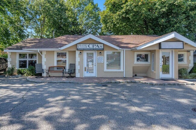
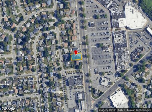
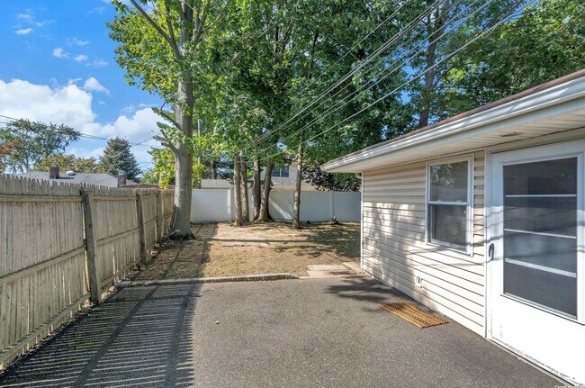
388 S Oyster Bay Rd, Hicksville, NY 11801
NEARBY LISTINGS FOR SALE OR LEASE
Property Detail
388 S Oyster Bay Rd
Nassau County-Suffolk County, NY
Map Of Hill View Farms Section No 1 At H
2489-12-294-00-0045-0
TOWN #3 SCH DIST 017
Commercialnec
Nassau
X
New York
36059C0145G
45
2025
0.20 AC
2025
Eastern Nassau
519500
Long Island (New York)
2,772 SF
DEMOGRAPHICS near 388 S Oyster Bay Rd
1 Mile
3 Mile
5 Mile
2024 Total Population
20,755
119,992
267,551
2029 Population
20,396
118,188
263,342
Pop Growth 2024-2029
(1.73%)
(1.50%)
(1.57%)
Average Age
42
43
42
2024 Total Households
6,539
38,573
84,918
HH Growth 2024-2029
(1.85%)
(1.57%)
(1.68%)
Median Household Inc
$146,306
$142,741
$137,434
Avg Household Size
3.10
3.00
3.00
2024 Avg HH Vehicles
2.00
2.00
2.00
Median Home Value
$713,170
$724,714
$675,144
Median Year Built
1955
1957
1956
Nearby Places
Map Layers
Map Styles
 Street
 Aerial
- Restaurants
- Banks
- Shops
- Fitness
- Groceries
PUBLIC TRANSPORTATION
COMMUTER RAIL
Hicksville Station (Montauk Branch - Long Island Rail Road, Port Jefferson Branch - Long Island Rail Road, Ronkonkoma Branch - Long Island Rail Road)
DRIVE
WALK
Distance
Hicksville Station (Montauk Branch - Long Island Rail Road, Port Jefferson Branch - Long Island Rail Road, Ronkonkoma Branch - Long Island Rail Road)
4 min
2.0 mi
Syosset Station (Port Jefferson Branch - Long Island Rail Road)
DRIVE
WALK
Distance
Syosset Station (Port Jefferson Branch - Long Island Rail Road)
6 min
2.9 mi
AIRPORT
John F Kennedy International
DRIVE
WALK
Distance
John F Kennedy International
36 min
22.9 mi
Long Island MacArthur
DRIVE
WALK
Distance
Long Island MacArthur
36 min
23.4 mi
LaGuardia
DRIVE
WALK
Distance
LaGuardia
36 min
23.5 mi
Freight Ports
NY - Red Hook Container Terminal
DRIVE
WALK
Distance
NY - Red Hook Container Terminal
47 min
31.7 mi
SALE & LEASE HISTORY
LISTING DATE
SALE/LEASE

Apr 06, 2021
For Sale
Nearby Properties
Address
Land Use
TOTAL SIZE
Lot Size
Zoning
Address
Land Use
TOTAL SIZE
Lot Size
Zoning
Address
Land Use
TOTAL SIZE
Lot Size
Zoning
Address
Land Use
TOTAL SIZE
Lot Size
Zoning
Address
Land Use
TOTAL SIZE
Lot Size
Zoning
6.30 AC
Address
Land Use
TOTAL SIZE
Lot Size
Zoning
1,945 SF
278.09 AC
Address
Land Use
TOTAL SIZE
Lot Size
Zoning
Address
Land Use
TOTAL SIZE
Lot Size
Zoning
178,486 SF
53.25 AC
Address
Land Use
TOTAL SIZE
Lot Size
Zoning
1,003,826 SF
84.27 AC
Address
Land Use
TOTAL SIZE
Lot Size
Zoning
469,586 SF
53.14 AC
Address
Land Use
TOTAL SIZE
Lot Size
Zoning
647,177 SF
51.88 AC
Address
Land Use
TOTAL SIZE
Lot Size
Zoning
15,825 SF
22.94 AC
Address
Land Use
TOTAL SIZE
Lot Size
Zoning
659,098 SF
34.76 AC
Address
Land Use
TOTAL SIZE
Lot Size
Zoning
Address
Land Use
TOTAL SIZE
Lot Size
Zoning
1,068,978 SF
56.12 AC
Address
Land Use
TOTAL SIZE
Lot Size
Zoning
143,519 SF
20.67 AC
Address
Land Use
TOTAL SIZE
Lot Size
Zoning
Address
Land Use
TOTAL SIZE
Lot Size
Zoning
505,020 SF
58.54 AC
Address
Land Use
TOTAL SIZE
Lot Size
Zoning
Address
Land Use
TOTAL SIZE
Lot Size
Zoning
332,290 SF
25.91 AC
Address
Land Use
TOTAL SIZE
Lot Size
Zoning
331,084 SF
26.95 AC
Address
Land Use
TOTAL SIZE
Lot Size
Zoning
146,287 SF
48.63 AC
Address
Land Use
TOTAL SIZE
Lot Size
Zoning
77,284 SF
40.86 AC
Address
Land Use
TOTAL SIZE
Lot Size
Zoning
177,845 SF
22.04 AC
Address
Land Use
TOTAL SIZE
Lot Size
Zoning
12,261 SF
12.83 AC
Address
Land Use
TOTAL SIZE
Lot Size
Zoning
60,571 SF
127.50 AC
Address
Land Use
TOTAL SIZE
Lot Size
Zoning
130,994 SF
27.94 AC
Address
Land Use
TOTAL SIZE
Lot Size
Zoning
Address
Land Use
TOTAL SIZE
Lot Size
Zoning
98,802 SF
9.70 AC
Address
Land Use
TOTAL SIZE
Lot Size
Zoning
34,500 SF
16 AC
Address
Land Use
TOTAL SIZE
Lot Size
Zoning
84,714 SF
15.09 AC
The World's #1 Commercial Real Estate Marketplace
Connect with us
© 2025 CoStar Group
The information above has been obtained from sources believed reliable. While we do not doubt its accuracy we have not verified it and make no guarantee, warranty or representation about it. It is your responsibility to independently confirm its accuracy and completeness. Any projections, opinions, assumptions, or estimates used are for example only and do not represent the current or future performance of the property. The value of this transaction to you depends on tax and other factors which should be evaluated by your tax, financial, and legal advisors. You and your advisors should conduct a careful, independent investigation of the property to determine to your satisfaction the suitability of the property for your needs.