Property Record
390 W Java Dr, Sunnyvale, CA 94089


Property Detail
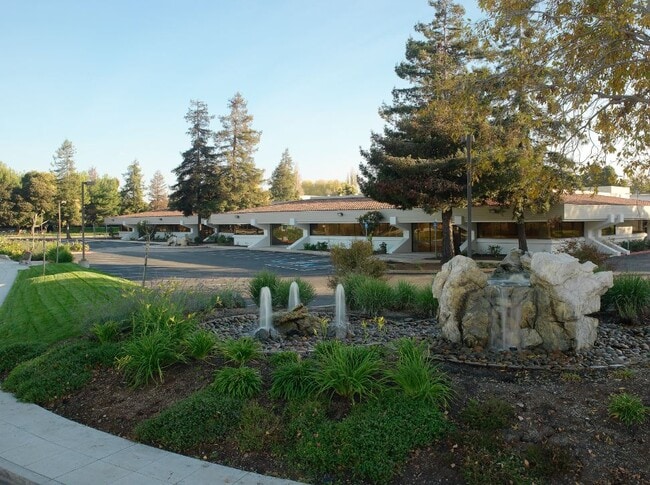
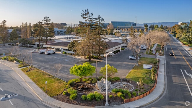
390 W Java Dr
Scientificpharmaceuticalmedicalresearchfacility
SANTA CLARA
MP-TO
California
AE The base floodplain where base flood elevations are provided. AE Zones are now used on new format FIRMs instead of A1-A30 Zones.
3.64 AC
2024
Moffett Park
2025
South Bay/San Jose
504602
San Jose-Sunnyvale-Santa Clara, CA
48,480 SF
110-25-046
NEARBY LISTINGS FOR SALE OR LEASE
DEMOGRAPHICS near 390 W Java Dr
1 mile
3 mile
5 mile
2025 Total Population
7,867
97,347
341,896
2030 Population
8,094
100,845
352,767
Pop Growth 2025-2030
+ 2.89%
+ 3.59%
+ 3.18%
Average Age
39
38
38
2025 Total Households
3,362
38,291
131,970
HH Growth 2025-2030
+ 2.77%
+ 3.67%
+ 3.25%
Median Household Inc
$181,715
$174,490
$186,789
Avg Household Size
2.30
2.50
2.50
2025 Avg HH Vehicles
2.00
2.00
2.00
Median Home Value
$542,308
$1,070,050
$1,108,539
Median Year Built
1994
1984
1978
Nearby Places
Map Layers
Map Styles
 Street
 Aerial
Layers
 Traffic
 Biking
Places
Listings with unknown addresses are not visible on the map
- Restaurants
- Banks
- Shops
- Fitness
- Groceries
PUBLIC TRANSPORTATION
TRANSIT/SUBWAY
Borregas Station (Mountain View - Winchester Line - Santa Clara VTA Light Rail)
Drive
Walk
Distance
Borregas Station (Mountain View - Winchester Line - Santa Clara VTA Light Rail)
1 min
4 min
0.2 mi
Lockheed Martin Station (Mountain View - Winchester Line - Santa Clara VTA Light Rail)
Drive
Walk
Distance
Lockheed Martin Station (Mountain View - Winchester Line - Santa Clara VTA Light Rail)
3 min
10 min
0.5 mi
Crossman Station (Mountain View - Winchester Line - Santa Clara VTA Light Rail)
Drive
Walk
Distance
Crossman Station (Mountain View - Winchester Line - Santa Clara VTA Light Rail)
4 min
13 min
0.6 mi
COMMUTER RAIL
Sunnyvale (Caltrain - Caltrain (Caltrain))
Drive
Walk
Distance
Sunnyvale (Caltrain - Caltrain (Caltrain))
9 min
3.2 mi
Lawrence (Caltrain - Caltrain (Caltrain))
Drive
Walk
Distance
Lawrence (Caltrain - Caltrain (Caltrain))
10 min
4.2 mi
AIRPORT
Norman Y Mineta San Jose International
Drive
Walk
Distance
Norman Y Mineta San Jose International
12 min
7.3 mi
San Francisco International
Drive
Walk
Distance
San Francisco International
30 min
28.5 mi
Metro Oakland International
Drive
Walk
Distance
Metro Oakland International
42 min
35.8 mi
SALE & LEASE HISTORY
LISTING DATE
SALE/LEASE

Nov 08, 2016
For Lease
May 20, 2021
For Lease
May 20, 2021
For Lease
Mar 30, 2017
For Lease
Feb 15, 2022
For Lease
Feb 15, 2022
For Lease
Nearby Properties
Address
Land Use
TOTAL SIZE
Lot Size
Zoning
Address
Land Use
TOTAL SIZE
Lot Size
Zoning
777,000 SF
17.84 AC
MS
Address
Land Use
TOTAL SIZE
Lot Size
Zoning
499,360 SF
31.95 AC
MM40
Address
Land Use
TOTAL SIZE
Lot Size
Zoning
424,316 SF
22.37 AC
SU
Address
Land Use
TOTAL SIZE
Lot Size
Zoning
1,640,399 SF
101.23 AC
MP-I
Address
Land Use
TOTAL SIZE
Lot Size
Zoning
318,172 SF
60.47 AC
MP-TO
Address
Land Use
TOTAL SIZE
Lot Size
Zoning
107,203 SF
21.74 AC
MXD2
Address
Land Use
TOTAL SIZE
Lot Size
Zoning
16.72 AC
MSLSP
Address
Land Use
TOTAL SIZE
Lot Size
Zoning
440,173 SF
25.33 AC
P39
Address
Land Use
TOTAL SIZE
Lot Size
Zoning
73,425 SF
14.20 AC
MS
Address
Land Use
TOTAL SIZE
Lot Size
Zoning
4 AC
DSP/1
Address
Land Use
TOTAL SIZE
Lot Size
Zoning
181,709 SF
24.01 AC
MPI
Address
Land Use
TOTAL SIZE
Lot Size
Zoning
81,250 SF
14.73 AC
MPT
Address
Land Use
TOTAL SIZE
Lot Size
Zoning
431,256 SF
12.43 AC
PPSP
Address
Land Use
TOTAL SIZE
Lot Size
Zoning
350,633 SF
1.08 AC
MPTOD
Address
Land Use
TOTAL SIZE
Lot Size
Zoning
350,633 SF
1.27 AC
MPTOD
Address
Land Use
TOTAL SIZE
Lot Size
Zoning
23.19 AC
MP-I
Address
Land Use
TOTAL SIZE
Lot Size
Zoning
350,633 SF
1.08 AC
MPTOD
Address
Land Use
TOTAL SIZE
Lot Size
Zoning
587,826 SF
2.54 AC
DSP/1
Address
Land Use
TOTAL SIZE
Lot Size
Zoning
353,745 SF
14.82 AC
PPSP
Address
Land Use
TOTAL SIZE
Lot Size
Zoning
17.25 AC
MPI
Address
Land Use
TOTAL SIZE
Lot Size
Zoning
162,205 SF
18.69 AC
MS
Address
Land Use
TOTAL SIZE
Lot Size
Zoning
23,709 SF
7.48 AC
PPSP
Address
Land Use
TOTAL SIZE
Lot Size
Zoning
22,400 SF
11.43 AC
MP-TO
Address
Land Use
TOTAL SIZE
Lot Size
Zoning
22.40 AC
PD
Address
Land Use
TOTAL SIZE
Lot Size
Zoning
22.40 AC
PD
Address
Land Use
TOTAL SIZE
Lot Size
Zoning
350,633 SF
1.27 AC
MPTOD
Address
Land Use
TOTAL SIZE
Lot Size
Zoning
350,633 SF
1.27 AC
MPTOD
Address
Land Use
TOTAL SIZE
Lot Size
Zoning
312,510 SF
23.46 AC
P41
Address
Land Use
TOTAL SIZE
Lot Size
Zoning
309,559 SF
5.69 AC
ML
Address
Land Use
TOTAL SIZE
Lot Size
Zoning
314,352 SF
0.95 AC
MP-TO
The World's #1 Commercial Real Estate Marketplace
Connect with us
© 2026 CoStar Group
The information above has been obtained from sources believed reliable. While we do not doubt its accuracy we have not verified it and make no guarantee, warranty or representation about it. It is your responsibility to independently confirm its accuracy and completeness. Any projections, opinions, assumptions, or estimates used are for example only and do not represent the current or future performance of the property. The value of this transaction to you depends on tax and other factors which should be evaluated by your tax, financial, and legal advisors. You and your advisors should conduct a careful, independent investigation of the property to determine to your satisfaction the suitability of the property for your needs.