Property Record
3880 Steven Dr, Deforest, WI 53532
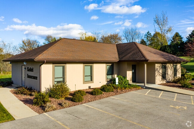

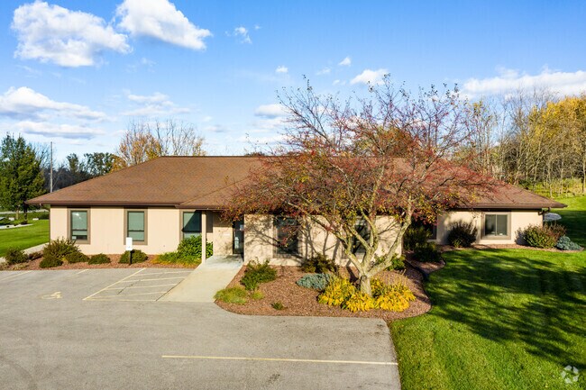

Property Detail
3880 Steven Dr
Madison, WI
LOT 1 CSM 9638 CS55/210&213-3/30/2000 F/K/A OUTLOT 11 TERRACE PARKLANDS DESCR AS SEC 3-8-10 PRT NE1/4NW1/4 (0.793 ACRES)
0810-032-1596-0
Dane
Commercialnec
Wisconsin
B-1
1
B and X Area of moderate flood hazard, usually the area between the limits of the 100-year and 500-year floods.
0.79 AC
2025
Northeast Madison
2025
Milwaukee/Madison
011404
NEARBY LISTINGS FOR SALE OR LEASE
DEMOGRAPHICS near 3880 Steven Dr
1 mile
3 mile
5 mile
2025 Total Population
1,929
29,618
74,265
2030 Population
2,007
31,102
77,436
Pop Growth 2025-2030
+ 4.04%
+ 5.01%
+ 4.27%
Average Age
38
38
39
2025 Total Households
679
11,829
30,176
HH Growth 2025-2030
+ 4.27%
+ 5.31%
+ 4.58%
Median Household Inc
$116,085
$101,990
$90,119
Avg Household Size
2.80
2.50
2.40
2025 Avg HH Vehicles
2.00
2.00
2.00
Median Home Value
$408,735
$423,304
$378,750
Median Year Built
1993
2001
1993
Nearby Places
Map Layers
Map Styles
 Street
 Aerial
Layers
 Traffic
 Biking
Places
Listings with unknown addresses are not visible on the map
- Restaurants
- Banks
- Shops
- Fitness
- Groceries
PUBLIC TRANSPORTATION
AIRPORT
Dane County Regional/Truax Field
Drive
Walk
Distance
Dane County Regional/Truax Field
14 min
8.0 mi
Freight Ports
Port Milwaukee
Drive
Walk
Distance
Port Milwaukee
95 min
82.1 mi
SALE & LEASE HISTORY
LISTING DATE
SALE/LEASE

Apr 21, 2021
For Lease
Nearby Properties
Address
Land Use
TOTAL SIZE
Lot Size
Zoning
Address
Land Use
TOTAL SIZE
Lot Size
Zoning
274,139 SF
7.45 AC
SEC
Address
Land Use
TOTAL SIZE
Lot Size
Zoning
385,400 SF
62.07 AC
IL
Address
Land Use
TOTAL SIZE
Lot Size
Zoning
8.49 AC
SFR
Address
Land Use
TOTAL SIZE
Lot Size
Zoning
48.24 AC
Address
Land Use
TOTAL SIZE
Lot Size
Zoning
107,751 SF
22.34 AC
IL
Address
Land Use
TOTAL SIZE
Lot Size
Zoning
912,762 SF
24.28 AC
SEC
Address
Land Use
TOTAL SIZE
Lot Size
Zoning
Address
Land Use
TOTAL SIZE
Lot Size
Zoning
Address
Land Use
TOTAL SIZE
Lot Size
Zoning
37.54 AC
Address
Land Use
TOTAL SIZE
Lot Size
Zoning
13,780 SF
16.96 AC
SO
Address
Land Use
TOTAL SIZE
Lot Size
Zoning
443,828 SF
25.96 AC
SEC
Address
Land Use
TOTAL SIZE
Lot Size
Zoning
8.56 AC
Address
Land Use
TOTAL SIZE
Lot Size
Zoning
26.32 AC
Address
Land Use
TOTAL SIZE
Lot Size
Zoning
737,119 SF
59.57 AC
SEC
Address
Land Use
TOTAL SIZE
Lot Size
Zoning
24.70 AC
Address
Land Use
TOTAL SIZE
Lot Size
Zoning
237,482 SF
8.24 AC
PD
Address
Land Use
TOTAL SIZE
Lot Size
Zoning
46,902 SF
5.28 AC
PD
Address
Land Use
TOTAL SIZE
Lot Size
Zoning
222,532 SF
18.26 AC
PD
Address
Land Use
TOTAL SIZE
Lot Size
Zoning
282,902 SF
24.96 AC
SEC
Address
Land Use
TOTAL SIZE
Lot Size
Zoning
Address
Land Use
TOTAL SIZE
Lot Size
Zoning
3.03 AC
RH-35
Address
Land Use
TOTAL SIZE
Lot Size
Zoning
170,180 SF
10.01 AC
PD
Address
Land Use
TOTAL SIZE
Lot Size
Zoning
Address
Land Use
TOTAL SIZE
Lot Size
Zoning
Address
Land Use
TOTAL SIZE
Lot Size
Zoning
Address
Land Use
TOTAL SIZE
Lot Size
Zoning
152,566 SF
4.21 AC
PD
Address
Land Use
TOTAL SIZE
Lot Size
Zoning
70,080 SF
3.21 AC
Address
Land Use
TOTAL SIZE
Lot Size
Zoning
26,854 SF
8.25 AC
UR12
Address
Land Use
TOTAL SIZE
Lot Size
Zoning
16.64 AC
Address
Land Use
TOTAL SIZE
Lot Size
Zoning
62,705 SF
11.48 AC
SEC
The World's #1 Commercial Real Estate Marketplace
Connect with us
© 2026 CoStar Group
The information above has been obtained from sources believed reliable. While we do not doubt its accuracy we have not verified it and make no guarantee, warranty or representation about it. It is your responsibility to independently confirm its accuracy and completeness. Any projections, opinions, assumptions, or estimates used are for example only and do not represent the current or future performance of the property. The value of this transaction to you depends on tax and other factors which should be evaluated by your tax, financial, and legal advisors. You and your advisors should conduct a careful, independent investigation of the property to determine to your satisfaction the suitability of the property for your needs.