Property Record
38869 Morris Point Rd, Abell, MD 20606


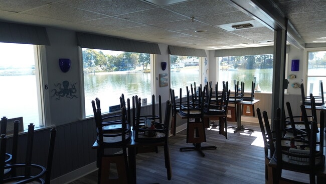
This Property Is For Sale
Property Detail
38869 Morris Point Rd
07-021054
42,602 SF MORRIS POINT RD CANOE NECK CREEK
Restaurantbuilding
Saint Marys
RCL
Maryland
AE The base floodplain where base flood elevations are provided. AE Zones are now used on new format FIRMs instead of A1-A30 Zones.
0.98 AC
2025
St Mary's County
2025
Washington, DC
875300
California-Lexington Park, MD
960 SF
NEARBY LISTINGS FOR SALE OR LEASE
-
-
View all Abell listings for sale on LoopNet.com
DEMOGRAPHICS near 38869 Morris Point Rd
1 mile
3 mile
5 mile
2025 Total Population
376
3,022
6,829
2030 Population
378
3,099
6,981
Pop Growth 2025-2030
+ 0.53%
+ 2.55%
+ 2.23%
Average Age
44
45
45
2025 Total Households
149
1,213
2,668
HH Growth 2025-2030
+ 0.67%
+ 2.56%
+ 2.25%
Median Household Inc
$110,714
$95,436
$111,287
Avg Household Size
2.50
2.50
2.50
2025 Avg HH Vehicles
3.00
3.00
3.00
Median Home Value
$471,211
$434,814
$441,561
Median Year Built
1981
1980
1985
Nearby Places
Map Layers
Map Styles
 Street
 Aerial
Layers
 Traffic
 Biking
Places
Listings with unknown addresses are not visible on the map
- Restaurants
- Banks
- Shops
- Fitness
- Groceries
Nearby Properties
Address
Land Use
TOTAL SIZE
Lot Size
Zoning
Address
Land Use
TOTAL SIZE
Lot Size
Zoning
732 SF
790.02 AC
RPD
Address
Land Use
TOTAL SIZE
Lot Size
Zoning
1,620 SF
7.98 AC
CM
Address
Land Use
TOTAL SIZE
Lot Size
Zoning
14,041 SF
8.66 AC
RPD
Address
Land Use
TOTAL SIZE
Lot Size
Zoning
2,484 SF
1.59 AC
RPD
Address
Land Use
TOTAL SIZE
Lot Size
Zoning
1,572 SF
9.46 AC
RPD
Address
Land Use
TOTAL SIZE
Lot Size
Zoning
494 SF
4 AC
CM
Address
Land Use
TOTAL SIZE
Lot Size
Zoning
6,009 SF
3.50 AC
RPD
Address
Land Use
TOTAL SIZE
Lot Size
Zoning
1,542 SF
3.17 AC
RPD
Address
Land Use
TOTAL SIZE
Lot Size
Zoning
6,320 SF
1.55 AC
RSC
Address
Land Use
TOTAL SIZE
Lot Size
Zoning
1,152 SF
1.45 AC
CM
Address
Land Use
TOTAL SIZE
Lot Size
Zoning
4,446 SF
2 AC
RPD
Address
Land Use
TOTAL SIZE
Lot Size
Zoning
4,446 SF
2 AC
RPD
Address
Land Use
TOTAL SIZE
Lot Size
Zoning
4,446 SF
2 AC
RPD
Address
Land Use
TOTAL SIZE
Lot Size
Zoning
2,556 SF
1.43 AC
CM
Address
Land Use
TOTAL SIZE
Lot Size
Zoning
3,040 SF
1 AC
RCL
Address
Land Use
TOTAL SIZE
Lot Size
Zoning
2,950 SF
1.03 AC
RCL
Address
Land Use
TOTAL SIZE
Lot Size
Zoning
2,658 SF
2.51 AC
RPD
Address
Land Use
TOTAL SIZE
Lot Size
Zoning
432 SF
0.98 AC
RCL
Address
Land Use
TOTAL SIZE
Lot Size
Zoning
1,536 SF
2.56 AC
CM
Address
Land Use
TOTAL SIZE
Lot Size
Zoning
8,944 SF
8.55 AC
CVC
Address
Land Use
TOTAL SIZE
Lot Size
Zoning
5,535 SF
1.14 AC
RNC
Address
Land Use
TOTAL SIZE
Lot Size
Zoning
2,025 SF
3.12 AC
RPD
Address
Land Use
TOTAL SIZE
Lot Size
Zoning
2,520 SF
14.16 AC
RPD
Address
Land Use
TOTAL SIZE
Lot Size
Zoning
10,551 SF
5.81 AC
RSC
Address
Land Use
TOTAL SIZE
Lot Size
Zoning
1,989 SF
3 AC
RPD
Address
Land Use
TOTAL SIZE
Lot Size
Zoning
4,024 SF
1 AC
RSC
Address
Land Use
TOTAL SIZE
Lot Size
Zoning
1,185 SF
1.94 AC
CM
Address
Land Use
TOTAL SIZE
Lot Size
Zoning
123.81 AC
RPD
Address
Land Use
TOTAL SIZE
Lot Size
Zoning
2,400 SF
3.78 AC
RPD
The World's #1 Commercial Real Estate Marketplace
Connect with us
© 2026 CoStar Group
The information above has been obtained from sources believed reliable. While we do not doubt its accuracy we have not verified it and make no guarantee, warranty or representation about it. It is your responsibility to independently confirm its accuracy and completeness. Any projections, opinions, assumptions, or estimates used are for example only and do not represent the current or future performance of the property. The value of this transaction to you depends on tax and other factors which should be evaluated by your tax, financial, and legal advisors. You and your advisors should conduct a careful, independent investigation of the property to determine to your satisfaction the suitability of the property for your needs.