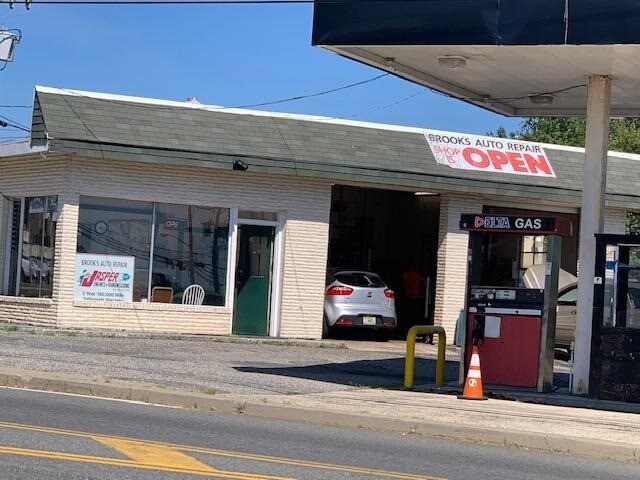
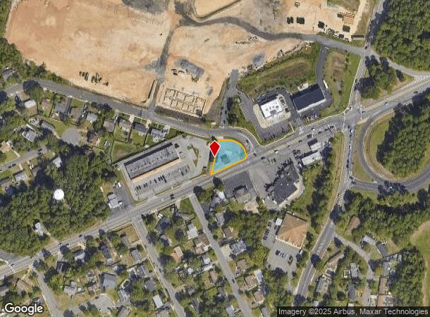
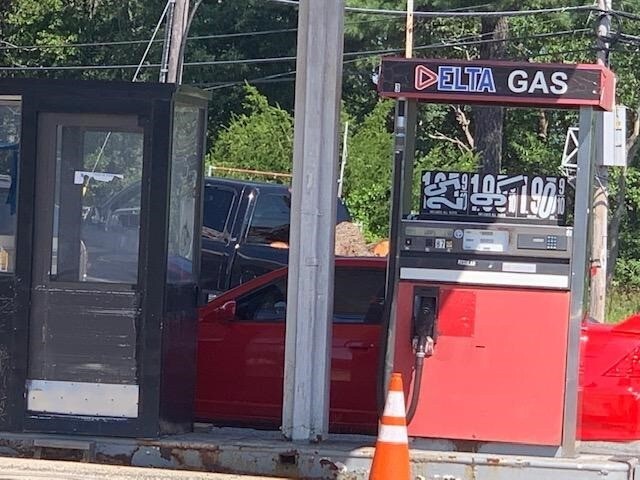
Property Record
389 Dover Rd, Toms River, NJ 08757

NEARBY LISTINGS FOR SALE OR LEASE
Property Detail
389 Dover Rd
New York-Jersey City-White Plains, NY-NJ
.27 AC
30-00022-0000-00010-18
Ocean
Commercialnec
New Jersey
X
10.18
34029C0304F
0.27 AC
2024
Ocean County
2025
Northern New Jersey
724000
DEMOGRAPHICS near 389 Dover Rd
1 Mile
3 Mile
5 Mile
2024 Total Population
7,058
49,559
126,188
2029 Population
7,461
52,346
133,704
Pop Growth 2024-2029
+ 5.71%
+ 5.62%
+ 5.96%
Average Age
37
43
43
2024 Total Households
2,288
19,569
49,208
HH Growth 2024-2029
+ 5.11%
+ 5.21%
+ 5.52%
Median Household Inc
$77,402
$71,719
$74,717
Avg Household Size
3.00
2.40
2.40
2024 Avg HH Vehicles
2.00
2.00
2.00
Median Home Value
$247,440
$266,512
$281,497
Median Year Built
1968
1975
1977
Nearby Places
Map Layers
Map Styles
 Street
 Aerial
- Restaurants
- Banks
- Shops
- Fitness
- Groceries
SALE & LEASE HISTORY
LISTING DATE
SALE/LEASE

Sep 19, 2019
For Sale
Nearby Properties
Address
Land Use
TOTAL SIZE
Lot Size
Zoning
Address
Land Use
TOTAL SIZE
Lot Size
Zoning
35,102 SF
139.33 AC
LI
Address
Land Use
TOTAL SIZE
Lot Size
Zoning
38.17 AC
HMS
Address
Land Use
TOTAL SIZE
Lot Size
Zoning
15.67 AC
RC
Address
Land Use
TOTAL SIZE
Lot Size
Zoning
44,584 SF
11.85 AC
VO
Address
Land Use
TOTAL SIZE
Lot Size
Zoning
8,512 SF
25.67 AC
RC
Address
Land Use
TOTAL SIZE
Lot Size
Zoning
165,024 SF
22.43 AC
HB
Address
Land Use
TOTAL SIZE
Lot Size
Zoning
8.21 AC
VO
Address
Land Use
TOTAL SIZE
Lot Size
Zoning
31,302 SF
13.76 AC
EM18
Address
Land Use
TOTAL SIZE
Lot Size
Zoning
18,890 SF
24.59 AC
SPLT
Address
Land Use
TOTAL SIZE
Lot Size
Zoning
56,332 SF
8.85 AC
SPLT
Address
Land Use
TOTAL SIZE
Lot Size
Zoning
19,836 SF
13.03 AC
EM18
Address
Land Use
TOTAL SIZE
Lot Size
Zoning
7,436 SF
22.36 AC
MF8
Address
Land Use
TOTAL SIZE
Lot Size
Zoning
13,872 SF
22.96 AC
MF8
Address
Land Use
TOTAL SIZE
Lot Size
Zoning
15.68 AC
MF8
Address
Land Use
TOTAL SIZE
Lot Size
Zoning
2,549 SF
16.02 AC
RC
Address
Land Use
TOTAL SIZE
Lot Size
Zoning
35,800 SF
24.53 AC
RHB
Address
Land Use
TOTAL SIZE
Lot Size
Zoning
44,394 SF
7.66 AC
EM18
Address
Land Use
TOTAL SIZE
Lot Size
Zoning
15,243 SF
5.47 AC
HMS
Address
Land Use
TOTAL SIZE
Lot Size
Zoning
1.98 AC
HB
Address
Land Use
TOTAL SIZE
Lot Size
Zoning
115,528 SF
17.59 AC
SPLT
Address
Land Use
TOTAL SIZE
Lot Size
Zoning
8.82 AC
O15
Address
Land Use
TOTAL SIZE
Lot Size
Zoning
9,343 SF
31.93 AC
SPLT
Address
Land Use
TOTAL SIZE
Lot Size
Zoning
103,750 SF
24.23 AC
R120
Address
Land Use
TOTAL SIZE
Lot Size
Zoning
5,303 SF
2.14 AC
VO
Address
Land Use
TOTAL SIZE
Lot Size
Zoning
23.28 AC
R75
Address
Land Use
TOTAL SIZE
Lot Size
Zoning
36,624 SF
3.15 AC
HMS
Address
Land Use
TOTAL SIZE
Lot Size
Zoning
9,267 SF
401.95 AC
RC
Address
Land Use
TOTAL SIZE
Lot Size
Zoning
14,356 SF
27.24 AC
R90
Address
Land Use
TOTAL SIZE
Lot Size
Zoning
3,524 SF
10 AC
HB
Address
Land Use
TOTAL SIZE
Lot Size
Zoning
5,876 SF
3.56 AC
O15
The World's #1 Commercial Real Estate Marketplace
Connect with us
© 2025 CoStar Group
The information above has been obtained from sources believed reliable. While we do not doubt its accuracy we have not verified it and make no guarantee, warranty or representation about it. It is your responsibility to independently confirm its accuracy and completeness. Any projections, opinions, assumptions, or estimates used are for example only and do not represent the current or future performance of the property. The value of this transaction to you depends on tax and other factors which should be evaluated by your tax, financial, and legal advisors. You and your advisors should conduct a careful, independent investigation of the property to determine to your satisfaction the suitability of the property for your needs.