Property Record
3890 Buchanan Ave Sw, Grand Rapids, MI 49548


NEARBY LISTINGS FOR SALE OR LEASE
Property Detail
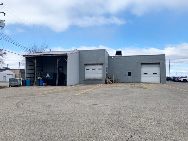
3890 Buchanan Ave Sw
41-17-24-276-014
Roselawn Park No.1
Industrialgeneral
LOTS 51 52 & 53 ALSO THAT PART OF VAC PORTION OF BUCHANAN AVE ADJ ON THE W ALSO LOTS 78 79 & 80 * ROSELAWN PARK NO.1
X
Kent
26081C0418D
Michigan
2024
0.88 AC
2025
S Grand Rapids/Kentwood
014100
West Michigan
11,046 SF
Grand Rapids-Wyoming, MI
DEMOGRAPHICS near 3890 Buchanan Ave Sw
1 Mile
3 Mile
5 Mile
2024 Total Population
10,944
112,946
270,515
2029 Population
10,974
113,616
272,454
Pop Growth 2024-2029
+ 0.27%
+ 0.59%
+ 0.72%
Average Age
37
37
37
2024 Total Households
4,160
41,321
102,615
HH Growth 2024-2029
+ 0.22%
+ 0.61%
+ 0.78%
Median Household Inc
$57,520
$59,228
$63,592
Avg Household Size
2.60
2.60
2.50
2024 Avg HH Vehicles
2.00
2.00
2.00
Median Home Value
$146,679
$168,231
$208,509
Median Year Built
1955
1963
1969
Nearby Places
Map Layers
Map Styles
 Street
 Aerial
- Restaurants
- Banks
- Shops
- Fitness
- Groceries
PUBLIC TRANSPORTATION
COMMUTER RAIL
DRIVE
WALK
Distance
8 min
5.3 mi
AIRPORT
Gerald R Ford International
DRIVE
WALK
Distance
Gerald R Ford International
19 min
9.3 mi
SALE & LEASE HISTORY
LISTING DATE
SALE/LEASE

Jul 07, 2021
For Lease
Nearby Properties
Address
Land Use
TOTAL SIZE
Lot Size
Zoning
Address
Land Use
TOTAL SIZE
Lot Size
Zoning
290,627 SF
Address
Land Use
TOTAL SIZE
Lot Size
Zoning
295,027 SF
51.42 AC
I3
Address
Land Use
TOTAL SIZE
Lot Size
Zoning
649,177 SF
55.67 AC
SD-IT
Address
Land Use
TOTAL SIZE
Lot Size
Zoning
941,968 SF
38.56 AC
SD-IT
Address
Land Use
TOTAL SIZE
Lot Size
Zoning
398,607 SF
33.51 AC
R4
Address
Land Use
TOTAL SIZE
Lot Size
Zoning
27.25 AC
SD-PRD
Address
Land Use
TOTAL SIZE
Lot Size
Zoning
1,426,319 SF
54.81 AC
SD-IT
Address
Land Use
TOTAL SIZE
Lot Size
Zoning
26.94 AC
Address
Land Use
TOTAL SIZE
Lot Size
Zoning
87.39 AC
I2
Address
Land Use
TOTAL SIZE
Lot Size
Zoning
386,450 SF
29.10 AC
Address
Land Use
TOTAL SIZE
Lot Size
Zoning
264,739 SF
26.56 AC
I2
Address
Land Use
TOTAL SIZE
Lot Size
Zoning
465,772 SF
61.95 AC
I1
Address
Land Use
TOTAL SIZE
Lot Size
Zoning
22.35 AC
Address
Land Use
TOTAL SIZE
Lot Size
Zoning
153,571 SF
12.28 AC
SD-PRD
Address
Land Use
TOTAL SIZE
Lot Size
Zoning
536,296 SF
26.16 AC
SD-IT
Address
Land Use
TOTAL SIZE
Lot Size
Zoning
179,436 SF
24.94 AC
I2
Address
Land Use
TOTAL SIZE
Lot Size
Zoning
212,353 SF
16.52 AC
R4
Address
Land Use
TOTAL SIZE
Lot Size
Zoning
20.30 AC
Address
Land Use
TOTAL SIZE
Lot Size
Zoning
29.13 AC
Address
Land Use
TOTAL SIZE
Lot Size
Zoning
162,228 SF
14.31 AC
R4
Address
Land Use
TOTAL SIZE
Lot Size
Zoning
Address
Land Use
TOTAL SIZE
Lot Size
Zoning
349,885 SF
8.92 AC
I1
Address
Land Use
TOTAL SIZE
Lot Size
Zoning
157,386 SF
13.11 AC
R4
Address
Land Use
TOTAL SIZE
Lot Size
Zoning
720 SF
74.47 AC
R4-MOBILE
Address
Land Use
TOTAL SIZE
Lot Size
Zoning
442,193 SF
17.90 AC
I1
Address
Land Use
TOTAL SIZE
Lot Size
Zoning
116,832 SF
14.32 AC
R4
Address
Land Use
TOTAL SIZE
Lot Size
Zoning
6.37 AC
MCN-MDR
Address
Land Use
TOTAL SIZE
Lot Size
Zoning
50.15 AC
Address
Land Use
TOTAL SIZE
Lot Size
Zoning
203,567 SF
17.48 AC
I2
Address
Land Use
TOTAL SIZE
Lot Size
Zoning
132,600 SF
14 AC
R-PUD-1
The World's #1 Commercial Real Estate Marketplace
Connect with us
© 2026 CoStar Group
The information above has been obtained from sources believed reliable. While we do not doubt its accuracy we have not verified it and make no guarantee, warranty or representation about it. It is your responsibility to independently confirm its accuracy and completeness. Any projections, opinions, assumptions, or estimates used are for example only and do not represent the current or future performance of the property. The value of this transaction to you depends on tax and other factors which should be evaluated by your tax, financial, and legal advisors. You and your advisors should conduct a careful, independent investigation of the property to determine to your satisfaction the suitability of the property for your needs.