Property Record
3891 Highway 17, Murrells Inlet, SC 29576

NEARBY LISTINGS FOR SALE OR LEASE
-
-
View all Murrells Inlet listings for sale on LoopNet.com
Property Detail
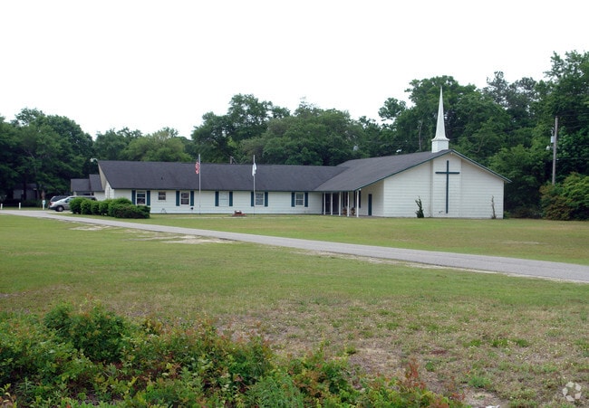
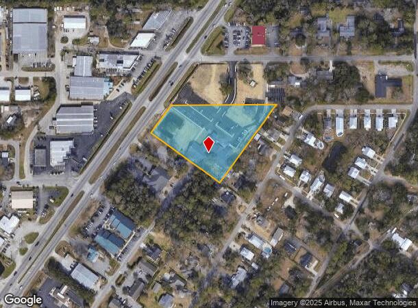
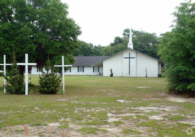
3891 Highway 17
41-0109-080-06-00
Mu
Religious
U S HWY 17 BYPASS (CHURCH, FELLOWSHIP HALL, VAN SHELTER, OFFICE BLDG)
X
Georgetown
45043C0250G
South Carolina
0
2.90 AC
2024
Myrtle Beach South
920510
Other Market Areas
10,532 SF
Georgetown, SC
DEMOGRAPHICS near 3891 Highway 17
1 Mile
3 Mile
5 Mile
2024 Total Population
3,253
27,801
51,924
2029 Population
3,455
32,081
61,693
Pop Growth 2024-2029
+ 6.21%
+ 15.40%
+ 18.81%
Average Age
51
53
52
2024 Total Households
1,541
13,228
24,295
HH Growth 2024-2029
+ 5.91%
+ 14.44%
+ 17.74%
Median Household Inc
$65,600
$59,797
$62,303
Avg Household Size
2.10
2.10
2.10
2024 Avg HH Vehicles
2.00
2.00
2.00
Median Home Value
$329,018
$265,917
$257,848
Median Year Built
1999
1999
1997
Nearby Places
Map Layers
Map Styles
 Street
 Aerial
- Restaurants
- Banks
- Shops
- Fitness
- Groceries
PUBLIC TRANSPORTATION
AIRPORT
Myrtle Beach International
DRIVE
WALK
Distance
Myrtle Beach International
23 min
14.7 mi
Nearby Properties
Address
Land Use
TOTAL SIZE
Lot Size
Zoning
Address
Land Use
TOTAL SIZE
Lot Size
Zoning
20.55 AC
Address
Land Use
TOTAL SIZE
Lot Size
Zoning
8,169 SF
2.70 AC
Address
Land Use
TOTAL SIZE
Lot Size
Zoning
37,976 SF
3.76 AC
Address
Land Use
TOTAL SIZE
Lot Size
Zoning
Address
Land Use
TOTAL SIZE
Lot Size
Zoning
13,244 SF
3.50 AC
Address
Land Use
TOTAL SIZE
Lot Size
Zoning
Address
Land Use
TOTAL SIZE
Lot Size
Zoning
3,696 SF
55.20 AC
Address
Land Use
TOTAL SIZE
Lot Size
Zoning
15,704 SF
1.97 AC
Address
Land Use
TOTAL SIZE
Lot Size
Zoning
7,144 SF
187.64 AC
Address
Land Use
TOTAL SIZE
Lot Size
Zoning
4.60 AC
Address
Land Use
TOTAL SIZE
Lot Size
Zoning
151,727 SF
21.25 AC
Address
Land Use
TOTAL SIZE
Lot Size
Zoning
2,510 SF
43.14 AC
Address
Land Use
TOTAL SIZE
Lot Size
Zoning
5,570 SF
21.44 AC
Address
Land Use
TOTAL SIZE
Lot Size
Zoning
Address
Land Use
TOTAL SIZE
Lot Size
Zoning
6,170 SF
2.50 AC
Address
Land Use
TOTAL SIZE
Lot Size
Zoning
Address
Land Use
TOTAL SIZE
Lot Size
Zoning
25,722 SF
13.73 AC
Address
Land Use
TOTAL SIZE
Lot Size
Zoning
Address
Land Use
TOTAL SIZE
Lot Size
Zoning
Address
Land Use
TOTAL SIZE
Lot Size
Zoning
Address
Land Use
TOTAL SIZE
Lot Size
Zoning
4,800 SF
75.54 AC
Address
Land Use
TOTAL SIZE
Lot Size
Zoning
5,230 SF
19.39 AC
Address
Land Use
TOTAL SIZE
Lot Size
Zoning
65,578 SF
12.12 AC
Address
Land Use
TOTAL SIZE
Lot Size
Zoning
Address
Land Use
TOTAL SIZE
Lot Size
Zoning
64,620 SF
7.90 AC
Address
Land Use
TOTAL SIZE
Lot Size
Zoning
3,052 SF
1 AC
Address
Land Use
TOTAL SIZE
Lot Size
Zoning
Address
Land Use
TOTAL SIZE
Lot Size
Zoning
108,250 SF
14.53 AC
The World's #1 Commercial Real Estate Marketplace
Connect with us
© 2025 CoStar Group
The information above has been obtained from sources believed reliable. While we do not doubt its accuracy we have not verified it and make no guarantee, warranty or representation about it. It is your responsibility to independently confirm its accuracy and completeness. Any projections, opinions, assumptions, or estimates used are for example only and do not represent the current or future performance of the property. The value of this transaction to you depends on tax and other factors which should be evaluated by your tax, financial, and legal advisors. You and your advisors should conduct a careful, independent investigation of the property to determine to your satisfaction the suitability of the property for your needs.