Property Record
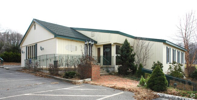
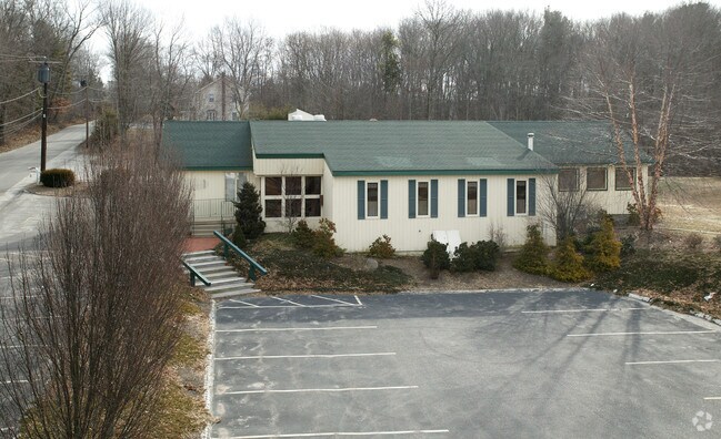
39 Adamec Rd, Willington, CT 06279

Property Detail
39 Adamec Rd
WILL-000000-000000-007800
Capitol
Commercialbuilding
Connecticut
DC
40-0
2025
2.38 AC
2025
Tolland County
840100
Hartford
6,192 SF
Hartford-West Hartford-East Hartford, CT
NEARBY LISTINGS FOR SALE OR LEASE
DEMOGRAPHICS near 39 Adamec Rd
1 mile
3 mile
5 mile
2025 Total Population
519
8,348
22,969
2030 Population
531
8,518
23,476
Pop Growth 2025-2030
+ 2.31%
+ 2.04%
+ 2.21%
Average Age
41
41
40
2025 Total Households
209
3,362
8,559
HH Growth 2025-2030
+ 2.39%
+ 2.11%
+ 2.36%
Median Household Inc
$91,666
$103,743
$105,851
Avg Household Size
2.30
2.40
2.50
2025 Avg HH Vehicles
2.00
2.00
2.00
Median Home Value
$283,333
$330,041
$353,109
Median Year Built
1977
1977
1978
Nearby Places
Map Layers
Map Styles
 Street
 Aerial
Layers
 Traffic
 Biking
Places
Listings with unknown addresses are not visible on the map
- Restaurants
- Banks
- Shops
- Fitness
- Groceries
PUBLIC TRANSPORTATION
AIRPORT
Bradley International
Drive
Walk
Distance
Bradley International
53 min
31.4 mi
Freight Ports
Port of Davisville, RI
Drive
Walk
Distance
Port of Davisville, RI
96 min
64.3 mi
Nearby Properties
Address
Land Use
TOTAL SIZE
Lot Size
Zoning
Address
Land Use
TOTAL SIZE
Lot Size
Zoning
258,330 SF
68.50 AC
RDD
Address
Land Use
TOTAL SIZE
Lot Size
Zoning
168,410 SF
100.15 AC
RDD
Address
Land Use
TOTAL SIZE
Lot Size
Zoning
48 AC
RDD
Address
Land Use
TOTAL SIZE
Lot Size
Zoning
75,689 SF
20 AC
R80
Address
Land Use
TOTAL SIZE
Lot Size
Zoning
63,016 SF
8.60 AC
R80
Address
Land Use
TOTAL SIZE
Lot Size
Zoning
113,904 SF
38.80 AC
R80
Address
Land Use
TOTAL SIZE
Lot Size
Zoning
59.01 AC
RDD
Address
Land Use
TOTAL SIZE
Lot Size
Zoning
61,155 SF
34 AC
R80
Address
Land Use
TOTAL SIZE
Lot Size
Zoning
27.98 AC
RDD
Address
Land Use
TOTAL SIZE
Lot Size
Zoning
28,401 SF
8 AC
R80
Address
Land Use
TOTAL SIZE
Lot Size
Zoning
31,016 SF
23 AC
R80
Address
Land Use
TOTAL SIZE
Lot Size
Zoning
10 AC
RDD
Address
Land Use
TOTAL SIZE
Lot Size
Zoning
33,328 SF
17.48 AC
R80
Address
Land Use
TOTAL SIZE
Lot Size
Zoning
38,054 SF
35.50 AC
R80
Address
Land Use
TOTAL SIZE
Lot Size
Zoning
27,740 SF
11.92 AC
RDD
Address
Land Use
TOTAL SIZE
Lot Size
Zoning
9.05 AC
TCZ
Address
Land Use
TOTAL SIZE
Lot Size
Zoning
10,728 SF
39.68 AC
RDD
Address
Land Use
TOTAL SIZE
Lot Size
Zoning
37,556 SF
7.91 AC
GDD
Address
Land Use
TOTAL SIZE
Lot Size
Zoning
13,426 SF
4.13 AC
R80
Address
Land Use
TOTAL SIZE
Lot Size
Zoning
462.80 AC
RDD
Address
Land Use
TOTAL SIZE
Lot Size
Zoning
1,200 SF
108 AC
RDD
Address
Land Use
TOTAL SIZE
Lot Size
Zoning
1,132 SF
0.78 AC
RDD
Address
Land Use
TOTAL SIZE
Lot Size
Zoning
1,952 SF
56 AC
R80
Address
Land Use
TOTAL SIZE
Lot Size
Zoning
32,583 SF
16.71 AC
DC
Address
Land Use
TOTAL SIZE
Lot Size
Zoning
22,133 SF
Address
Land Use
TOTAL SIZE
Lot Size
Zoning
44,000 SF
5 AC
DI
Address
Land Use
TOTAL SIZE
Lot Size
Zoning
15.32 AC
TCZ
Address
Land Use
TOTAL SIZE
Lot Size
Zoning
16,128 SF
4.91 AC
TCZ
Address
Land Use
TOTAL SIZE
Lot Size
Zoning
10,848 SF
8 AC
DCR
Address
Land Use
TOTAL SIZE
Lot Size
Zoning
31,200 SF
5.10 AC
DI
The World's #1 Commercial Real Estate Marketplace
Connect with us
© 2026 CoStar Group
The information above has been obtained from sources believed reliable. While we do not doubt its accuracy we have not verified it and make no guarantee, warranty or representation about it. It is your responsibility to independently confirm its accuracy and completeness. Any projections, opinions, assumptions, or estimates used are for example only and do not represent the current or future performance of the property. The value of this transaction to you depends on tax and other factors which should be evaluated by your tax, financial, and legal advisors. You and your advisors should conduct a careful, independent investigation of the property to determine to your satisfaction the suitability of the property for your needs.