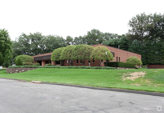
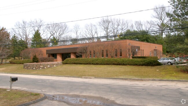
Property Record
39 Dell Manor Dr, Bristol, CT 06010
NEARBY LISTINGS FOR SALE OR LEASE
Property Detail
39 Dell Manor Dr
BRIS-000004-000000-000006A
Hartford
Industrialgeneral
Connecticut
X
6a
09009C0045H
1.46 AC
2025
Southwest Outlying
2025
Hartford
405402
Hartford-West Hartford-East Hartford, CT
10,100 SF
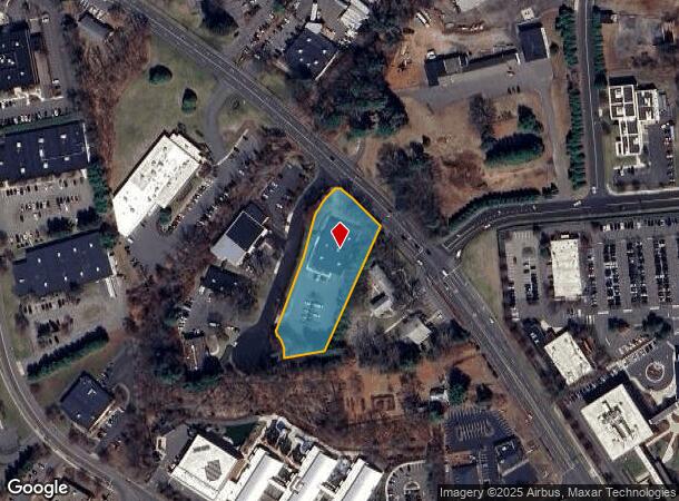
DEMOGRAPHICS near 39 Dell Manor Dr
1 Mile
3 Mile
5 Mile
2024 Total Population
4,684
55,359
123,303
2029 Population
4,700
55,282
123,105
Pop Growth 2024-2029
+ 0.34%
(0.14%)
(0.16%)
Average Age
43
42
43
2024 Total Households
2,282
23,766
51,506
HH Growth 2024-2029
+ 0.31%
(0.18%)
(0.19%)
Median Household Inc
$58,234
$71,217
$80,500
Avg Household Size
2.00
2.30
2.30
2024 Avg HH Vehicles
2.00
2.00
2.00
Median Home Value
$183,995
$226,904
$254,792
Median Year Built
1981
1966
1969
Nearby Places
Map Layers
Map Styles
 Street
 Aerial
- Restaurants
- Banks
- Shops
- Fitness
- Groceries
PUBLIC TRANSPORTATION
AIRPORT
Tweed/New Haven
DRIVE
WALK
Distance
Tweed/New Haven
47 min
29.4 mi
Bradley International
DRIVE
WALK
Distance
Bradley International
50 min
32.9 mi
Freight Ports
Port of New Haven
DRIVE
WALK
Distance
Port of New Haven
41 min
26.8 mi
SALE & LEASE HISTORY
LISTING DATE
SALE/LEASE

Sep 25, 2016
For Lease
Jan 17, 2018
For Lease
Nearby Properties
Address
Land Use
TOTAL SIZE
Lot Size
Zoning
Address
Land Use
TOTAL SIZE
Lot Size
Zoning
77,001 SF
54.59 AC
IP-1
Address
Land Use
TOTAL SIZE
Lot Size
Zoning
349,054 SF
12.03 AC
R-15
Address
Land Use
TOTAL SIZE
Lot Size
Zoning
100,304 SF
28.80 AC
IP-1
Address
Land Use
TOTAL SIZE
Lot Size
Zoning
58,473 SF
18.20 AC
IP-1
Address
Land Use
TOTAL SIZE
Lot Size
Zoning
145,719 SF
17.90 AC
R-15
Address
Land Use
TOTAL SIZE
Lot Size
Zoning
114,375 SF
12.72 AC
IP-1
Address
Land Use
TOTAL SIZE
Lot Size
Zoning
330,400 SF
36.90 AC
IP-1
Address
Land Use
TOTAL SIZE
Lot Size
Zoning
28.47 AC
R-10
Address
Land Use
TOTAL SIZE
Lot Size
Zoning
12,892 SF
20.91 AC
A
Address
Land Use
TOTAL SIZE
Lot Size
Zoning
56,184 SF
19.42 AC
BG
Address
Land Use
TOTAL SIZE
Lot Size
Zoning
171,826 SF
36.60 AC
R-15
Address
Land Use
TOTAL SIZE
Lot Size
Zoning
199,744 SF
44.70 AC
R-15
Address
Land Use
TOTAL SIZE
Lot Size
Zoning
62,232 SF
0.90 AC
BD-1
Address
Land Use
TOTAL SIZE
Lot Size
Zoning
502,440 SF
27.87 AC
I-2
Address
Land Use
TOTAL SIZE
Lot Size
Zoning
4,000 SF
13.78 AC
BG
Address
Land Use
TOTAL SIZE
Lot Size
Zoning
17.62 AC
B
Address
Land Use
TOTAL SIZE
Lot Size
Zoning
120,801 SF
8.35 AC
R-40
Address
Land Use
TOTAL SIZE
Lot Size
Zoning
29.05 AC
R-20
Address
Land Use
TOTAL SIZE
Lot Size
Zoning
149,912 SF
13.66 AC
B
Address
Land Use
TOTAL SIZE
Lot Size
Zoning
3,084 SF
14.90 AC
BG
Address
Land Use
TOTAL SIZE
Lot Size
Zoning
133,720 SF
7.34 AC
IP-1
Address
Land Use
TOTAL SIZE
Lot Size
Zoning
130,252 SF
14.82 AC
B
Address
Land Use
TOTAL SIZE
Lot Size
Zoning
137,510 SF
12.95 AC
B
Address
Land Use
TOTAL SIZE
Lot Size
Zoning
16.04 AC
B
Address
Land Use
TOTAL SIZE
Lot Size
Zoning
51,851 SF
1.32 AC
BD-1
Address
Land Use
TOTAL SIZE
Lot Size
Zoning
52,128 SF
7.20 AC
A
Address
Land Use
TOTAL SIZE
Lot Size
Zoning
1,250 SF
14.90 AC
I
Address
Land Use
TOTAL SIZE
Lot Size
Zoning
150,972 SF
9.99 AC
I-1
Address
Land Use
TOTAL SIZE
Lot Size
Zoning
98,463 SF
5.01 AC
I-1
Address
Land Use
TOTAL SIZE
Lot Size
Zoning
47,218 SF
3.62 AC
BD-1
The World's #1 Commercial Real Estate Marketplace
Connect with us
© 2026 CoStar Group
The information above has been obtained from sources believed reliable. While we do not doubt its accuracy we have not verified it and make no guarantee, warranty or representation about it. It is your responsibility to independently confirm its accuracy and completeness. Any projections, opinions, assumptions, or estimates used are for example only and do not represent the current or future performance of the property. The value of this transaction to you depends on tax and other factors which should be evaluated by your tax, financial, and legal advisors. You and your advisors should conduct a careful, independent investigation of the property to determine to your satisfaction the suitability of the property for your needs.