Property Record
39 E Cedar St, Newington, CT 06111
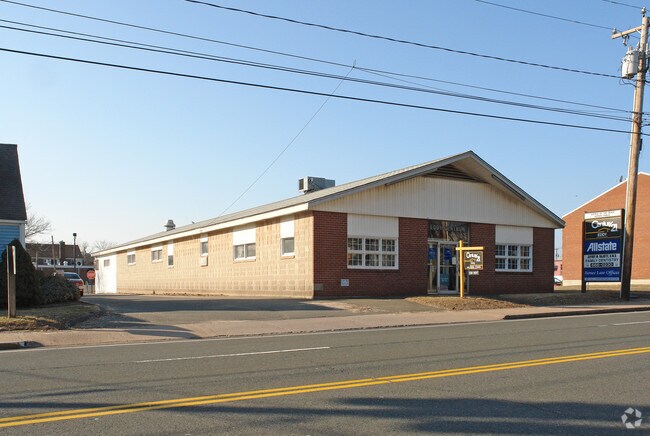

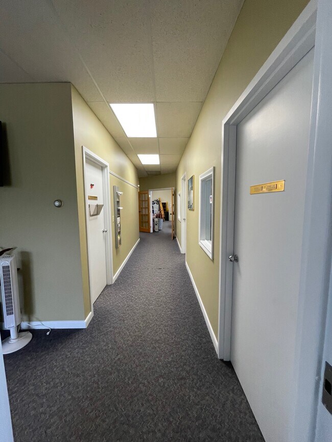
Property Detail
39 E Cedar St
Officebuilding
Capitol
B-TC
Connecticut
B and X Area of moderate flood hazard, usually the area between the limits of the 100-year and 500-year floods.
0.22 AC
2024
Newington
2025
Hartford
494400
Hartford-West Hartford-East Hartford, CT
6,160 SF
NEWI-000010-000651
NEARBY LISTINGS FOR SALE OR LEASE
DEMOGRAPHICS near 39 E Cedar St
1 mile
3 mile
5 mile
2025 Total Population
7,615
83,124
265,139
2030 Population
7,701
84,198
268,756
Pop Growth 2025-2030
+ 1.13%
+ 1.29%
+ 1.36%
Average Age
44
42
40
2025 Total Households
3,199
33,034
107,448
HH Growth 2025-2030
+ 1.19%
+ 1.30%
+ 1.46%
Median Household Inc
$97,750
$94,493
$73,749
Avg Household Size
2.30
2.40
2.30
2025 Avg HH Vehicles
2.00
2.00
2.00
Median Home Value
$291,509
$291,289
$300,398
Median Year Built
1956
1961
1957
Nearby Places
Map Layers
Map Styles
 Street
 Aerial
Transit
 Traffic
 Biking
Places
Listings with unknown addresses are not visible on the map
- Restaurants
- Banks
- Shops
- Fitness
- Groceries
PUBLIC TRANSPORTATION
COMMUTER RAIL
Drive
Walk
Distance
13 min
6.3 mi
Drive
Walk
Distance
13 min
6.5 mi
AIRPORT
Bradley International
Drive
Walk
Distance
Bradley International
42 min
24.0 mi
Tweed/New Haven
Drive
Walk
Distance
Tweed/New Haven
50 min
34.7 mi
Freight Ports
Port of New Haven
Drive
Walk
Distance
Port of New Haven
46 min
32.4 mi
SALE & LEASE HISTORY
LISTING DATE
SALE/LEASE

May 30, 2019
For Lease
May 05, 2023
For Lease
Dec 18, 2018
For Lease
Nearby Properties
Address
Land Use
TOTAL SIZE
Lot Size
Zoning
Address
Land Use
TOTAL SIZE
Lot Size
Zoning
284,432 SF
32.12 AC
PL
Address
Land Use
TOTAL SIZE
Lot Size
Zoning
261,072 SF
44.47 AC
PL
Address
Land Use
TOTAL SIZE
Lot Size
Zoning
54.95 AC
PDR
Address
Land Use
TOTAL SIZE
Lot Size
Zoning
20.61 AC
R-10,S
Address
Land Use
TOTAL SIZE
Lot Size
Zoning
23.62 AC
A3
Address
Land Use
TOTAL SIZE
Lot Size
Zoning
117,139 SF
6.77 AC
T
Address
Land Use
TOTAL SIZE
Lot Size
Zoning
254,786 SF
36 AC
A
Address
Land Use
TOTAL SIZE
Lot Size
Zoning
223,885 SF
43.33 AC
CAMP
Address
Land Use
TOTAL SIZE
Lot Size
Zoning
3,416 SF
19.31 AC
SRD
Address
Land Use
TOTAL SIZE
Lot Size
Zoning
13.34 AC
PD
Address
Land Use
TOTAL SIZE
Lot Size
Zoning
78,109 SF
8.22 AC
T
Address
Land Use
TOTAL SIZE
Lot Size
Zoning
16.94 AC
C1
Address
Land Use
TOTAL SIZE
Lot Size
Zoning
126.75 AC
OS
Address
Land Use
TOTAL SIZE
Lot Size
Zoning
171,729 SF
80.59 AC
R-12/
Address
Land Use
TOTAL SIZE
Lot Size
Zoning
14,364 SF
2.72 AC
S3
Address
Land Use
TOTAL SIZE
Lot Size
Zoning
13.13 AC
SDD/BG
Address
Land Use
TOTAL SIZE
Lot Size
Zoning
111,532 SF
12.50 AC
R-12
Address
Land Use
TOTAL SIZE
Lot Size
Zoning
68 AC
R-20
Address
Land Use
TOTAL SIZE
Lot Size
Zoning
68,967 SF
11.25 AC
O
Address
Land Use
TOTAL SIZE
Lot Size
Zoning
18.40 AC
PD
Address
Land Use
TOTAL SIZE
Lot Size
Zoning
16.29 AC
PD
Address
Land Use
TOTAL SIZE
Lot Size
Zoning
3,380 SF
20.36 AC
A1
Address
Land Use
TOTAL SIZE
Lot Size
Zoning
53.52 AC
PL
Address
Land Use
TOTAL SIZE
Lot Size
Zoning
622,262 SF
47.95 AC
I
Address
Land Use
TOTAL SIZE
Lot Size
Zoning
186,777 SF
21.25 AC
RC
Address
Land Use
TOTAL SIZE
Lot Size
Zoning
8.51 AC
S2
Address
Land Use
TOTAL SIZE
Lot Size
Zoning
155,962 SF
15.35 AC
B2
Address
Land Use
TOTAL SIZE
Lot Size
Zoning
75,478 SF
14.40 AC
A1
Address
Land Use
TOTAL SIZE
Lot Size
Zoning
10.76 AC
PD
Address
Land Use
TOTAL SIZE
Lot Size
Zoning
97.02 AC
A1
The World's #1 Commercial Real Estate Marketplace
Connect with us
© 2026 CoStar Group
The information above has been obtained from sources believed reliable. While we do not doubt its accuracy we have not verified it and make no guarantee, warranty or representation about it. It is your responsibility to independently confirm its accuracy and completeness. Any projections, opinions, assumptions, or estimates used are for example only and do not represent the current or future performance of the property. The value of this transaction to you depends on tax and other factors which should be evaluated by your tax, financial, and legal advisors. You and your advisors should conduct a careful, independent investigation of the property to determine to your satisfaction the suitability of the property for your needs.