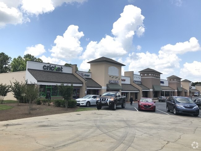
Property Record
39 E May St, Winder, GA 30680


Property Detail
39 E May St
WN13-109
39 E MAY ST
Stripcommercialcenter
BARROW
B-2,R-3
Georgia
B and X Area of moderate flood hazard, usually the area between the limits of the 100-year and 500-year floods.
9.15 AC
2025
S Barrow
2025
Atlanta
180204
Atlanta-Sandy Springs-Roswell, GA
51,753 SF
NEARBY LISTINGS FOR SALE OR LEASE
DEMOGRAPHICS near 39 E May St
1 mile
3 mile
5 mile
2025 Total Population
6,047
28,925
53,716
2030 Population
6,797
32,686
60,793
Pop Growth 2025-2030
+ 12.40%
+ 13.00%
+ 13.17%
Average Age
37
38
37
2025 Total Households
2,286
10,293
18,537
HH Growth 2025-2030
+ 12.42%
+ 13.02%
+ 13.21%
Median Household Inc
$45,671
$58,696
$64,051
Avg Household Size
2.60
2.80
2.80
2025 Avg HH Vehicles
2.00
2.00
2.00
Median Home Value
$235,974
$273,746
$288,244
Median Year Built
1983
1996
1999
Nearby Places
Map Layers
Map Styles
 Street
 Aerial
Layers
 Traffic
 Biking
Places
Listings with unknown addresses are not visible on the map
- Restaurants
- Banks
- Shops
- Fitness
- Groceries
SALE & LEASE HISTORY
LISTING DATE
SALE/LEASE

Sep 24, 2016
For Lease
Sep 13, 2021
For Sale
Jun 25, 2018
For Lease
Nearby Properties
Address
Land Use
TOTAL SIZE
Lot Size
Zoning
Address
Land Use
TOTAL SIZE
Lot Size
Zoning
1,456 SF
1,732.81 AC
G
Address
Land Use
TOTAL SIZE
Lot Size
Zoning
165,737 SF
124.90 AC
G
Address
Land Use
TOTAL SIZE
Lot Size
Zoning
105,850 SF
61 AC
G
Address
Land Use
TOTAL SIZE
Lot Size
Zoning
6,928 SF
358.89 AC
AC
Address
Land Use
TOTAL SIZE
Lot Size
Zoning
690,427 SF
156.03 AC
M-1
Address
Land Use
TOTAL SIZE
Lot Size
Zoning
165,737 SF
9.70 AC
G
Address
Land Use
TOTAL SIZE
Lot Size
Zoning
50,000 SF
29 AC
G
Address
Land Use
TOTAL SIZE
Lot Size
Zoning
89,684 SF
64.92 AC
B-2
Address
Land Use
TOTAL SIZE
Lot Size
Zoning
20,132 SF
56.30 AC
M-2
Address
Land Use
TOTAL SIZE
Lot Size
Zoning
38,000 SF
362.35 AC
G,R-1A
Address
Land Use
TOTAL SIZE
Lot Size
Zoning
189,400 SF
24.79 AC
C-2
Address
Land Use
TOTAL SIZE
Lot Size
Zoning
233,462 SF
25.22 AC
C-2
Address
Land Use
TOTAL SIZE
Lot Size
Zoning
83,937 SF
17.83 AC
B-1
Address
Land Use
TOTAL SIZE
Lot Size
Zoning
35,790 SF
69.65 AC
G
Address
Land Use
TOTAL SIZE
Lot Size
Zoning
81,934 SF
30.94 AC
M-2
Address
Land Use
TOTAL SIZE
Lot Size
Zoning
3,370 SF
352.38 AC
G,TNPD
Address
Land Use
TOTAL SIZE
Lot Size
Zoning
60,540 SF
79.35 AC
AG
Address
Land Use
TOTAL SIZE
Lot Size
Zoning
48,998 SF
15.53 AC
B-1
Address
Land Use
TOTAL SIZE
Lot Size
Zoning
3,462 SF
10.05 AC
G,R-3
Address
Land Use
TOTAL SIZE
Lot Size
Zoning
26,802 SF
5 AC
AG
Address
Land Use
TOTAL SIZE
Lot Size
Zoning
2,160 SF
23.93 AC
B-1
Address
Land Use
TOTAL SIZE
Lot Size
Zoning
4,210 SF
3.30 AC
G
Address
Land Use
TOTAL SIZE
Lot Size
Zoning
4,405 SF
7.48 AC
B-1,R-1,R-
Address
Land Use
TOTAL SIZE
Lot Size
Zoning
14,800 SF
57.87 AC
M-1
Address
Land Use
TOTAL SIZE
Lot Size
Zoning
20,592 SF
66.11 AC
G
Address
Land Use
TOTAL SIZE
Lot Size
Zoning
93,959 SF
14.28 AC
B-1
Address
Land Use
TOTAL SIZE
Lot Size
Zoning
30,575 SF
7.27 AC
G,R-1A
Address
Land Use
TOTAL SIZE
Lot Size
Zoning
59,898 SF
38.86 AC
M-1
Address
Land Use
TOTAL SIZE
Lot Size
Zoning
76,768 SF
24.98 AC
R-1
The World's #1 Commercial Real Estate Marketplace
Connect with us
© 2026 CoStar Group
The information above has been obtained from sources believed reliable. While we do not doubt its accuracy we have not verified it and make no guarantee, warranty or representation about it. It is your responsibility to independently confirm its accuracy and completeness. Any projections, opinions, assumptions, or estimates used are for example only and do not represent the current or future performance of the property. The value of this transaction to you depends on tax and other factors which should be evaluated by your tax, financial, and legal advisors. You and your advisors should conduct a careful, independent investigation of the property to determine to your satisfaction the suitability of the property for your needs.