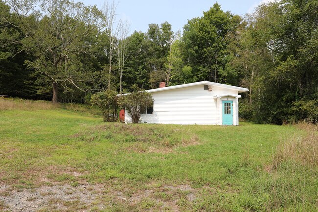
Property Record
39 Freer Rd, Ellenville, NY 12428


NEARBY LISTINGS FOR SALE OR LEASE
Property Detail
39 Freer Rd
5689-082.004-0001-036.000-0000
Ulster
Manufacturinglight
New York
X
36.000
36111C0700F
73.80 AC
2025
Hudson Valley Area
2024
Other Market Areas
954700
Kingston, NY
16,045 SF
DEMOGRAPHICS near 39 Freer Rd
1 Mile
3 Mile
5 Mile
2024 Total Population
70
5,358
9,780
2029 Population
70
5,384
9,809
Pop Growth 2024-2029
0.00%
+ 0.49%
+ 0.30%
Average Age
46
40
42
2024 Total Households
29
2,078
3,767
HH Growth 2024-2029
0.00%
+ 0.48%
+ 0.24%
Median Household Inc
$107,500
$60,859
$62,311
Avg Household Size
2.30
2.50
2.40
2024 Avg HH Vehicles
2.00
2.00
2.00
Median Home Value
$269,999
$187,530
$185,127
Median Year Built
1960
1959
1961
Nearby Places
Map Layers
Map Styles
 Street
 Aerial
- Restaurants
- Banks
- Shops
- Fitness
- Groceries
PUBLIC TRANSPORTATION
AIRPORT
New York Stewart International
DRIVE
WALK
Distance
New York Stewart International
60 min
33.7 mi
Freight Ports
Albany, NY Port
DRIVE
WALK
Distance
Albany, NY Port
108 min
82.2 mi
SALE & LEASE HISTORY
LISTING DATE
SALE/LEASE

Nov 29, 2022
For Sale
Jun 05, 2024
For Lease
Feb 08, 2024
For Sale
Aug 30, 2018
For Sale
Nearby Properties
Address
Land Use
TOTAL SIZE
Lot Size
Zoning
Address
Land Use
TOTAL SIZE
Lot Size
Zoning
14,400 SF
107 AC
RU
Address
Land Use
TOTAL SIZE
Lot Size
Zoning
168,959 SF
177.40 AC
VP
Address
Land Use
TOTAL SIZE
Lot Size
Zoning
23,968 SF
55.20 AC
RU
Address
Land Use
TOTAL SIZE
Lot Size
Zoning
12,480 SF
103 AC
RU
Address
Land Use
TOTAL SIZE
Lot Size
Zoning
82,557 SF
463.60 AC
VP
Address
Land Use
TOTAL SIZE
Lot Size
Zoning
10,558 SF
125.40 AC
RU
Address
Land Use
TOTAL SIZE
Lot Size
Zoning
8,928 SF
5.66 AC
R-3
Address
Land Use
TOTAL SIZE
Lot Size
Zoning
18,762 SF
3.19 AC
R-3
Address
Land Use
TOTAL SIZE
Lot Size
Zoning
22,875 SF
101.40 AC
Address
Land Use
TOTAL SIZE
Lot Size
Zoning
19,752 SF
11 AC
05 - COMME
Address
Land Use
TOTAL SIZE
Lot Size
Zoning
Address
Land Use
TOTAL SIZE
Lot Size
Zoning
29,280 SF
1.55 AC
05 - COMME
Address
Land Use
TOTAL SIZE
Lot Size
Zoning
129,841 SF
8.13 AC
06 - INDUS
Address
Land Use
TOTAL SIZE
Lot Size
Zoning
22,665 SF
0.50 AC
06 - INDUS
Address
Land Use
TOTAL SIZE
Lot Size
Zoning
15,037 SF
3.42 AC
R-2
Address
Land Use
TOTAL SIZE
Lot Size
Zoning
3,696 SF
0.60 AC
B-1
Address
Land Use
TOTAL SIZE
Lot Size
Zoning
8,923 SF
0.97 AC
05 - COMME
Address
Land Use
TOTAL SIZE
Lot Size
Zoning
11,580 SF
1 AC
05 - COMME
Address
Land Use
TOTAL SIZE
Lot Size
Zoning
13,464 SF
40 AC
RU
Address
Land Use
TOTAL SIZE
Lot Size
Zoning
34,090 SF
1.80 AC
RC40
Address
Land Use
TOTAL SIZE
Lot Size
Zoning
2,686 SF
177.50 AC
RC40
Address
Land Use
TOTAL SIZE
Lot Size
Zoning
2,856 SF
203.40 AC
RU
Address
Land Use
TOTAL SIZE
Lot Size
Zoning
8,854 SF
0.81 AC
06 - INDUS
Address
Land Use
TOTAL SIZE
Lot Size
Zoning
7,378 SF
1.04 AC
B-3
Address
Land Use
TOTAL SIZE
Lot Size
Zoning
5,172 SF
19.60 AC
BH
Address
Land Use
TOTAL SIZE
Lot Size
Zoning
3,150 SF
1.99 AC
R-2
Address
Land Use
TOTAL SIZE
Lot Size
Zoning
2,358 SF
1.11 AC
R/O
Address
Land Use
TOTAL SIZE
Lot Size
Zoning
2,372 SF
0.30 AC
B-1
Address
Land Use
TOTAL SIZE
Lot Size
Zoning
57 AC
RU
Address
Land Use
TOTAL SIZE
Lot Size
Zoning
4,406 SF
49.76 AC
RA
The World's #1 Commercial Real Estate Marketplace
Connect with us
© 2025 CoStar Group
The information above has been obtained from sources believed reliable. While we do not doubt its accuracy we have not verified it and make no guarantee, warranty or representation about it. It is your responsibility to independently confirm its accuracy and completeness. Any projections, opinions, assumptions, or estimates used are for example only and do not represent the current or future performance of the property. The value of this transaction to you depends on tax and other factors which should be evaluated by your tax, financial, and legal advisors. You and your advisors should conduct a careful, independent investigation of the property to determine to your satisfaction the suitability of the property for your needs.