Property Record
39 N State Home Rd, Monroe Township, NJ 08831


This Property Is For Sale
NEARBY LISTINGS FOR SALE OR LEASE
Property Detail
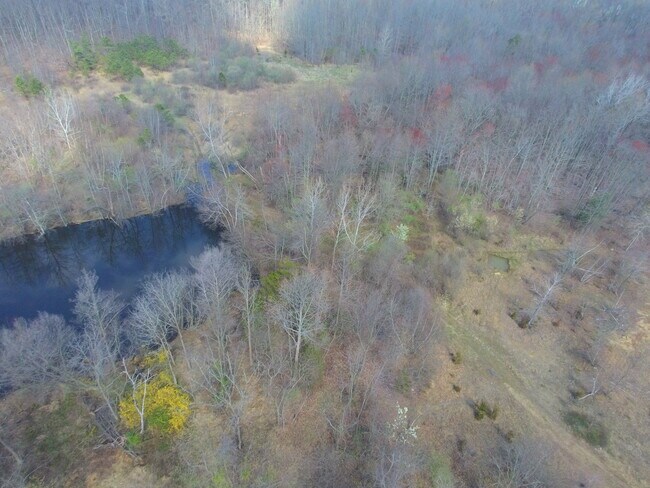
39 N State Home Rd
12-00076-0000-00024
25.1700
Storemultistory
Middlesex
A
New Jersey
34023C0257F
24
2024
25.17 AC
2025
Brunswick
008212
Northern New Jersey
1,500 SF
New York-Jersey City-White Plains, NY-NJ
DEMOGRAPHICS near 39 N State Home Rd
1 Mile
3 Mile
5 Mile
2024 Total Population
2,541
37,519
118,953
2029 Population
2,564
37,557
118,356
Pop Growth 2024-2029
+ 0.91%
+ 0.10%
(0.50%)
Average Age
40
44
46
2024 Total Households
711
13,214
45,298
HH Growth 2024-2029
+ 0.84%
+ 0.05%
(0.78%)
Median Household Inc
$175,977
$123,777
$108,530
Avg Household Size
3.50
2.80
2.60
2024 Avg HH Vehicles
2.00
2.00
2.00
Median Home Value
$702,191
$508,287
$431,873
Median Year Built
1999
1991
1981
Nearby Places
Map Layers
Map Styles
 Street
 Aerial
- Restaurants
- Banks
- Shops
- Fitness
- Groceries
PUBLIC TRANSPORTATION
AIRPORT
Trenton Mercer
DRIVE
WALK
Distance
Trenton Mercer
46 min
28.9 mi
Newark Liberty International
DRIVE
WALK
Distance
Newark Liberty International
50 min
38.2 mi
Freight Ports
New York Container Terminal
DRIVE
WALK
Distance
New York Container Terminal
44 min
30.4 mi
Nearby Properties
Address
Land Use
TOTAL SIZE
Lot Size
Zoning
Address
Land Use
TOTAL SIZE
Lot Size
Zoning
1,154,372 SF
167.04 AC
LI
Address
Land Use
TOTAL SIZE
Lot Size
Zoning
382,699 SF
29.60 AC
R30
Address
Land Use
TOTAL SIZE
Lot Size
Zoning
14,552 SF
484.47 AC
R20
Address
Land Use
TOTAL SIZE
Lot Size
Zoning
5.10 AC
Address
Land Use
TOTAL SIZE
Lot Size
Zoning
168,226 SF
49.66 AC
R30
Address
Land Use
TOTAL SIZE
Lot Size
Zoning
5,660 SF
112.88 AC
HD
Address
Land Use
TOTAL SIZE
Lot Size
Zoning
7,701 SF
38.78 AC
R30
Address
Land Use
TOTAL SIZE
Lot Size
Zoning
8,512 SF
65.36 AC
MH
Address
Land Use
TOTAL SIZE
Lot Size
Zoning
69.11 AC
VC-1
Address
Land Use
TOTAL SIZE
Lot Size
Zoning
2.53 AC
HR
Address
Land Use
TOTAL SIZE
Lot Size
Zoning
624 SF
210.30 AC
R30
Address
Land Use
TOTAL SIZE
Lot Size
Zoning
93,180 SF
0.65 AC
C-4
Address
Land Use
TOTAL SIZE
Lot Size
Zoning
750 SF
280.39 AC
SD5
Address
Land Use
TOTAL SIZE
Lot Size
Zoning
8.04 AC
PR
Address
Land Use
TOTAL SIZE
Lot Size
Zoning
27.15 AC
I-3
Address
Land Use
TOTAL SIZE
Lot Size
Zoning
164.10 AC
R30
Address
Land Use
TOTAL SIZE
Lot Size
Zoning
88,177 SF
20.40 AC
R30
Address
Land Use
TOTAL SIZE
Lot Size
Zoning
22.92 AC
VC-1
Address
Land Use
TOTAL SIZE
Lot Size
Zoning
17,600 SF
4.77 AC
LI
Address
Land Use
TOTAL SIZE
Lot Size
Zoning
Address
Land Use
TOTAL SIZE
Lot Size
Zoning
89.98 AC
HD
Address
Land Use
TOTAL SIZE
Lot Size
Zoning
62,591 SF
19.89 AC
FHC
Address
Land Use
TOTAL SIZE
Lot Size
Zoning
63,144 SF
20.70 AC
R20
Address
Land Use
TOTAL SIZE
Lot Size
Zoning
37.44 AC
HD
Address
Land Use
TOTAL SIZE
Lot Size
Zoning
618.08 AC
RP
Address
Land Use
TOTAL SIZE
Lot Size
Zoning
26,450 SF
18.80 AC
R30
Address
Land Use
TOTAL SIZE
Lot Size
Zoning
30,905 SF
8.56 AC
NC
Address
Land Use
TOTAL SIZE
Lot Size
Zoning
2.04 AC
APT
Address
Land Use
TOTAL SIZE
Lot Size
Zoning
74,394 SF
11.70 AC
R-10
Address
Land Use
TOTAL SIZE
Lot Size
Zoning
61,699 SF
9.03 AC
R20
The World's #1 Commercial Real Estate Marketplace
Connect with us
© 2025 CoStar Group
The information above has been obtained from sources believed reliable. While we do not doubt its accuracy we have not verified it and make no guarantee, warranty or representation about it. It is your responsibility to independently confirm its accuracy and completeness. Any projections, opinions, assumptions, or estimates used are for example only and do not represent the current or future performance of the property. The value of this transaction to you depends on tax and other factors which should be evaluated by your tax, financial, and legal advisors. You and your advisors should conduct a careful, independent investigation of the property to determine to your satisfaction the suitability of the property for your needs.