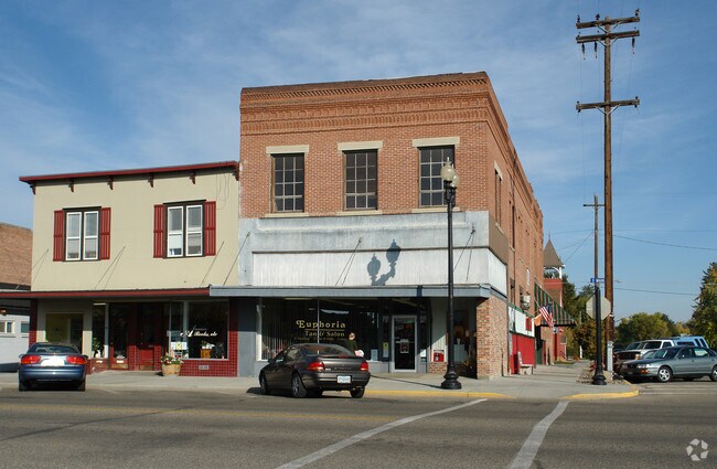
Property Record
39 S Main St, Payette, ID 83661


Property Detail
39 S Main St
Ontario, OR-ID
MASTERS ORIG LT 10 BLK 9
P14700090100
Payette
Storebuilding
Idaho
2025
10
2025
0.10 AC
960100
Idaho South Area
8,292 SF
Other Market Areas
NEARBY LISTINGS FOR SALE OR LEASE
DEMOGRAPHICS near 39 S Main St
1 mile
3 mile
5 mile
2025 Total Population
6,319
13,640
33,380
2030 Population
6,658
14,405
34,756
Pop Growth 2025-2030
+ 5.36%
+ 5.61%
+ 4.12%
Average Age
40
40
40
2025 Total Households
2,431
5,147
12,395
HH Growth 2025-2030
+ 5.43%
+ 5.63%
+ 4.18%
Median Household Inc
$52,202
$61,517
$59,044
Avg Household Size
2.50
2.60
2.60
2025 Avg HH Vehicles
2.00
2.00
2.00
Median Home Value
$320,904
$335,431
$320,131
Median Year Built
1973
1976
1976
Nearby Places
Map Layers
Map Styles
 Street
 Aerial
Layers
 Traffic
 Biking
Places
Listings with unknown addresses are not visible on the map
- Restaurants
- Banks
- Shops
- Fitness
- Groceries
SALE & LEASE HISTORY
LISTING DATE
SALE/LEASE

Sep 23, 2016
For Sale
Nearby Properties
Address
Land Use
TOTAL SIZE
Lot Size
Zoning
Address
Land Use
TOTAL SIZE
Lot Size
Zoning
1.57 AC
Address
Land Use
TOTAL SIZE
Lot Size
Zoning
38,083 SF
1.37 AC
Address
Land Use
TOTAL SIZE
Lot Size
Zoning
13,110 SF
7.54 AC
O-I1
Address
Land Use
TOTAL SIZE
Lot Size
Zoning
34,363 SF
1.54 AC
O-RM
Address
Land Use
TOTAL SIZE
Lot Size
Zoning
22,520 SF
4.24 AC
Address
Land Use
TOTAL SIZE
Lot Size
Zoning
29,844 SF
9.25 AC
Address
Land Use
TOTAL SIZE
Lot Size
Zoning
10,620 SF
40 AC
Address
Land Use
TOTAL SIZE
Lot Size
Zoning
7.71 AC
Address
Land Use
TOTAL SIZE
Lot Size
Zoning
37,759 SF
4.48 AC
Address
Land Use
TOTAL SIZE
Lot Size
Zoning
6,680 SF
3.51 AC
Address
Land Use
TOTAL SIZE
Lot Size
Zoning
94.01 AC
O-I2+
Address
Land Use
TOTAL SIZE
Lot Size
Zoning
24,244 SF
2.37 AC
Address
Land Use
TOTAL SIZE
Lot Size
Zoning
18,580 SF
5 AC
O-PF
Address
Land Use
TOTAL SIZE
Lot Size
Zoning
53,040 SF
4.29 AC
O-RM
Address
Land Use
TOTAL SIZE
Lot Size
Zoning
11.81 AC
Address
Land Use
TOTAL SIZE
Lot Size
Zoning
10,955 SF
1.03 AC
Address
Land Use
TOTAL SIZE
Lot Size
Zoning
16,606 SF
1.90 AC
Address
Land Use
TOTAL SIZE
Lot Size
Zoning
4,221 SF
2 AC
Address
Land Use
TOTAL SIZE
Lot Size
Zoning
Address
Land Use
TOTAL SIZE
Lot Size
Zoning
3,800 SF
1.93 AC
Address
Land Use
TOTAL SIZE
Lot Size
Zoning
15,461 SF
4.65 AC
Address
Land Use
TOTAL SIZE
Lot Size
Zoning
50.97 AC
O-I2
Address
Land Use
TOTAL SIZE
Lot Size
Zoning
25,625 SF
3.35 AC
Address
Land Use
TOTAL SIZE
Lot Size
Zoning
22,253 SF
1.03 AC
Address
Land Use
TOTAL SIZE
Lot Size
Zoning
7,689 SF
0.60 AC
Address
Land Use
TOTAL SIZE
Lot Size
Zoning
20,020 SF
2.17 AC
Address
Land Use
TOTAL SIZE
Lot Size
Zoning
4.53 AC
Address
Land Use
TOTAL SIZE
Lot Size
Zoning
13,824 SF
1.02 AC
Address
Land Use
TOTAL SIZE
Lot Size
Zoning
16,152 SF
3.02 AC
Address
Land Use
TOTAL SIZE
Lot Size
Zoning
7,225 SF
0.98 AC
The World's #1 Commercial Real Estate Marketplace
Connect with us
© 2026 CoStar Group
The information above has been obtained from sources believed reliable. While we do not doubt its accuracy we have not verified it and make no guarantee, warranty or representation about it. It is your responsibility to independently confirm its accuracy and completeness. Any projections, opinions, assumptions, or estimates used are for example only and do not represent the current or future performance of the property. The value of this transaction to you depends on tax and other factors which should be evaluated by your tax, financial, and legal advisors. You and your advisors should conduct a careful, independent investigation of the property to determine to your satisfaction the suitability of the property for your needs.