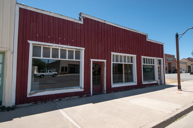
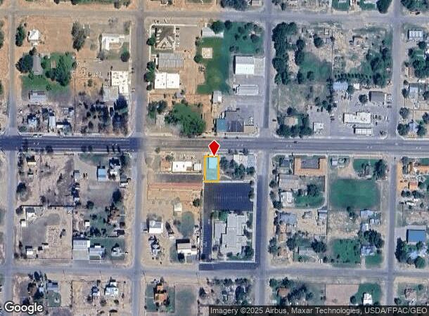
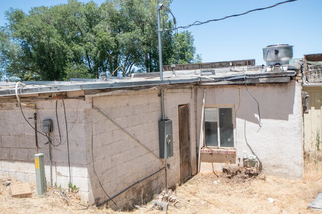
Property Record
39 W Main St, Escalante, UT 84726
NEARBY LISTINGS FOR SALE OR LEASE
-
-
View all Escalante listings for sale on LoopNet.com
Property Detail
39 W Main St
Other Market Areas
Garfield
04-0022-0383
Utah
Singlefamilyresidentialassumed
0.15 AC
2,341 SF
Utah South Area
DEMOGRAPHICS near 39 W Main St
1 Mile
3 Mile
5 Mile
2024 Total Population
1,405
1,456
1,462
2029 Population
1,569
1,626
1,632
Pop Growth 2024-2029
+ 11.67%
+ 11.68%
+ 11.63%
Average Age
46
46
46
2024 Total Households
597
618
621
HH Growth 2024-2029
+ 12.06%
+ 12.14%
+ 12.08%
Median Household Inc
$43,839
$43,792
$43,806
Avg Household Size
2.30
2.30
2.30
2024 Avg HH Vehicles
3.00
3.00
3.00
Median Home Value
$271,211
$270,588
$270,588
Median Year Built
1993
1993
1993
Nearby Places
Map Layers
Map Styles
 Street
 Aerial
- Restaurants
- Banks
- Shops
- Fitness
- Groceries
SALE & LEASE HISTORY
LISTING DATE
SALE/LEASE

Mar 09, 2017
For Sale
Jun 12, 2020
For Sale
Nearby Properties
Address
Land Use
TOTAL SIZE
Lot Size
Zoning
Address
Land Use
TOTAL SIZE
Lot Size
Zoning
31,031 SF
3.11 AC
Address
Land Use
TOTAL SIZE
Lot Size
Zoning
197.28 AC
Address
Land Use
TOTAL SIZE
Lot Size
Zoning
2,304 SF
0.43 AC
Address
Land Use
TOTAL SIZE
Lot Size
Zoning
2,402 SF
10 AC
Address
Land Use
TOTAL SIZE
Lot Size
Zoning
2,208 SF
0.46 AC
Address
Land Use
TOTAL SIZE
Lot Size
Zoning
53.47 AC
Address
Land Use
TOTAL SIZE
Lot Size
Zoning
42.30 AC
Address
Land Use
TOTAL SIZE
Lot Size
Zoning
199.14 AC
Address
Land Use
TOTAL SIZE
Lot Size
Zoning
38.86 AC
Address
Land Use
TOTAL SIZE
Lot Size
Zoning
1,327 SF
0.40 AC
Address
Land Use
TOTAL SIZE
Lot Size
Zoning
Address
Land Use
TOTAL SIZE
Lot Size
Zoning
14.25 AC
Address
Land Use
TOTAL SIZE
Lot Size
Zoning
1,344 SF
35.50 AC
Address
Land Use
TOTAL SIZE
Lot Size
Zoning
29.60 AC
Address
Land Use
TOTAL SIZE
Lot Size
Zoning
28.26 AC
Address
Land Use
TOTAL SIZE
Lot Size
Zoning
25.65 AC
Address
Land Use
TOTAL SIZE
Lot Size
Zoning
24.50 AC
Address
Land Use
TOTAL SIZE
Lot Size
Zoning
Address
Land Use
TOTAL SIZE
Lot Size
Zoning
11.72 AC
Address
Land Use
TOTAL SIZE
Lot Size
Zoning
Address
Land Use
TOTAL SIZE
Lot Size
Zoning
21.75 AC
Address
Land Use
TOTAL SIZE
Lot Size
Zoning
Address
Land Use
TOTAL SIZE
Lot Size
Zoning
72.48 AC
Address
Land Use
TOTAL SIZE
Lot Size
Zoning
20.48 AC
Address
Land Use
TOTAL SIZE
Lot Size
Zoning
66.27 AC
Address
Land Use
TOTAL SIZE
Lot Size
Zoning
21.89 AC
Address
Land Use
TOTAL SIZE
Lot Size
Zoning
10.02 AC
Address
Land Use
TOTAL SIZE
Lot Size
Zoning
Address
Land Use
TOTAL SIZE
Lot Size
Zoning
The World's #1 Commercial Real Estate Marketplace
Connect with us
© 2025 CoStar Group
The information above has been obtained from sources believed reliable. While we do not doubt its accuracy we have not verified it and make no guarantee, warranty or representation about it. It is your responsibility to independently confirm its accuracy and completeness. Any projections, opinions, assumptions, or estimates used are for example only and do not represent the current or future performance of the property. The value of this transaction to you depends on tax and other factors which should be evaluated by your tax, financial, and legal advisors. You and your advisors should conduct a careful, independent investigation of the property to determine to your satisfaction the suitability of the property for your needs.