Property Record
390 1St St Sw, Bandon, OR 97411

NEARBY LISTINGS FOR SALE OR LEASE
-
-
View all Bandon listings for sale on LoopNet.com
Property Detail
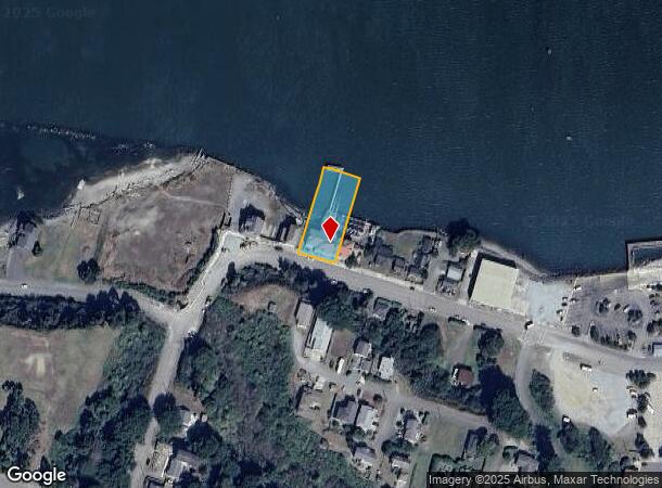
390 1St St Sw
1001035500
Coos
Miscellaneous
Oregon
AE
2300
41011C0681F
0.59 AC
0
Oregon West Area
2025
Other Market Areas
001001
Coos Bay, OR
DEMOGRAPHICS near 390 1St St Sw
1 Mile
3 Mile
5 Mile
2024 Total Population
2,465
5,202
6,197
2029 Population
2,470
5,210
6,199
Pop Growth 2024-2029
+ 0.20%
+ 0.15%
+ 0.03%
Average Age
53
53
52
2024 Total Households
1,225
2,507
2,943
HH Growth 2024-2029
+ 0.08%
+ 0.12%
+ 0.07%
Median Household Inc
$36,524
$41,617
$42,378
Avg Household Size
1.90
2.00
2.00
2024 Avg HH Vehicles
2.00
2.00
2.00
Median Home Value
$424,180
$422,608
$435,461
Median Year Built
1981
1984
1984
Nearby Places
Map Layers
Map Styles
 Street
 Aerial
- Restaurants
- Banks
- Shops
- Fitness
- Groceries
Nearby Properties
Address
Land Use
TOTAL SIZE
Lot Size
Zoning
Address
Land Use
TOTAL SIZE
Lot Size
Zoning
9,553 SF
4.71 AC
CD-2
Address
Land Use
TOTAL SIZE
Lot Size
Zoning
63,692 SF
5.01 AC
IND
Address
Land Use
TOTAL SIZE
Lot Size
Zoning
0.98 AC
PF
Address
Land Use
TOTAL SIZE
Lot Size
Zoning
58,381 SF
4.72 AC
C-2
Address
Land Use
TOTAL SIZE
Lot Size
Zoning
5.11 AC
NR/R-2
Address
Land Use
TOTAL SIZE
Lot Size
Zoning
9,553 SF
4.71 AC
CD-2
Address
Land Use
TOTAL SIZE
Lot Size
Zoning
616 SF
24.31 AC
PF
Address
Land Use
TOTAL SIZE
Lot Size
Zoning
1.91 AC
CD-1
Address
Land Use
TOTAL SIZE
Lot Size
Zoning
3,048 SF
6.70 AC
CD-1
Address
Land Use
TOTAL SIZE
Lot Size
Zoning
840 SF
5.35 AC
PF
Address
Land Use
TOTAL SIZE
Lot Size
Zoning
2.36 AC
PF
Address
Land Use
TOTAL SIZE
Lot Size
Zoning
12.07 AC
UR-1
Address
Land Use
TOTAL SIZE
Lot Size
Zoning
2.20 AC
PF
Address
Land Use
TOTAL SIZE
Lot Size
Zoning
33.28 AC
IND
Address
Land Use
TOTAL SIZE
Lot Size
Zoning
2.93 AC
CD-1
Address
Land Use
TOTAL SIZE
Lot Size
Zoning
1,704 SF
72.58 AC
IND
Address
Land Use
TOTAL SIZE
Lot Size
Zoning
63,250 SF
167.20 AC
REC
Address
Land Use
TOTAL SIZE
Lot Size
Zoning
24,400 SF
2.58 AC
CD-1
Address
Land Use
TOTAL SIZE
Lot Size
Zoning
9,194 SF
2.83 AC
CD-1
Address
Land Use
TOTAL SIZE
Lot Size
Zoning
7,284 SF
7.30 AC
RR-2, IND
Address
Land Use
TOTAL SIZE
Lot Size
Zoning
8.99 AC
PF
Address
Land Use
TOTAL SIZE
Lot Size
Zoning
3.37 AC
C-3
Address
Land Use
TOTAL SIZE
Lot Size
Zoning
4.62 AC
PF
Address
Land Use
TOTAL SIZE
Lot Size
Zoning
1.72 AC
CD-1
Address
Land Use
TOTAL SIZE
Lot Size
Zoning
1.39 AC
C-2
Address
Land Use
TOTAL SIZE
Lot Size
Zoning
3.74 AC
RR-2
Address
Land Use
TOTAL SIZE
Lot Size
Zoning
6,973 SF
0.42 AC
CD-1
Address
Land Use
TOTAL SIZE
Lot Size
Zoning
0.35 AC
C-1
Address
Land Use
TOTAL SIZE
Lot Size
Zoning
9,400 SF
3.64 AC
PF
The World's #1 Commercial Real Estate Marketplace
Connect with us
© 2025 CoStar Group
The information above has been obtained from sources believed reliable. While we do not doubt its accuracy we have not verified it and make no guarantee, warranty or representation about it. It is your responsibility to independently confirm its accuracy and completeness. Any projections, opinions, assumptions, or estimates used are for example only and do not represent the current or future performance of the property. The value of this transaction to you depends on tax and other factors which should be evaluated by your tax, financial, and legal advisors. You and your advisors should conduct a careful, independent investigation of the property to determine to your satisfaction the suitability of the property for your needs.