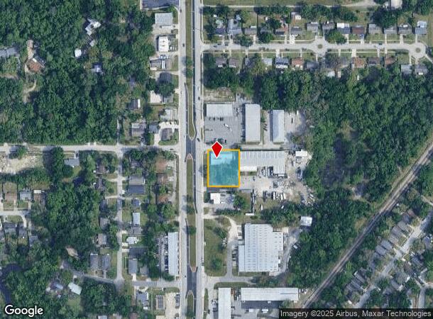
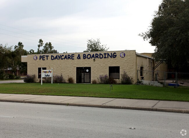
Property Record
390 Corporate Way, Longwood, FL 32750

NEARBY LISTINGS FOR SALE OR LEASE
Property Detail
390 Corporate Way
Orlando-Kissimmee-Sanford, FL
Bradleys Add
32-20-30-505-0000-013C
N 183.1 FT OF W 200 FT OF LOT 13 (LESS RD ON W) BRADLEYS ADD PB 1 PG 17
Officebuilding
Seminole
X
Florida
12117C0155F
13
2024
0.64 AC
2024
Longwood
021506
Orlando
3,750 SF
DEMOGRAPHICS near 390 Corporate Way
1 Mile
3 Mile
5 Mile
2024 Total Population
8,617
69,683
195,016
2029 Population
8,926
72,485
203,054
Pop Growth 2024-2029
+ 3.59%
+ 4.02%
+ 4.12%
Average Age
41
42
42
2024 Total Households
3,286
27,314
79,215
HH Growth 2024-2029
+ 3.71%
+ 4.14%
+ 4.31%
Median Household Inc
$62,327
$66,151
$68,036
Avg Household Size
2.60
2.50
2.40
2024 Avg HH Vehicles
2.00
2.00
2.00
Median Home Value
$262,138
$284,253
$304,807
Median Year Built
1981
1983
1983
Nearby Places
Map Layers
Map Styles
 Street
 Aerial
- Restaurants
- Banks
- Shops
- Fitness
- Groceries
PUBLIC TRANSPORTATION
COMMUTER RAIL
DRIVE
WALK
Distance
2 min
16 min
0.8 mi
DRIVE
WALK
Distance
8 min
3.8 mi
AIRPORT
Orlando Sanford International
DRIVE
WALK
Distance
Orlando Sanford International
17 min
9.2 mi
Orlando International
DRIVE
WALK
Distance
Orlando International
37 min
20.6 mi
Daytona Beach International
DRIVE
WALK
Distance
Daytona Beach International
56 min
41.8 mi
Freight Ports
Port Canaveral
DRIVE
WALK
Distance
Port Canaveral
81 min
62.6 mi
Nearby Properties
Address
Land Use
TOTAL SIZE
Lot Size
Zoning
Address
Land Use
TOTAL SIZE
Lot Size
Zoning
1,770 SF
47.41 AC
PUD
Address
Land Use
TOTAL SIZE
Lot Size
Zoning
21.25 AC
GC
Address
Land Use
TOTAL SIZE
Lot Size
Zoning
2,548 SF
34.45 AC
PUD
Address
Land Use
TOTAL SIZE
Lot Size
Zoning
629,182 SF
1.81 AC
R1A
Address
Land Use
TOTAL SIZE
Lot Size
Zoning
206 SF
1.43 AC
VMU
Address
Land Use
TOTAL SIZE
Lot Size
Zoning
350,767 SF
11.12 AC
PUD
Address
Land Use
TOTAL SIZE
Lot Size
Zoning
320,968 SF
2.96 AC
PUD
Address
Land Use
TOTAL SIZE
Lot Size
Zoning
456 SF
9.56 AC
Address
Land Use
TOTAL SIZE
Lot Size
Zoning
97,888 SF
3.72 AC
IND
Address
Land Use
TOTAL SIZE
Lot Size
Zoning
17,728 SF
14.64 AC
GC
Address
Land Use
TOTAL SIZE
Lot Size
Zoning
147,310 SF
16.71 AC
GC
Address
Land Use
TOTAL SIZE
Lot Size
Zoning
560,170 SF
32.59 AC
M1A
Address
Land Use
TOTAL SIZE
Lot Size
Zoning
155,533 SF
11.49 AC
M1A
Address
Land Use
TOTAL SIZE
Lot Size
Zoning
365,430 SF
2.70 AC
RMF13
Address
Land Use
TOTAL SIZE
Lot Size
Zoning
390,293 SF
47.33 AC
PI
Address
Land Use
TOTAL SIZE
Lot Size
Zoning
1,518 SF
12.08 AC
PUD
Address
Land Use
TOTAL SIZE
Lot Size
Zoning
1,696 SF
0.16 AC
A1
Address
Land Use
TOTAL SIZE
Lot Size
Zoning
212,638 SF
28.72 AC
M1
Address
Land Use
TOTAL SIZE
Lot Size
Zoning
8,975 SF
13.13 AC
C1
Address
Land Use
TOTAL SIZE
Lot Size
Zoning
156,858 SF
21.29 AC
M1A
Address
Land Use
TOTAL SIZE
Lot Size
Zoning
195,936 SF
58.50 AC
PUD
Address
Land Use
TOTAL SIZE
Lot Size
Zoning
140,065 SF
10.62 AC
M1A
Address
Land Use
TOTAL SIZE
Lot Size
Zoning
95,076 SF
23.30 AC
Address
Land Use
TOTAL SIZE
Lot Size
Zoning
111,586 SF
8.76 AC
M1A
Address
Land Use
TOTAL SIZE
Lot Size
Zoning
136,532 SF
12.13 AC
GC
Address
Land Use
TOTAL SIZE
Lot Size
Zoning
121,655 SF
10.65 AC
M1A
Address
Land Use
TOTAL SIZE
Lot Size
Zoning
220 SF
7.72 AC
GC
Address
Land Use
TOTAL SIZE
Lot Size
Zoning
140,456 SF
8.45 AC
R1
Address
Land Use
TOTAL SIZE
Lot Size
Zoning
69,574 SF
3.25 AC
M1A
Address
Land Use
TOTAL SIZE
Lot Size
Zoning
117,600 SF
7.70 AC
M1A
The World's #1 Commercial Real Estate Marketplace
Connect with us
© 2025 CoStar Group
The information above has been obtained from sources believed reliable. While we do not doubt its accuracy we have not verified it and make no guarantee, warranty or representation about it. It is your responsibility to independently confirm its accuracy and completeness. Any projections, opinions, assumptions, or estimates used are for example only and do not represent the current or future performance of the property. The value of this transaction to you depends on tax and other factors which should be evaluated by your tax, financial, and legal advisors. You and your advisors should conduct a careful, independent investigation of the property to determine to your satisfaction the suitability of the property for your needs.