Property Record
390 Griswold St Ne, Warren, OH 44483
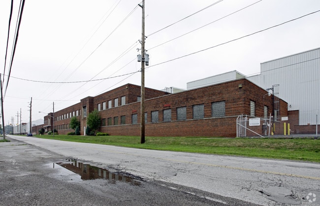


Property Detail
390 Griswold St Ne
Youngstown-Warren, OH
36&37& 19.829 38&39&40.41 ALL&PT GRISWOLD ST
39-538544
Trumbull
Factorymedium
Ohio
B and X Area of moderate flood hazard, usually the area between the limits of the 100-year and 500-year floods.
36
2025
19.83 AC
2025
Warren
921100
Youngstown/Warren/Boardman
NEARBY LISTINGS FOR SALE OR LEASE
DEMOGRAPHICS near 390 Griswold St Ne
1 mile
3 mile
5 mile
2025 Total Population
9,320
47,021
79,179
2030 Population
9,614
47,524
79,433
Pop Growth 2025-2030
+ 3.15%
+ 1.07%
+ 0.32%
Average Age
39
41
42
2025 Total Households
3,755
19,936
33,876
HH Growth 2025-2030
+ 3.01%
+ 0.93%
+ 0.23%
Median Household Inc
$28,799
$37,591
$45,820
Avg Household Size
2.10
2.20
2.20
2025 Avg HH Vehicles
2.00
1.00
2.00
Median Home Value
$62,016
$83,571
$121,528
Median Year Built
1949
1956
1961
Nearby Places
Map Layers
Map Styles
 Street
 Aerial
Layers
 Traffic
 Biking
Places
Listings with unknown addresses are not visible on the map
- Restaurants
- Banks
- Shops
- Fitness
- Groceries
Nearby Properties
Address
Land Use
TOTAL SIZE
Lot Size
Zoning
Address
Land Use
TOTAL SIZE
Lot Size
Zoning
283,853 SF
17.20 AC
Address
Land Use
TOTAL SIZE
Lot Size
Zoning
116,311 SF
9.16 AC
Address
Land Use
TOTAL SIZE
Lot Size
Zoning
101,372 SF
0.57 AC
Address
Land Use
TOTAL SIZE
Lot Size
Zoning
98,353 SF
132.90 AC
Address
Land Use
TOTAL SIZE
Lot Size
Zoning
44,600 SF
151.65 AC
Address
Land Use
TOTAL SIZE
Lot Size
Zoning
274,954 SF
6.75 AC
Address
Land Use
TOTAL SIZE
Lot Size
Zoning
1,404,342 SF
72.77 AC
Address
Land Use
TOTAL SIZE
Lot Size
Zoning
4,798 SF
41.21 AC
Address
Land Use
TOTAL SIZE
Lot Size
Zoning
114,710 SF
29.79 AC
Address
Land Use
TOTAL SIZE
Lot Size
Zoning
142,467 SF
4.40 AC
Address
Land Use
TOTAL SIZE
Lot Size
Zoning
110,043 SF
10 AC
Address
Land Use
TOTAL SIZE
Lot Size
Zoning
3,752 SF
1.37 AC
Address
Land Use
TOTAL SIZE
Lot Size
Zoning
175,920 SF
17.34 AC
Address
Land Use
TOTAL SIZE
Lot Size
Zoning
216,467 SF
23.90 AC
Address
Land Use
TOTAL SIZE
Lot Size
Zoning
49,752 SF
11.40 AC
Address
Land Use
TOTAL SIZE
Lot Size
Zoning
66,942 SF
2.07 AC
Address
Land Use
TOTAL SIZE
Lot Size
Zoning
25,067 SF
4.74 AC
Address
Land Use
TOTAL SIZE
Lot Size
Zoning
55,318 SF
2.45 AC
Address
Land Use
TOTAL SIZE
Lot Size
Zoning
29.72 AC
Address
Land Use
TOTAL SIZE
Lot Size
Zoning
160,740 SF
4.08 AC
Address
Land Use
TOTAL SIZE
Lot Size
Zoning
37,053 SF
16.46 AC
Address
Land Use
TOTAL SIZE
Lot Size
Zoning
253,756 SF
16.25 AC
Address
Land Use
TOTAL SIZE
Lot Size
Zoning
12.72 AC
Address
Land Use
TOTAL SIZE
Lot Size
Zoning
106,350 SF
17.79 AC
Address
Land Use
TOTAL SIZE
Lot Size
Zoning
44,671 SF
1.83 AC
Address
Land Use
TOTAL SIZE
Lot Size
Zoning
38,752 SF
18.49 AC
Address
Land Use
TOTAL SIZE
Lot Size
Zoning
1,732 SF
47.89 AC
Address
Land Use
TOTAL SIZE
Lot Size
Zoning
13,051 SF
10.60 AC
Address
Land Use
TOTAL SIZE
Lot Size
Zoning
112,736 SF
19.70 AC
Address
Land Use
TOTAL SIZE
Lot Size
Zoning
19,011 SF
5.37 AC
The World's #1 Commercial Real Estate Marketplace
Connect with us
© 2026 CoStar Group
The information above has been obtained from sources believed reliable. While we do not doubt its accuracy we have not verified it and make no guarantee, warranty or representation about it. It is your responsibility to independently confirm its accuracy and completeness. Any projections, opinions, assumptions, or estimates used are for example only and do not represent the current or future performance of the property. The value of this transaction to you depends on tax and other factors which should be evaluated by your tax, financial, and legal advisors. You and your advisors should conduct a careful, independent investigation of the property to determine to your satisfaction the suitability of the property for your needs.