Property Record
390 N Ironhead St, Vale, OR 97918
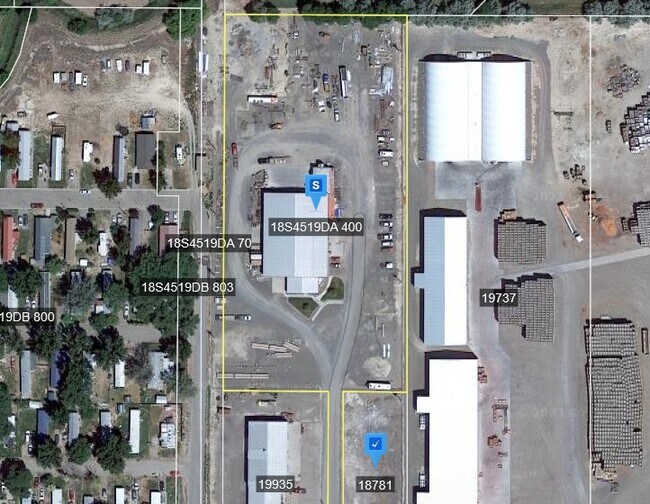
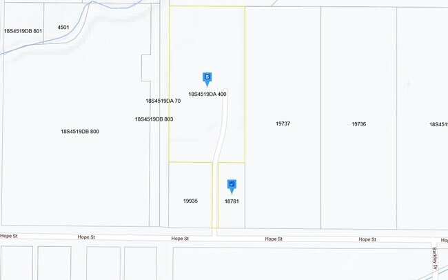
Property Detail
390 N Ironhead St
19936
Malheur
Countyproperty
Oregon
V-I
4.03 AC
0
Oregon East Area
2025
Other Market Areas
970600
Ontario, OR-ID
14,248 SF
NEARBY LISTINGS FOR SALE OR LEASE
-
-
View all Vale listings for sale on LoopNet.com
DEMOGRAPHICS near 390 N Ironhead St
1 mile
3 mile
5 mile
2025 Total Population
2,408
3,398
3,942
2030 Population
2,471
3,500
4,063
Pop Growth 2025-2030
+ 2.62%
+ 3.00%
+ 3.07%
Average Age
39
39
40
2025 Total Households
891
1,240
1,412
HH Growth 2025-2030
+ 2.81%
+ 3.15%
+ 3.19%
Median Household Inc
$58,411
$57,925
$58,072
Avg Household Size
2.60
2.60
2.60
2025 Avg HH Vehicles
2.00
2.00
2.00
Median Home Value
$250,952
$285,999
$307,530
Median Year Built
1971
1973
1974
Nearby Places
Map Layers
Map Styles
 Street
 Aerial
Layers
 Traffic
 Biking
Places
Listings with unknown addresses are not visible on the map
- Restaurants
- Banks
- Shops
- Fitness
- Groceries
Nearby Properties
Address
Land Use
TOTAL SIZE
Lot Size
Zoning
Address
Land Use
TOTAL SIZE
Lot Size
Zoning
70,816 SF
28.98 AC
V-PF
Address
Land Use
TOTAL SIZE
Lot Size
Zoning
144.80 AC
V-AP+
Address
Land Use
TOTAL SIZE
Lot Size
Zoning
56,286 SF
1.84 AC
V-C
Address
Land Use
TOTAL SIZE
Lot Size
Zoning
39,570 SF
1.62 AC
V-R1
Address
Land Use
TOTAL SIZE
Lot Size
Zoning
8.78 AC
V-I
Address
Land Use
TOTAL SIZE
Lot Size
Zoning
57,752 SF
1.88 AC
V-PF
Address
Land Use
TOTAL SIZE
Lot Size
Zoning
1,736 SF
90.84 AC
C-A1
Address
Land Use
TOTAL SIZE
Lot Size
Zoning
56.78 AC
V-R1
Address
Land Use
TOTAL SIZE
Lot Size
Zoning
5.53 AC
V-I
Address
Land Use
TOTAL SIZE
Lot Size
Zoning
5,920 SF
1.01 AC
V-R1
Address
Land Use
TOTAL SIZE
Lot Size
Zoning
1.72 AC
V-PF
Address
Land Use
TOTAL SIZE
Lot Size
Zoning
16,539 SF
2.54 AC
V-C
Address
Land Use
TOTAL SIZE
Lot Size
Zoning
9,920 SF
7.53 AC
V-I
Address
Land Use
TOTAL SIZE
Lot Size
Zoning
89.84 AC
C-A1
Address
Land Use
TOTAL SIZE
Lot Size
Zoning
21,301 SF
3.51 AC
V-C
Address
Land Use
TOTAL SIZE
Lot Size
Zoning
0.92 AC
V-C
Address
Land Use
TOTAL SIZE
Lot Size
Zoning
5.53 AC
V-I
Address
Land Use
TOTAL SIZE
Lot Size
Zoning
4,360 SF
0.43 AC
V-C
Address
Land Use
TOTAL SIZE
Lot Size
Zoning
3,316 SF
0.92 AC
V-C
Address
Land Use
TOTAL SIZE
Lot Size
Zoning
9,100 SF
0.92 AC
V-C
Address
Land Use
TOTAL SIZE
Lot Size
Zoning
14,701 SF
0.92 AC
V-C
Address
Land Use
TOTAL SIZE
Lot Size
Zoning
6,888 SF
4.70 AC
C-RR
Address
Land Use
TOTAL SIZE
Lot Size
Zoning
1,560 SF
80.50 AC
C-A1
Address
Land Use
TOTAL SIZE
Lot Size
Zoning
1,765 SF
117.13 AC
C-A1
Address
Land Use
TOTAL SIZE
Lot Size
Zoning
12,354 SF
2.13 AC
V-I
Address
Land Use
TOTAL SIZE
Lot Size
Zoning
17,313 SF
10.84 AC
V-PF
Address
Land Use
TOTAL SIZE
Lot Size
Zoning
3,632 SF
0.69 AC
V-C
Address
Land Use
TOTAL SIZE
Lot Size
Zoning
1,548 SF
227.01 AC
C-A1
Address
Land Use
TOTAL SIZE
Lot Size
Zoning
119.80 AC
C-A2
Address
Land Use
TOTAL SIZE
Lot Size
Zoning
2,042 SF
297.52 AC
C-A1
The World's #1 Commercial Real Estate Marketplace
Connect with us
© 2026 CoStar Group
The information above has been obtained from sources believed reliable. While we do not doubt its accuracy we have not verified it and make no guarantee, warranty or representation about it. It is your responsibility to independently confirm its accuracy and completeness. Any projections, opinions, assumptions, or estimates used are for example only and do not represent the current or future performance of the property. The value of this transaction to you depends on tax and other factors which should be evaluated by your tax, financial, and legal advisors. You and your advisors should conduct a careful, independent investigation of the property to determine to your satisfaction the suitability of the property for your needs.