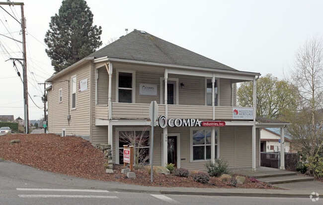
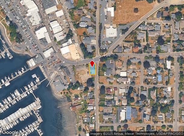
Property Record
390 Ne Hostmark St, Poulsbo, WA 98370
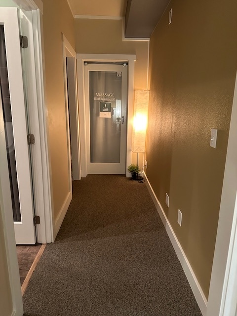
Current Lease Availabilities
NEARBY LISTINGS FOR SALE OR LEASE
Property Detail
390 Ne Hostmark St
Bremerton-Silverdale, WA
Bla#201203280236
232601-2-207-2005
Kitsap
Sfr
Washington
X
0.12 AC
53031C1335C
Poulsbo
2,732 SF
Bremerton/Silverdale
DEMOGRAPHICS near 390 Ne Hostmark St
1 Mile
3 Mile
5 Mile
2024 Total Population
5,670
19,289
47,851
2029 Population
5,673
19,318
47,997
Pop Growth 2024-2029
+ 0.05%
+ 0.15%
+ 0.31%
Average Age
47
44
40
2024 Total Households
2,477
7,620
17,450
HH Growth 2024-2029
(0.16%)
+ 0.03%
+ 0.13%
Median Household Inc
$70,282
$94,242
$94,067
Avg Household Size
2.20
2.40
2.50
2024 Avg HH Vehicles
2.00
2.00
2.00
Median Home Value
$554,127
$564,025
$556,165
Median Year Built
1986
1991
1990
Nearby Places
- Restaurants
- Banks
- Shops
- Fitness
- Groceries
PUBLIC TRANSPORTATION
AIRPORT
Seattle Paine Field International
DRIVE
WALK
Distance
Seattle Paine Field International
69 min
27.8 mi
Seattle-Tacoma International
DRIVE
WALK
Distance
Seattle-Tacoma International
94 min
47.6 mi
Freight Ports
Port of Seattle
DRIVE
WALK
Distance
Port of Seattle
81 min
38.1 mi
Nearby Properties
Address
Land Use
TOTAL SIZE
Lot Size
Zoning
Address
Land Use
TOTAL SIZE
Lot Size
Zoning
5,198 SF
9.52 AC
RH
Address
Land Use
TOTAL SIZE
Lot Size
Zoning
126,691 SF
6.42 AC
RM
Address
Land Use
TOTAL SIZE
Lot Size
Zoning
140,624 SF
8.46 AC
RH
Address
Land Use
TOTAL SIZE
Lot Size
Zoning
132,992 SF
6.67 AC
RH
Address
Land Use
TOTAL SIZE
Lot Size
Zoning
203,311 SF
20.20 AC
C-4
Address
Land Use
TOTAL SIZE
Lot Size
Zoning
4.06 AC
RM
Address
Land Use
TOTAL SIZE
Lot Size
Zoning
61,458 SF
6.54 AC
RH
Address
Land Use
TOTAL SIZE
Lot Size
Zoning
48,000 SF
0.54 AC
WATER
Address
Land Use
TOTAL SIZE
Lot Size
Zoning
124,970 SF
9.06 AC
C-3
Address
Land Use
TOTAL SIZE
Lot Size
Zoning
94,292 SF
9.34 AC
RL
Address
Land Use
TOTAL SIZE
Lot Size
Zoning
82,081 SF
5.57 AC
RH
Address
Land Use
TOTAL SIZE
Lot Size
Zoning
69,264 SF
4.90 AC
C-1
Address
Land Use
TOTAL SIZE
Lot Size
Zoning
83,314 SF
6.66 AC
BP
Address
Land Use
TOTAL SIZE
Lot Size
Zoning
1,680 SF
14.25 AC
RH
Address
Land Use
TOTAL SIZE
Lot Size
Zoning
70,762 SF
5.90 AC
RH
Address
Land Use
TOTAL SIZE
Lot Size
Zoning
16,358 SF
0.70 AC
C-1
Address
Land Use
TOTAL SIZE
Lot Size
Zoning
103,919 SF
9.02 AC
LI
Address
Land Use
TOTAL SIZE
Lot Size
Zoning
51,096 SF
2.37 AC
C-4
Address
Land Use
TOTAL SIZE
Lot Size
Zoning
98,525 SF
11.40 AC
C-4
Address
Land Use
TOTAL SIZE
Lot Size
Zoning
70,570 SF
6.93 AC
C-3
Address
Land Use
TOTAL SIZE
Lot Size
Zoning
41,492 SF
3.44 AC
RH
Address
Land Use
TOTAL SIZE
Lot Size
Zoning
60,790 SF
5.64 AC
C-3
Address
Land Use
TOTAL SIZE
Lot Size
Zoning
61,185 SF
4.88 AC
C-3
Address
Land Use
TOTAL SIZE
Lot Size
Zoning
35,080 SF
2.99 AC
RH
Address
Land Use
TOTAL SIZE
Lot Size
Zoning
39,474 SF
2.98 AC
RH
Address
Land Use
TOTAL SIZE
Lot Size
Zoning
37,036 SF
2.83 AC
BP
Address
Land Use
TOTAL SIZE
Lot Size
Zoning
41,936 SF
4.03 AC
C-4
Address
Land Use
TOTAL SIZE
Lot Size
Zoning
5.31 AC
LI
Address
Land Use
TOTAL SIZE
Lot Size
Zoning
21,468 SF
0.88 AC
WATER
Address
Land Use
TOTAL SIZE
Lot Size
Zoning
31,193 SF
23.66 AC
RHTW
The World's #1 Commercial Real Estate Marketplace
Connect with us
© 2025 CoStar Group
The information above has been obtained from sources believed reliable. While we do not doubt its accuracy we have not verified it and make no guarantee, warranty or representation about it. It is your responsibility to independently confirm its accuracy and completeness. Any projections, opinions, assumptions, or estimates used are for example only and do not represent the current or future performance of the property. The value of this transaction to you depends on tax and other factors which should be evaluated by your tax, financial, and legal advisors. You and your advisors should conduct a careful, independent investigation of the property to determine to your satisfaction the suitability of the property for your needs.