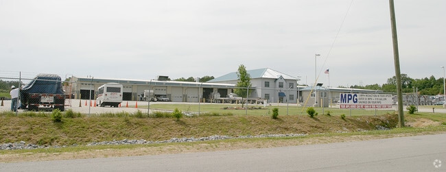
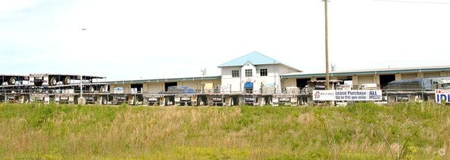
Property Record
3900 Acipco Industrial Dr, Birmingham, AL 35214

NEARBY LISTINGS FOR SALE OR LEASE
Property Detail
3900 Acipco Industrial Dr
Birmingham, AL
Acipco Industrial Park 22
22-00-15-2-002-001.000
LOT 1 ACIPCO INDUSTRIAL PARK PB 192 PG 91
Transportnec
Jefferson
X
Alabama
01073C0386G
1
2023
20.02 AC
2024
Fultondale
000800
Birmingham
48,558 SF
DEMOGRAPHICS near 3900 Acipco Industrial Dr
1 Mile
3 Mile
5 Mile
2024 Total Population
956
30,278
100,000
2029 Population
965
30,307
100,733
Pop Growth 2024-2029
+ 0.94%
+ 0.10%
+ 0.73%
Average Age
45
42
39
2024 Total Households
418
12,270
41,719
HH Growth 2024-2029
+ 0.96%
+ 0.23%
+ 1.01%
Median Household Inc
$41,621
$37,401
$36,177
Avg Household Size
2.30
2.30
2.10
2024 Avg HH Vehicles
2.00
2.00
1.00
Median Home Value
$68,859
$95,678
$99,887
Median Year Built
1951
1966
1967
Nearby Places
Map Layers
Map Styles
 Street
 Aerial
- Restaurants
- Banks
- Shops
- Fitness
- Groceries
PUBLIC TRANSPORTATION
COMMUTER RAIL
Birmingham (Crescent - Amtrak)
DRIVE
WALK
Distance
Birmingham (Crescent - Amtrak)
10 min
5.6 mi
AIRPORT
Birmingham-Shuttlesworth International
DRIVE
WALK
Distance
Birmingham-Shuttlesworth International
16 min
10.4 mi
Freight Ports
Port of Mobile
DRIVE
WALK
Distance
Port of Mobile
285 min
260.2 mi
Nearby Properties
Address
Land Use
TOTAL SIZE
Lot Size
Zoning
Address
Land Use
TOTAL SIZE
Lot Size
Zoning
2,017,741 SF
37.70 AC
M2M1
Address
Land Use
TOTAL SIZE
Lot Size
Zoning
186,000 SF
12.63 AC
QM1
Address
Land Use
TOTAL SIZE
Lot Size
Zoning
186,911 SF
12 AC
QM1
Address
Land Use
TOTAL SIZE
Lot Size
Zoning
140,000 SF
4.80 AC
M3
Address
Land Use
TOTAL SIZE
Lot Size
Zoning
123,937 SF
7.79 AC
R4
Address
Land Use
TOTAL SIZE
Lot Size
Zoning
239,755 SF
17 AC
M2
Address
Land Use
TOTAL SIZE
Lot Size
Zoning
10,297 SF
9.76 AC
QM
Address
Land Use
TOTAL SIZE
Lot Size
Zoning
109,753 SF
6.18 AC
R5
Address
Land Use
TOTAL SIZE
Lot Size
Zoning
87,516 SF
9.90 AC
QM1
Address
Land Use
TOTAL SIZE
Lot Size
Zoning
70,900 SF
13.53 AC
QM1
Address
Land Use
TOTAL SIZE
Lot Size
Zoning
147,113 SF
18.31 AC
M2
Address
Land Use
TOTAL SIZE
Lot Size
Zoning
49,235 SF
9.90 AC
R7/P
Address
Land Use
TOTAL SIZE
Lot Size
Zoning
77,303 SF
3.91 AC
M1
Address
Land Use
TOTAL SIZE
Lot Size
Zoning
46,584 SF
14.50 AC
R4
Address
Land Use
TOTAL SIZE
Lot Size
Zoning
137,360 SF
59 AC
M2
Address
Land Use
TOTAL SIZE
Lot Size
Zoning
5,500 SF
4.19 AC
C2
Address
Land Use
TOTAL SIZE
Lot Size
Zoning
86,118 SF
11.70 AC
I3
Address
Land Use
TOTAL SIZE
Lot Size
Zoning
466,927 SF
23 AC
M1
Address
Land Use
TOTAL SIZE
Lot Size
Zoning
129,067 SF
21 AC
M1
Address
Land Use
TOTAL SIZE
Lot Size
Zoning
56,650 SF
20 AC
I-2
Address
Land Use
TOTAL SIZE
Lot Size
Zoning
28,638 SF
1.84 AC
B2
Address
Land Use
TOTAL SIZE
Lot Size
Zoning
45,661 SF
6.40 AC
I3
Address
Land Use
TOTAL SIZE
Lot Size
Zoning
62,104 SF
3.20 AC
CB1
Address
Land Use
TOTAL SIZE
Lot Size
Zoning
106,501 SF
10.50 AC
I3
Address
Land Use
TOTAL SIZE
Lot Size
Zoning
324,003 SF
7.60 AC
B6
Address
Land Use
TOTAL SIZE
Lot Size
Zoning
70,850 SF
7.50 AC
M3
Address
Land Use
TOTAL SIZE
Lot Size
Zoning
24,920 SF
6 AC
I3
Address
Land Use
TOTAL SIZE
Lot Size
Zoning
66,000 SF
6.90 AC
M3
Address
Land Use
TOTAL SIZE
Lot Size
Zoning
99,455 SF
5.01 AC
M1
Address
Land Use
TOTAL SIZE
Lot Size
Zoning
107,697 SF
34.50 AC
M2
The World's #1 Commercial Real Estate Marketplace
Connect with us
© 2026 CoStar Group
The information above has been obtained from sources believed reliable. While we do not doubt its accuracy we have not verified it and make no guarantee, warranty or representation about it. It is your responsibility to independently confirm its accuracy and completeness. Any projections, opinions, assumptions, or estimates used are for example only and do not represent the current or future performance of the property. The value of this transaction to you depends on tax and other factors which should be evaluated by your tax, financial, and legal advisors. You and your advisors should conduct a careful, independent investigation of the property to determine to your satisfaction the suitability of the property for your needs.