Property Record
3900 Bakers Ferry Rd Sw, Atlanta, GA 30331
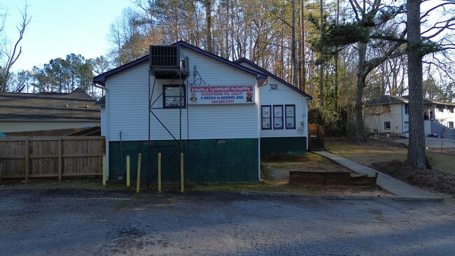
This Property Is For Sale
NEARBY LISTINGS FOR SALE OR LEASE
Property Detail
3900 Bakers Ferry Rd Sw
14F-0014-0005-012-9
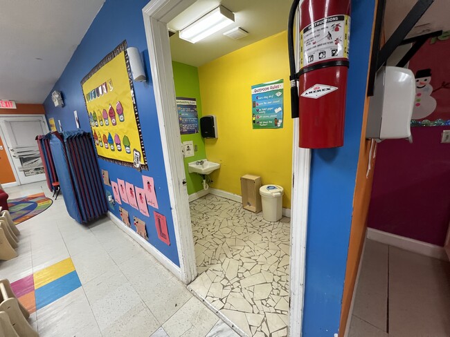
KA KIDDI ACADEMY LEARNING CENTE
Daycare
Fulton
X
Georgia
13121C0219F
14
2024
0.69 AC
2025
S Fulton/Union City
007806
Atlanta
2,520 SF
Atlanta-Sandy Springs-Roswell, GA
DEMOGRAPHICS near 3900 Bakers Ferry Rd Sw
1 Mile
3 Mile
5 Mile
2024 Total Population
9,339
50,716
159,518
2029 Population
9,651
52,802
167,460
Pop Growth 2024-2029
+ 3.34%
+ 4.11%
+ 4.98%
Average Age
40
39
38
2024 Total Households
3,664
20,159
63,225
HH Growth 2024-2029
+ 3.30%
+ 4.14%
+ 4.98%
Median Household Inc
$53,033
$48,257
$53,387
Avg Household Size
2.40
2.40
2.40
2024 Avg HH Vehicles
1.00
1.00
1.00
Median Home Value
$127,272
$230,599
$271,523
Median Year Built
1972
1975
1978
Nearby Places
- Restaurants
- Banks
- Shops
- Fitness
- Groceries
PUBLIC TRANSPORTATION
AIRPORT
Hartsfield - Jackson Atlanta International
DRIVE
WALK
Distance
Hartsfield - Jackson Atlanta International
25 min
17.8 mi
Freight Ports
Georgia Ports - Savannah
DRIVE
WALK
Distance
Georgia Ports - Savannah
287 min
255.0 mi
Nearby Properties
Address
Land Use
TOTAL SIZE
Lot Size
Zoning
Address
Land Use
TOTAL SIZE
Lot Size
Zoning
Address
Land Use
TOTAL SIZE
Lot Size
Zoning
1,151,446 SF
I2
Address
Land Use
TOTAL SIZE
Lot Size
Zoning
6,603,740 SF
24.69 AC
RG3
Address
Land Use
TOTAL SIZE
Lot Size
Zoning
285.03 AC
I2
Address
Land Use
TOTAL SIZE
Lot Size
Zoning
694,436 SF
36.80 AC
HI
Address
Land Use
TOTAL SIZE
Lot Size
Zoning
283,396 SF
29.88 AC
RM-12
Address
Land Use
TOTAL SIZE
Lot Size
Zoning
814,536 SF
37 AC
R3
Address
Land Use
TOTAL SIZE
Lot Size
Zoning
1,825,146 SF
16.16 AC
RG3
Address
Land Use
TOTAL SIZE
Lot Size
Zoning
237,515 SF
16.68 AC
C2
Address
Land Use
TOTAL SIZE
Lot Size
Zoning
241,200 SF
18.40 AC
RM-12
Address
Land Use
TOTAL SIZE
Lot Size
Zoning
395,218 SF
21.61 AC
A1
Address
Land Use
TOTAL SIZE
Lot Size
Zoning
729,946 SF
34.07 AC
M2
Address
Land Use
TOTAL SIZE
Lot Size
Zoning
70.35 AC
R3
Address
Land Use
TOTAL SIZE
Lot Size
Zoning
498,167 SF
11.18 AC
HI/WS
Address
Land Use
TOTAL SIZE
Lot Size
Zoning
520,556 SF
5.47 AC
RG2
Address
Land Use
TOTAL SIZE
Lot Size
Zoning
77.56 AC
RG3
Address
Land Use
TOTAL SIZE
Lot Size
Zoning
77.30 AC
M2
Address
Land Use
TOTAL SIZE
Lot Size
Zoning
152,348 SF
12.76 AC
RM-12
Address
Land Use
TOTAL SIZE
Lot Size
Zoning
339,382 SF
18.45 AC
HI
Address
Land Use
TOTAL SIZE
Lot Size
Zoning
286,400 SF
17.29 AC
I2
Address
Land Use
TOTAL SIZE
Lot Size
Zoning
1,715,322 SF
18.09 AC
A1
Address
Land Use
TOTAL SIZE
Lot Size
Zoning
1,477,770 SF
13.60 AC
C1
Address
Land Use
TOTAL SIZE
Lot Size
Zoning
680,087 SF
41.40 AC
M2
Address
Land Use
TOTAL SIZE
Lot Size
Zoning
725,612 SF
11.60 AC
A
Address
Land Use
TOTAL SIZE
Lot Size
Zoning
111,047 SF
14.40 AC
GC
Address
Land Use
TOTAL SIZE
Lot Size
Zoning
229,860 SF
4.27 AC
RG2
Address
Land Use
TOTAL SIZE
Lot Size
Zoning
113,293 SF
17.92 AC
M2
Address
Land Use
TOTAL SIZE
Lot Size
Zoning
903,588 SF
6.94 AC
RG3
Address
Land Use
TOTAL SIZE
Lot Size
Zoning
874,924 SF
10 AC
C1
Address
Land Use
TOTAL SIZE
Lot Size
Zoning
55,788 SF
44.07 AC
I1
The World's #1 Commercial Real Estate Marketplace
Connect with us
© 2025 CoStar Group
The information above has been obtained from sources believed reliable. While we do not doubt its accuracy we have not verified it and make no guarantee, warranty or representation about it. It is your responsibility to independently confirm its accuracy and completeness. Any projections, opinions, assumptions, or estimates used are for example only and do not represent the current or future performance of the property. The value of this transaction to you depends on tax and other factors which should be evaluated by your tax, financial, and legal advisors. You and your advisors should conduct a careful, independent investigation of the property to determine to your satisfaction the suitability of the property for your needs.