Property Record
3900 E Stanford Dr, Paradise Valley, AZ 85253

Save to a Folder
{{folder.Name}}
{{folder.ListingIds.length}} Properties
{{folder.ListingIds.length}} Property
Create a New Folder
Property Detail
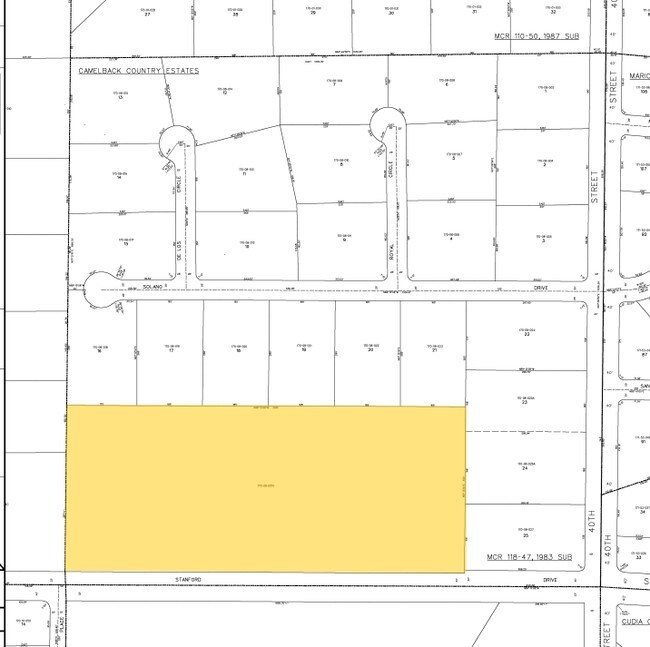
3900 E Stanford Dr
170-08-001G
S 450 OF W 1000 OF SE4 NE4 EX S 33 RD 9.59AC
Religious
Maricopa
PF
Arizona
AE The base floodplain where base flood elevations are provided. AE Zones are now used on new format FIRMs instead of A1-A30 Zones.
9.57 AC
0
Camelback Corridor
2025
Phoenix
105103
Phoenix-Mesa-Chandler, AZ
24,088 SF
NEARBY LISTINGS FOR SALE OR LEASE
-
-
View all Paradise Valley listings for sale on LoopNet.com
DEMOGRAPHICS near 3900 E Stanford Dr
1 mile
3 mile
5 mile
2025 Total Population
8,658
83,575
300,041
2030 Population
9,059
87,570
314,530
Pop Growth 2025-2030
+ 4.63%
+ 4.78%
+ 4.83%
Average Age
44
41
40
2025 Total Households
3,999
39,174
136,844
HH Growth 2025-2030
+ 4.73%
+ 4.96%
+ 5.05%
Median Household Inc
$136,119
$100,939
$86,100
Avg Household Size
2.10
2.10
2.10
2025 Avg HH Vehicles
2.00
2.00
2.00
Median Home Value
$1,055,590
$843,422
$714,149
Median Year Built
1972
1973
1976
Nearby Places
Map Layers
Map Styles
 Street
 Aerial
Layers
 Traffic
 Biking
Places
Listings with unknown addresses are not visible on the map
- Restaurants
- Banks
- Shops
- Fitness
- Groceries
PUBLIC TRANSPORTATION
AIRPORT
Phoenix Sky Harbor International
Drive
Walk
Distance
Phoenix Sky Harbor International
16 min
8.2 mi
Phoenix-Mesa Gateway
Drive
Walk
Distance
Phoenix-Mesa Gateway
49 min
32.8 mi
Freight Ports
Port of San Diego
Drive
Walk
Distance
Port of San Diego
407 min
363.0 mi
Nearby Properties
Address
Land Use
TOTAL SIZE
Lot Size
Zoning
Address
Land Use
TOTAL SIZE
Lot Size
Zoning
103,415 SF
4.61 AC
C-T
Address
Land Use
TOTAL SIZE
Lot Size
Zoning
71,306 SF
8.93 AC
M-H
Address
Land Use
TOTAL SIZE
Lot Size
Zoning
969,844 SF
27.97 AC
PAD
Address
Land Use
TOTAL SIZE
Lot Size
Zoning
1,457,213 SF
41.78 AC
PUD
Address
Land Use
TOTAL SIZE
Lot Size
Zoning
953,192 SF
28.99 AC
Address
Land Use
TOTAL SIZE
Lot Size
Zoning
50,161 SF
2.05 AC
M-H
Address
Land Use
TOTAL SIZE
Lot Size
Zoning
410,000 SF
1.86 AC
C-C
Address
Land Use
TOTAL SIZE
Lot Size
Zoning
386,004 SF
37.82 AC
R-6
Address
Land Use
TOTAL SIZE
Lot Size
Zoning
812,968 SF
7.08 AC
Address
Land Use
TOTAL SIZE
Lot Size
Zoning
402,448 SF
24.08 AC
C-C
Address
Land Use
TOTAL SIZE
Lot Size
Zoning
517,609 SF
1.67 AC
C-C
Address
Land Use
TOTAL SIZE
Lot Size
Zoning
599,524 SF
5.09 AC
R5
Address
Land Use
TOTAL SIZE
Lot Size
Zoning
656,952 SF
3.58 AC
Address
Land Use
TOTAL SIZE
Lot Size
Zoning
517,502 SF
21.26 AC
SUPR
Address
Land Use
TOTAL SIZE
Lot Size
Zoning
567,481 SF
2 AC
Address
Land Use
TOTAL SIZE
Lot Size
Zoning
575,103 SF
2.24 AC
Address
Land Use
TOTAL SIZE
Lot Size
Zoning
312,104 SF
1.08 AC
C-2
Address
Land Use
TOTAL SIZE
Lot Size
Zoning
29,100 SF
1.42 AC
M-H
Address
Land Use
TOTAL SIZE
Lot Size
Zoning
282,287 SF
38.68 AC
R-10
Address
Land Use
TOTAL SIZE
Lot Size
Zoning
812,214 SF
4.91 AC
C-C
Address
Land Use
TOTAL SIZE
Lot Size
Zoning
266,869 SF
7.55 AC
C-C
Address
Land Use
TOTAL SIZE
Lot Size
Zoning
426,310 SF
1.44 AC
Address
Land Use
TOTAL SIZE
Lot Size
Zoning
536,856 SF
20.27 AC
PSC
Address
Land Use
TOTAL SIZE
Lot Size
Zoning
1,137 SF
76.71 AC
RE35
Address
Land Use
TOTAL SIZE
Lot Size
Zoning
341,434 SF
22.48 AC
C-T
Address
Land Use
TOTAL SIZE
Lot Size
Zoning
533,579 SF
1.91 AC
Address
Land Use
TOTAL SIZE
Lot Size
Zoning
515,440 SF
3.02 AC
C-T
Address
Land Use
TOTAL SIZE
Lot Size
Zoning
508,796 SF
4.71 AC
PAD
Address
Land Use
TOTAL SIZE
Lot Size
Zoning
382,687 SF
11.31 AC
C-O
The World's #1 Commercial Real Estate Marketplace
Connect with us
© 2026 CoStar Group
The information above has been obtained from sources believed reliable. While we do not doubt its accuracy we have not verified it and make no guarantee, warranty or representation about it. It is your responsibility to independently confirm its accuracy and completeness. Any projections, opinions, assumptions, or estimates used are for example only and do not represent the current or future performance of the property. The value of this transaction to you depends on tax and other factors which should be evaluated by your tax, financial, and legal advisors. You and your advisors should conduct a careful, independent investigation of the property to determine to your satisfaction the suitability of the property for your needs.