Property Record
39000 W Huron River Dr, Romulus, MI 48174


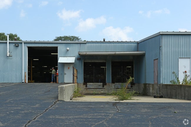
Property Detail
39000 W Huron River Dr
80-074-01-0151-003
19B151A2 151B1 THAT PART OF LOT 151 SUPERVISORS ROMULUS PLAT NO 8 ALSO THAT PT DESC AS BEG AT A POINT ON THE N LINE OF HURON
Manufacturinglight
Wayne
M1-LIG
Michigan
B and X Area of moderate flood hazard, usually the area between the limits of the 100-year and 500-year floods.
151
2025
3.66 AC
2025
Airport District
586300
Detroit
50,192 SF
Detroit-Warren-Dearborn, MI
NEARBY LISTINGS FOR SALE OR LEASE
DEMOGRAPHICS near 39000 W Huron River Dr
1 mile
3 mile
5 mile
2025 Total Population
1,293
23,868
63,205
2030 Population
1,270
23,482
62,364
Pop Growth 2025-2030
(1.78%)
(1.62%)
(1.33%)
Average Age
44
41
40
2025 Total Households
536
9,881
26,068
HH Growth 2025-2030
(1.68%)
(1.70%)
(1.40%)
Median Household Inc
$77,286
$71,462
$70,504
Avg Household Size
2.40
2.40
2.40
2025 Avg HH Vehicles
2.00
2.00
2.00
Median Home Value
$214,084
$231,338
$223,723
Median Year Built
1962
1974
1975
Nearby Places
Map Layers
Map Styles
 Street
 Aerial
Layers
 Traffic
 Biking
Places
Listings with unknown addresses are not visible on the map
- Restaurants
- Banks
- Shops
- Fitness
- Groceries
PUBLIC TRANSPORTATION
AIRPORT
Detroit Metro Wayne County
Drive
Walk
Distance
Detroit Metro Wayne County
15 min
7.0 mi
Windsor International
Drive
Walk
Distance
Windsor International
54 min
34.0 mi
Freight Ports
Drive
Walk
Distance
62 min
47.7 mi
Nearby Properties
Address
Land Use
TOTAL SIZE
Lot Size
Zoning
Address
Land Use
TOTAL SIZE
Lot Size
Zoning
739,289 SF
238.69 AC
AG
Address
Land Use
TOTAL SIZE
Lot Size
Zoning
500,240 SF
M1-LIG
Address
Land Use
TOTAL SIZE
Lot Size
Zoning
919,978 SF
65.96 AC
MT IND
Address
Land Use
TOTAL SIZE
Lot Size
Zoning
461,566 SF
50.13 AC
RM MULT
Address
Land Use
TOTAL SIZE
Lot Size
Zoning
146,562 SF
M2-GEN
Address
Land Use
TOTAL SIZE
Lot Size
Zoning
495,062 SF
52.40 AC
M1 LIG
Address
Land Use
TOTAL SIZE
Lot Size
Zoning
500,240 SF
55.95 AC
M2-GEN
Address
Land Use
TOTAL SIZE
Lot Size
Zoning
1,141,765 SF
154.21 AC
M2-GEN
Address
Land Use
TOTAL SIZE
Lot Size
Zoning
600,000 SF
M1-LIG
Address
Land Use
TOTAL SIZE
Lot Size
Zoning
393,948 SF
43.43 AC
M2-GEN
Address
Land Use
TOTAL SIZE
Lot Size
Zoning
435,648 SF
27.84 AC
M2-GEN
Address
Land Use
TOTAL SIZE
Lot Size
Zoning
1,071,200 SF
85.27 AC
M1 LIG
Address
Land Use
TOTAL SIZE
Lot Size
Zoning
199,922 SF
30.86 AC
M2-GEN
Address
Land Use
TOTAL SIZE
Lot Size
Zoning
250,263 SF
18.81 AC
RM-MLTI
Address
Land Use
TOTAL SIZE
Lot Size
Zoning
285,080 SF
21.89 AC
M2-GEN
Address
Land Use
TOTAL SIZE
Lot Size
Zoning
240,355 SF
26.05 AC
M2-GEN
Address
Land Use
TOTAL SIZE
Lot Size
Zoning
462,840 SF
45.66 AC
PDA
Address
Land Use
TOTAL SIZE
Lot Size
Zoning
5,382 SF
109.33 AC
RMH-MOB
Address
Land Use
TOTAL SIZE
Lot Size
Zoning
659,516 SF
46.15 AC
MT IND
Address
Land Use
TOTAL SIZE
Lot Size
Zoning
437,836 SF
28.75 AC
M1 LIG
Address
Land Use
TOTAL SIZE
Lot Size
Zoning
249,090 SF
27.15 AC
M1-LIG
Address
Land Use
TOTAL SIZE
Lot Size
Zoning
161,794 SF
17.73 AC
RM MULT
Address
Land Use
TOTAL SIZE
Lot Size
Zoning
87,000 SF
18.02 AC
Address
Land Use
TOTAL SIZE
Lot Size
Zoning
25,002 SF
7.91 AC
C1 GEN
Address
Land Use
TOTAL SIZE
Lot Size
Zoning
268,800 SF
17.47 AC
M1-LIG
Address
Land Use
TOTAL SIZE
Lot Size
Zoning
88,790 SF
M2-GEN
Address
Land Use
TOTAL SIZE
Lot Size
Zoning
10,500 SF
186.68 AC
C1 GEN
Address
Land Use
TOTAL SIZE
Lot Size
Zoning
M1-LIG
Address
Land Use
TOTAL SIZE
Lot Size
Zoning
9,573 SF
182.48 AC
M2 GEN
Address
Land Use
TOTAL SIZE
Lot Size
Zoning
76,763 SF
9.63 AC
M1 LIG
The World's #1 Commercial Real Estate Marketplace
Connect with us
© 2026 CoStar Group
The information above has been obtained from sources believed reliable. While we do not doubt its accuracy we have not verified it and make no guarantee, warranty or representation about it. It is your responsibility to independently confirm its accuracy and completeness. Any projections, opinions, assumptions, or estimates used are for example only and do not represent the current or future performance of the property. The value of this transaction to you depends on tax and other factors which should be evaluated by your tax, financial, and legal advisors. You and your advisors should conduct a careful, independent investigation of the property to determine to your satisfaction the suitability of the property for your needs.