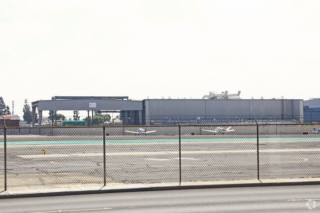
Property Record
3901 Jack Northrop Ave, Hawthorne, CA 90250

NEARBY LISTINGS FOR SALE OR LEASE
Property Detail
3901 Jack Northrop Ave
Los Angeles-Long Beach-Glendale, CA
9681
4049-013-004
POR SW 1/4 SEC 10 T3S R14W, VAC STS EX OF ST LOTS 1 THRU 5 BLKS 1-4 TR=9681
Heavyindustrial
Los Angeles
X
California
06037C1790F
1-5
2024
42.66 AC
2025
Gardena/Hawthorne
602513
Los Angeles
986,604 SF
DEMOGRAPHICS near 3901 Jack Northrop Ave
1 Mile
3 Mile
5 Mile
2024 Total Population
41,589
308,609
774,006
2029 Population
40,330
298,499
750,093
Pop Growth 2024-2029
(3.03%)
(3.28%)
(3.09%)
Average Age
37
38
39
2024 Total Households
13,328
100,806
256,412
HH Growth 2024-2029
(3.18%)
(3.50%)
(3.26%)
Median Household Inc
$61,467
$67,492
$73,507
Avg Household Size
3.00
3.00
2.90
2024 Avg HH Vehicles
2.00
2.00
2.00
Median Home Value
$720,817
$714,553
$779,214
Median Year Built
1965
1959
1959
Nearby Places
Map Layers
Map Styles
 Street
 Aerial
- Restaurants
- Banks
- Shops
- Fitness
- Groceries
PUBLIC TRANSPORTATION
AIRPORT
Los Angeles International
DRIVE
WALK
Distance
Los Angeles International
12 min
6.1 mi
Long Beach (Daugherty Field)
DRIVE
WALK
Distance
Long Beach (Daugherty Field)
24 min
16.0 mi
Bob Hope
DRIVE
WALK
Distance
Bob Hope
41 min
29.8 mi
Freight Ports
Port of Los Angeles
DRIVE
WALK
Distance
Port of Los Angeles
30 min
19.3 mi
Nearby Properties
Address
Land Use
TOTAL SIZE
Lot Size
Zoning
Address
Land Use
TOTAL SIZE
Lot Size
Zoning
2,531,696 SF
79.60 AC
INCR*
Address
Land Use
TOTAL SIZE
Lot Size
Zoning
584,746 SF
20.38 AC
MNIP
Address
Land Use
TOTAL SIZE
Lot Size
Zoning
Address
Land Use
TOTAL SIZE
Lot Size
Zoning
Address
Land Use
TOTAL SIZE
Lot Size
Zoning
Address
Land Use
TOTAL SIZE
Lot Size
Zoning
Address
Land Use
TOTAL SIZE
Lot Size
Zoning
565,264 SF
5.95 AC
Address
Land Use
TOTAL SIZE
Lot Size
Zoning
337,106 SF
9.56 AC
ESCM*
Address
Land Use
TOTAL SIZE
Lot Size
Zoning
724,715 SF
5.76 AC
INCR*
Address
Land Use
TOTAL SIZE
Lot Size
Zoning
944,791 SF
22.53 AC
ESCM*
Address
Land Use
TOTAL SIZE
Lot Size
Zoning
421,934 SF
8.24 AC
ESCM
Address
Land Use
TOTAL SIZE
Lot Size
Zoning
459,058 SF
8.84 AC
ESC3*
Address
Land Use
TOTAL SIZE
Lot Size
Zoning
652,774 SF
3.60 AC
LAC2
Address
Land Use
TOTAL SIZE
Lot Size
Zoning
718,086 SF
41.24 AC
RBI-1A
Address
Land Use
TOTAL SIZE
Lot Size
Zoning
418,131 SF
3.03 AC
LCC1
Address
Land Use
TOTAL SIZE
Lot Size
Zoning
793,455 SF
31.88 AC
ESM2*
Address
Land Use
TOTAL SIZE
Lot Size
Zoning
848,217 SF
36.09 AC
RBI-1A
Address
Land Use
TOTAL SIZE
Lot Size
Zoning
1,410,144 SF
6.35 AC
ESM2*
Address
Land Use
TOTAL SIZE
Lot Size
Zoning
189,244 SF
3.64 AC
ESCM*
Address
Land Use
TOTAL SIZE
Lot Size
Zoning
859,786 SF
4.82 AC
LAC2
Address
Land Use
TOTAL SIZE
Lot Size
Zoning
227,596 SF
14.38 AC
HAM1YY
Address
Land Use
TOTAL SIZE
Lot Size
Zoning
1,972,924 SF
ESCM*
Address
Land Use
TOTAL SIZE
Lot Size
Zoning
1,359,630 SF
29 AC
INCR*
Address
Land Use
TOTAL SIZE
Lot Size
Zoning
307,559 SF
5.96 AC
ESC3
Address
Land Use
TOTAL SIZE
Lot Size
Zoning
279,694 SF
3.19 AC
LCR1*
Address
Land Use
TOTAL SIZE
Lot Size
Zoning
543,897 SF
4.26 AC
ESC3*
Address
Land Use
TOTAL SIZE
Lot Size
Zoning
1,009,919 SF
8.80 AC
ESM1*
Address
Land Use
TOTAL SIZE
Lot Size
Zoning
354,673 SF
4.99 AC
ESCM*
Address
Land Use
TOTAL SIZE
Lot Size
Zoning
561,479 SF
4.44 AC
ESC3*
Address
Land Use
TOTAL SIZE
Lot Size
Zoning
362,343 SF
9.16 AC
ESM2*
The World's #1 Commercial Real Estate Marketplace
Connect with us
© 2025 CoStar Group
The information above has been obtained from sources believed reliable. While we do not doubt its accuracy we have not verified it and make no guarantee, warranty or representation about it. It is your responsibility to independently confirm its accuracy and completeness. Any projections, opinions, assumptions, or estimates used are for example only and do not represent the current or future performance of the property. The value of this transaction to you depends on tax and other factors which should be evaluated by your tax, financial, and legal advisors. You and your advisors should conduct a careful, independent investigation of the property to determine to your satisfaction the suitability of the property for your needs.