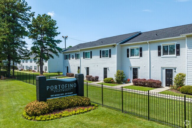
Property Record
3901 Michael Blvd, Mobile, AL 36609


Property Detail
3901 Michael Blvd
28-07-26-4-000-017
Delwood
Apartment
COMG AT NW COR OF SW 1/4 OF SEC 26 T4S R2W TH RUN S 990 FT (S) TO POB CONT S 380 FT TO CENTER OF BOLTONS BRANCH TH N 54 DEG
AE
Mobile
01097C0542L
Alabama
2025
4.14 AC
2025
Airmont
003205
Mobile
23,232 SF
Mobile, AL
NEARBY LISTINGS FOR SALE OR LEASE
-
-
View all Mobile listings for sale on LoopNet.com
DEMOGRAPHICS near 3901 Michael Blvd
1 mile
3 mile
5 mile
2024 Total Population
11,872
69,600
163,755
2029 Population
11,846
68,478
162,067
Pop Growth 2024-2029
(0.22%)
(1.61%)
(1.03%)
Average Age
34
37
39
2024 Total Households
5,241
28,820
67,848
HH Growth 2024-2029
(0.57%)
(1.76%)
(1.12%)
Median Household Inc
$38,286
$48,482
$47,161
Avg Household Size
2.20
2.20
2.30
2024 Avg HH Vehicles
2.00
2.00
2.00
Median Home Value
$168,633
$188,240
$164,682
Median Year Built
1977
1975
1974
Nearby Places
Map Layers
Map Styles
 Street
 Aerial
Transit
 Traffic
 Biking
Places
Listings with unknown addresses are not visible on the map
- Restaurants
- Banks
- Shops
- Fitness
- Groceries
PUBLIC TRANSPORTATION
AIRPORT
Mobile International
Drive
Walk
Distance
Mobile International
14 min
7.7 mi
Mobile Regional
Drive
Walk
Distance
Mobile Regional
18 min
8.0 mi
Freight Ports
Port of Mobile
Drive
Walk
Distance
Port of Mobile
17 min
11.1 mi
Nearby Properties
Address
Land Use
TOTAL SIZE
Lot Size
Zoning
Address
Land Use
TOTAL SIZE
Lot Size
Zoning
170,500 SF
154.49 AC
Address
Land Use
TOTAL SIZE
Lot Size
Zoning
142,425 SF
160 AC
Address
Land Use
TOTAL SIZE
Lot Size
Zoning
296,060 SF
40.49 AC
Address
Land Use
TOTAL SIZE
Lot Size
Zoning
148,656 SF
112.97 AC
Address
Land Use
TOTAL SIZE
Lot Size
Zoning
118,712 SF
9.90 AC
Address
Land Use
TOTAL SIZE
Lot Size
Zoning
359,478 SF
3.69 AC
Address
Land Use
TOTAL SIZE
Lot Size
Zoning
169,511 SF
44.42 AC
Address
Land Use
TOTAL SIZE
Lot Size
Zoning
139,460 SF
27.51 AC
Address
Land Use
TOTAL SIZE
Lot Size
Zoning
119,648 SF
38.21 AC
Address
Land Use
TOTAL SIZE
Lot Size
Zoning
194,016 SF
10.74 AC
Address
Land Use
TOTAL SIZE
Lot Size
Zoning
102,380 SF
12.24 AC
Address
Land Use
TOTAL SIZE
Lot Size
Zoning
30,972 SF
4.75 AC
Address
Land Use
TOTAL SIZE
Lot Size
Zoning
228,018 SF
4.80 AC
Address
Land Use
TOTAL SIZE
Lot Size
Zoning
57,452 SF
14.58 AC
Address
Land Use
TOTAL SIZE
Lot Size
Zoning
18,368 SF
14.70 AC
Address
Land Use
TOTAL SIZE
Lot Size
Zoning
31,452 SF
10.60 AC
Address
Land Use
TOTAL SIZE
Lot Size
Zoning
66,798 SF
10.31 AC
Address
Land Use
TOTAL SIZE
Lot Size
Zoning
65,356 SF
6.35 AC
Address
Land Use
TOTAL SIZE
Lot Size
Zoning
34,200 SF
30.03 AC
Address
Land Use
TOTAL SIZE
Lot Size
Zoning
19,536 SF
14.68 AC
Address
Land Use
TOTAL SIZE
Lot Size
Zoning
9,104 SF
13.52 AC
Address
Land Use
TOTAL SIZE
Lot Size
Zoning
208,683 SF
11.68 AC
Address
Land Use
TOTAL SIZE
Lot Size
Zoning
17,240 SF
12 AC
Address
Land Use
TOTAL SIZE
Lot Size
Zoning
29,448 SF
7.64 AC
Address
Land Use
TOTAL SIZE
Lot Size
Zoning
9,184 SF
12 AC
Address
Land Use
TOTAL SIZE
Lot Size
Zoning
62,859 SF
6.84 AC
Address
Land Use
TOTAL SIZE
Lot Size
Zoning
150,800 SF
15.39 AC
Address
Land Use
TOTAL SIZE
Lot Size
Zoning
16,584 SF
15.25 AC
Address
Land Use
TOTAL SIZE
Lot Size
Zoning
30,395 SF
44.92 AC
Address
Land Use
TOTAL SIZE
Lot Size
Zoning
45,648 SF
6.32 AC
The World's #1 Commercial Real Estate Marketplace
Connect with us
© 2026 CoStar Group
The information above has been obtained from sources believed reliable. While we do not doubt its accuracy we have not verified it and make no guarantee, warranty or representation about it. It is your responsibility to independently confirm its accuracy and completeness. Any projections, opinions, assumptions, or estimates used are for example only and do not represent the current or future performance of the property. The value of this transaction to you depends on tax and other factors which should be evaluated by your tax, financial, and legal advisors. You and your advisors should conduct a careful, independent investigation of the property to determine to your satisfaction the suitability of the property for your needs.