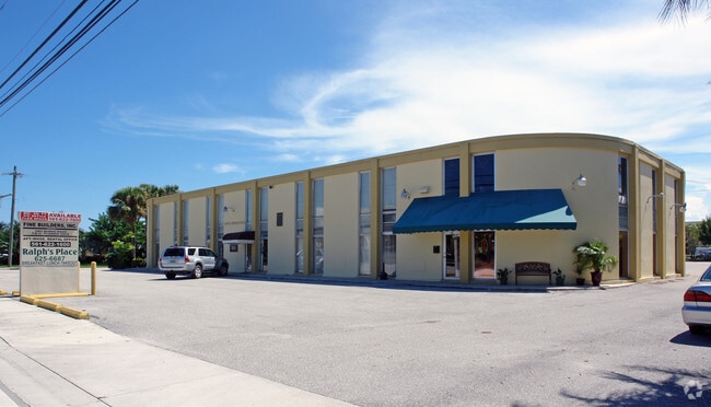
Property Record
3902 Burns Rd, Palm Beach Gardens, FL 33410


Current Lease Availabilities
NEARBY LISTINGS FOR SALE OR LEASE
Property Detail
3902 Burns Rd
West Palm Beach-Boca Raton-Delray Beach, FL
Acreage & Unrec
52-43-42-07-00-000-7290
7-42-43~ NLY 330 FT OF WLY 691.90 FT OF SW 1/4 (LESS WLY 437.28 FT~ NLY 30 FT & RTN CRV AREA BURNS RD & ELY 30 FT RIVERSIDE DR R/W)
Warehouse
Palm Beach
X
Florida
12099C0378F
1
2024
1.30 AC
2025
Palm Beach Gardens
000902
South Florida
18,643 SF
DEMOGRAPHICS near 3902 Burns Rd
1 Mile
3 Mile
5 Mile
2024 Total Population
10,499
87,011
173,543
2029 Population
10,825
90,461
182,584
Pop Growth 2024-2029
+ 3.11%
+ 3.97%
+ 5.21%
Average Age
43
45
46
2024 Total Households
4,818
37,487
73,921
HH Growth 2024-2029
+ 2.74%
+ 3.57%
+ 4.99%
Median Household Inc
$80,893
$85,440
$82,993
Avg Household Size
2.10
2.20
2.20
2024 Avg HH Vehicles
2.00
2.00
2.00
Median Home Value
$326,988
$401,451
$430,597
Median Year Built
1978
1988
1988
Nearby Places
Map Layers
Map Styles
 Street
 Aerial
- Restaurants
- Banks
- Shops
- Fitness
- Groceries
PUBLIC TRANSPORTATION
COMMUTER RAIL
Mangonia Park (Tri-County Commuter - South Florida Regional Transportation Authority (Tri-Rail))
DRIVE
WALK
Distance
Mangonia Park (Tri-County Commuter - South Florida Regional Transportation Authority (Tri-Rail))
12 min
6.1 mi
AIRPORT
Palm Beach International
DRIVE
WALK
Distance
Palm Beach International
22 min
15.1 mi
Freight Ports
Port of Palm Beach
DRIVE
WALK
Distance
Port of Palm Beach
11 min
5.6 mi
Nearby Properties
Address
Land Use
TOTAL SIZE
Lot Size
Zoning
Address
Land Use
TOTAL SIZE
Lot Size
Zoning
738,470 SF
43.51 AC
CG1
Address
Land Use
TOTAL SIZE
Lot Size
Zoning
621,404 SF
29.95 AC
PCD
Address
Land Use
TOTAL SIZE
Lot Size
Zoning
557,199 SF
46.91 AC
PCD
Address
Land Use
TOTAL SIZE
Lot Size
Zoning
545,613 SF
19.47 AC
PCD
Address
Land Use
TOTAL SIZE
Lot Size
Zoning
626,464 SF
2.91 AC
MXD
Address
Land Use
TOTAL SIZE
Lot Size
Zoning
390,568 SF
38.79 AC
NZ
Address
Land Use
TOTAL SIZE
Lot Size
Zoning
650,167 SF
27.64 AC
PCD
Address
Land Use
TOTAL SIZE
Lot Size
Zoning
566,998 SF
43.11 AC
PCD
Address
Land Use
TOTAL SIZE
Lot Size
Zoning
362,386 SF
22.51 AC
PCD
Address
Land Use
TOTAL SIZE
Lot Size
Zoning
351,267 SF
11.12 AC
PUD
Address
Land Use
TOTAL SIZE
Lot Size
Zoning
390,319 SF
44.34 AC
PCD
Address
Land Use
TOTAL SIZE
Lot Size
Zoning
308,087 SF
68.94 AC
P/I
Address
Land Use
TOTAL SIZE
Lot Size
Zoning
351,788 SF
13.75 AC
PCD
Address
Land Use
TOTAL SIZE
Lot Size
Zoning
416,171 SF
19.24 AC
R-PUD
Address
Land Use
TOTAL SIZE
Lot Size
Zoning
399,171 SF
6.60 AC
PCD
Address
Land Use
TOTAL SIZE
Lot Size
Zoning
195,263 SF
2.73 AC
PCD
Address
Land Use
TOTAL SIZE
Lot Size
Zoning
368,320 SF
23.07 AC
CLIC
Address
Land Use
TOTAL SIZE
Lot Size
Zoning
270,888 SF
8.93 AC
RH
Address
Land Use
TOTAL SIZE
Lot Size
Zoning
406,434 SF
40.60 AC
P/I
Address
Land Use
TOTAL SIZE
Lot Size
Zoning
248,945 SF
10.87 AC
PO
Address
Land Use
TOTAL SIZE
Lot Size
Zoning
59,520 SF
19.04 AC
C-S
Address
Land Use
TOTAL SIZE
Lot Size
Zoning
347,834 SF
8.92 AC
PCD
Address
Land Use
TOTAL SIZE
Lot Size
Zoning
680,979 SF
44.87 AC
PCD
Address
Land Use
TOTAL SIZE
Lot Size
Zoning
385,656 SF
15.86 AC
CO
Address
Land Use
TOTAL SIZE
Lot Size
Zoning
266,196 SF
17.61 AC
R-3
Address
Land Use
TOTAL SIZE
Lot Size
Zoning
381,665 SF
26.01 AC
PCD
Address
Land Use
TOTAL SIZE
Lot Size
Zoning
291,437 SF
22.02 AC
PO
Address
Land Use
TOTAL SIZE
Lot Size
Zoning
155,141 SF
25.97 AC
PCD
Address
Land Use
TOTAL SIZE
Lot Size
Zoning
109,243 SF
9.14 AC
CG1
Address
Land Use
TOTAL SIZE
Lot Size
Zoning
180,563 SF
54.46 AC
P/I
The World's #1 Commercial Real Estate Marketplace
Connect with us
© 2026 CoStar Group
The information above has been obtained from sources believed reliable. While we do not doubt its accuracy we have not verified it and make no guarantee, warranty or representation about it. It is your responsibility to independently confirm its accuracy and completeness. Any projections, opinions, assumptions, or estimates used are for example only and do not represent the current or future performance of the property. The value of this transaction to you depends on tax and other factors which should be evaluated by your tax, financial, and legal advisors. You and your advisors should conduct a careful, independent investigation of the property to determine to your satisfaction the suitability of the property for your needs.