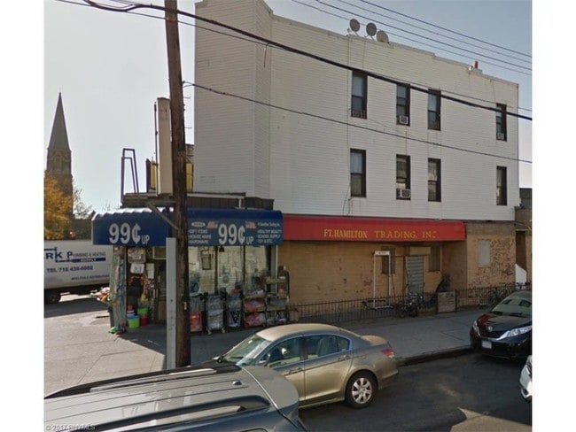
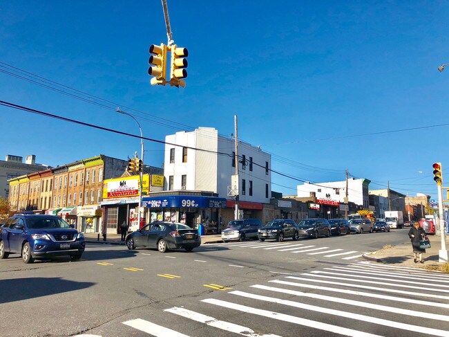
Property Record
3902 Fort Hamilton Pky, Brooklyn, NY 11218
NEARBY LISTINGS FOR SALE OR LEASE
Property Detail
3902 Fort Hamilton Pky
05584-0034
Kings
Commercialofficeresidentialmixeduse
New York
X
34
3604970213F
0.05 AC
2024
South Brooklyn
2025
Long Island (New York)
011000
New York-Jersey City-White Plains, NY-NJ
4,200 SF
DEMOGRAPHICS near 3902 Fort Hamilton Pky
1 Mile
3 Mile
5 Mile
2024 Total Population
150,908
1,047,423
2,256,241
2029 Population
138,238
978,353
2,114,270
Pop Growth 2024-2029
(8.40%)
(6.59%)
(6.29%)
Average Age
35
39
39
2024 Total Households
42,929
371,970
834,464
HH Growth 2024-2029
(8.87%)
(6.84%)
(6.60%)
Median Household Inc
$55,221
$74,513
$70,091
Avg Household Size
3.30
2.70
2.60
2024 Avg HH Vehicles
.00
1.00
1.00
Median Home Value
$942,994
$963,121
$836,968
Median Year Built
1947
1947
1948
Nearby Places
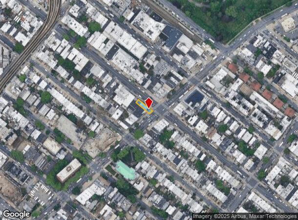
Map Layers
Map Styles
 Street
 Aerial
- Restaurants
- Banks
- Shops
- Fitness
- Groceries
PUBLIC TRANSPORTATION
TRANSIT/SUBWAY
9 Avenue (D - New York MTA Subway (The Subway), M - New York MTA Subway (The Subway))
DRIVE
WALK
Distance
9 Avenue (D - New York MTA Subway (The Subway), M - New York MTA Subway (The Subway))
1 min
6 min
0.3 mi
Church Avenue (F,G Line) (F - New York MTA Subway (The Subway))
DRIVE
WALK
Distance
Church Avenue (F,G Line) (F - New York MTA Subway (The Subway))
2 min
14 min
0.7 mi
50 Street (D,M Line) (D - New York MTA Subway (The Subway), M - New York MTA Subway (The Subway))
DRIVE
WALK
Distance
50 Street (D,M Line) (D - New York MTA Subway (The Subway), M - New York MTA Subway (The Subway))
3 min
15 min
0.8 mi
Ditmas Avenue (F - New York MTA Subway (The Subway))
DRIVE
WALK
Distance
Ditmas Avenue (F - New York MTA Subway (The Subway))
3 min
16 min
0.9 mi
COMMUTER RAIL
East New York Station (Far Rockaway Branch - Long Island Rail Road, Long Beach Branch - Long Island Rail Road, West Hempstead Branch - Long Island Rail Road)
DRIVE
WALK
Distance
East New York Station (Far Rockaway Branch - Long Island Rail Road, Long Beach Branch - Long Island Rail Road, West Hempstead Branch - Long Island Rail Road)
22 min
6.5 mi
AIRPORT
John F Kennedy International
DRIVE
WALK
Distance
John F Kennedy International
30 min
13.2 mi
Newark Liberty International
DRIVE
WALK
Distance
Newark Liberty International
28 min
18.8 mi
SALE & LEASE HISTORY
LISTING DATE
SALE/LEASE

Sep 06, 2018
For Sale
Nov 07, 2018
For Sale
May 09, 2017
For Sale
Nearby Properties
Address
Land Use
TOTAL SIZE
Lot Size
Zoning
Address
Land Use
TOTAL SIZE
Lot Size
Zoning
869,038 SF
1.53 AC
M1-1
Address
Land Use
TOTAL SIZE
Lot Size
Zoning
92,440 SF
466.23 AC
R5
Address
Land Use
TOTAL SIZE
Lot Size
Zoning
1,503,150 SF
20.47 AC
R5
Address
Land Use
TOTAL SIZE
Lot Size
Zoning
393.54 AC
PARK
Address
Land Use
TOTAL SIZE
Lot Size
Zoning
1,524,659 SF
170.96 AC
R4
Address
Land Use
TOTAL SIZE
Lot Size
Zoning
577,381 SF
3.19 AC
R6
Address
Land Use
TOTAL SIZE
Lot Size
Zoning
902,000 SF
6.44 AC
M3-1
Address
Land Use
TOTAL SIZE
Lot Size
Zoning
965,600 SF
6.65 AC
R5
Address
Land Use
TOTAL SIZE
Lot Size
Zoning
1,061,228 SF
8.86 AC
R5
Address
Land Use
TOTAL SIZE
Lot Size
Zoning
460,000 SF
3.21 AC
R6
Address
Land Use
TOTAL SIZE
Lot Size
Zoning
1,073,920 SF
16.53 AC
R6
Address
Land Use
TOTAL SIZE
Lot Size
Zoning
561,945 SF
11.58 AC
R6
Address
Land Use
TOTAL SIZE
Lot Size
Zoning
335,800 SF
1.51 AC
R6
Address
Land Use
TOTAL SIZE
Lot Size
Zoning
785,450 SF
14.22 AC
R6
Address
Land Use
TOTAL SIZE
Lot Size
Zoning
1,324,592 SF
5.13 AC
M3-1
Address
Land Use
TOTAL SIZE
Lot Size
Zoning
296,915 SF
0.31 AC
C5-3
Address
Land Use
TOTAL SIZE
Lot Size
Zoning
397,354 SF
0.61 AC
C5-2
Address
Land Use
TOTAL SIZE
Lot Size
Zoning
566,000 SF
12.33 AC
R6
Address
Land Use
TOTAL SIZE
Lot Size
Zoning
389,125 SF
3.48 AC
C6-4
Address
Land Use
TOTAL SIZE
Lot Size
Zoning
489,344 SF
3.78 AC
C6-4
Address
Land Use
TOTAL SIZE
Lot Size
Zoning
710,746 SF
1.88 AC
C63A
Address
Land Use
TOTAL SIZE
Lot Size
Zoning
427,208 SF
1.30 AC
R6
Address
Land Use
TOTAL SIZE
Lot Size
Zoning
393,092 SF
1.07 AC
R8A
Address
Land Use
TOTAL SIZE
Lot Size
Zoning
371,139 SF
3.22 AC
R5
Address
Land Use
TOTAL SIZE
Lot Size
Zoning
5,359,400 SF
59.07 AC
M2-1
Address
Land Use
TOTAL SIZE
Lot Size
Zoning
286,000 SF
12.63 AC
PARK
Address
Land Use
TOTAL SIZE
Lot Size
Zoning
240,382 SF
0.24 AC
R9
Address
Land Use
TOTAL SIZE
Lot Size
Zoning
1,785,288 SF
22.38 AC
M2-1
Address
Land Use
TOTAL SIZE
Lot Size
Zoning
3,970,000 SF
91.14 AC
M3-1
Address
Land Use
TOTAL SIZE
Lot Size
Zoning
517,033 SF
0.92 AC
C6-4
The World's #1 Commercial Real Estate Marketplace
Connect with us
© 2025 CoStar Group
The information above has been obtained from sources believed reliable. While we do not doubt its accuracy we have not verified it and make no guarantee, warranty or representation about it. It is your responsibility to independently confirm its accuracy and completeness. Any projections, opinions, assumptions, or estimates used are for example only and do not represent the current or future performance of the property. The value of this transaction to you depends on tax and other factors which should be evaluated by your tax, financial, and legal advisors. You and your advisors should conduct a careful, independent investigation of the property to determine to your satisfaction the suitability of the property for your needs.