Property Record
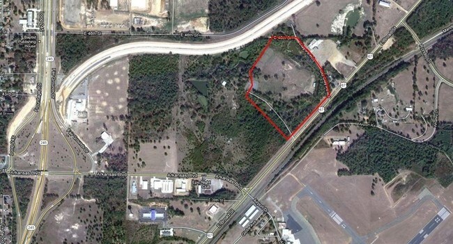
3903 E Broad St, Texarkana, AR 71854
Property Detail
3903 E Broad St
00232301
PT NE SE
Warehouse
MILLER
B and X Area of moderate flood hazard, usually the area between the limits of the 100-year and 500-year floods.
Arkansas
2025
10.36 AC
2025
Arkansas South Area
020801
Other Market Areas
1,800 SF
Texarkana, TX-AR
NEARBY LISTINGS FOR SALE OR LEASE
DEMOGRAPHICS near 3903 E Broad St
1 mile
3 mile
5 mile
2024 Total Population
581
17,947
45,922
2029 Population
557
17,424
45,496
Pop Growth 2024-2029
(4.13%)
(2.91%)
(0.93%)
Average Age
42
40
40
2024 Total Households
233
7,648
18,334
HH Growth 2024-2029
(4.29%)
(2.90%)
(0.98%)
Median Household Inc
$61,607
$47,911
$44,913
Avg Household Size
2.40
2.30
2.30
2024 Avg HH Vehicles
2.00
2.00
2.00
Median Home Value
$183,333
$175,379
$147,587
Median Year Built
1982
1981
1977
Nearby Places
Map Layers
Map Styles
 Street
 Aerial
Transit
 Traffic
 Biking
Places
Listings with unknown addresses are not visible on the map
- Restaurants
- Banks
- Shops
- Fitness
- Groceries
PUBLIC TRANSPORTATION
COMMUTER RAIL
Texarkana Amtrak Station (Texas Eagle - Amtrak)
Drive
Walk
Distance
Texarkana Amtrak Station (Texas Eagle - Amtrak)
7 min
4.7 mi
AIRPORT
Texarkana Regional-Webb Field
Drive
Walk
Distance
Texarkana Regional-Webb Field
9 min
3.5 mi
Freight Ports
Port of Shreveport
Drive
Walk
Distance
Port of Shreveport
108 min
95.6 mi
Nearby Properties
Address
Land Use
TOTAL SIZE
Lot Size
Zoning
Address
Land Use
TOTAL SIZE
Lot Size
Zoning
128,150 SF
11.57 AC
Address
Land Use
TOTAL SIZE
Lot Size
Zoning
219,618 SF
17.61 AC
Address
Land Use
TOTAL SIZE
Lot Size
Zoning
68,006 SF
4.86 AC
Address
Land Use
TOTAL SIZE
Lot Size
Zoning
150,522 SF
38.85 AC
Address
Land Use
TOTAL SIZE
Lot Size
Zoning
101,440 SF
4 AC
Address
Land Use
TOTAL SIZE
Lot Size
Zoning
67,944 SF
13.78 AC
Address
Land Use
TOTAL SIZE
Lot Size
Zoning
270,796 SF
33.10 AC
Address
Land Use
TOTAL SIZE
Lot Size
Zoning
15,048 SF
1.61 AC
Address
Land Use
TOTAL SIZE
Lot Size
Zoning
8,075 SF
8.75 AC
Address
Land Use
TOTAL SIZE
Lot Size
Zoning
96,550 SF
3.38 AC
Address
Land Use
TOTAL SIZE
Lot Size
Zoning
174,538 SF
17.82 AC
Address
Land Use
TOTAL SIZE
Lot Size
Zoning
22,840 SF
1.43 AC
Address
Land Use
TOTAL SIZE
Lot Size
Zoning
47,776 SF
8 AC
Address
Land Use
TOTAL SIZE
Lot Size
Zoning
54,136 SF
7.45 AC
Address
Land Use
TOTAL SIZE
Lot Size
Zoning
32,167 SF
3 AC
Address
Land Use
TOTAL SIZE
Lot Size
Zoning
36,320 SF
2.98 AC
Address
Land Use
TOTAL SIZE
Lot Size
Zoning
5,052 SF
8.73 AC
Address
Land Use
TOTAL SIZE
Lot Size
Zoning
101,920 SF
17.18 AC
Address
Land Use
TOTAL SIZE
Lot Size
Zoning
4,176 SF
0.99 AC
Address
Land Use
TOTAL SIZE
Lot Size
Zoning
211,666 SF
15.11 AC
Address
Land Use
TOTAL SIZE
Lot Size
Zoning
5,004 SF
0.96 AC
Address
Land Use
TOTAL SIZE
Lot Size
Zoning
9,997 SF
0.75 AC
Address
Land Use
TOTAL SIZE
Lot Size
Zoning
53,351 SF
2.27 AC
Address
Land Use
TOTAL SIZE
Lot Size
Zoning
49,836 SF
6.61 AC
Address
Land Use
TOTAL SIZE
Lot Size
Zoning
55,632 SF
2.28 AC
Address
Land Use
TOTAL SIZE
Lot Size
Zoning
15,940 SF
13.43 AC
Address
Land Use
TOTAL SIZE
Lot Size
Zoning
27,030 SF
2.42 AC
Address
Land Use
TOTAL SIZE
Lot Size
Zoning
7,313 SF
1.31 AC
Address
Land Use
TOTAL SIZE
Lot Size
Zoning
19,883 SF
5.89 AC
Address
Land Use
TOTAL SIZE
Lot Size
Zoning
2,103 SF
6.55 AC
The World's #1 Commercial Real Estate Marketplace
Connect with us
© 2026 CoStar Group
The information above has been obtained from sources believed reliable. While we do not doubt its accuracy we have not verified it and make no guarantee, warranty or representation about it. It is your responsibility to independently confirm its accuracy and completeness. Any projections, opinions, assumptions, or estimates used are for example only and do not represent the current or future performance of the property. The value of this transaction to you depends on tax and other factors which should be evaluated by your tax, financial, and legal advisors. You and your advisors should conduct a careful, independent investigation of the property to determine to your satisfaction the suitability of the property for your needs.