Property Record
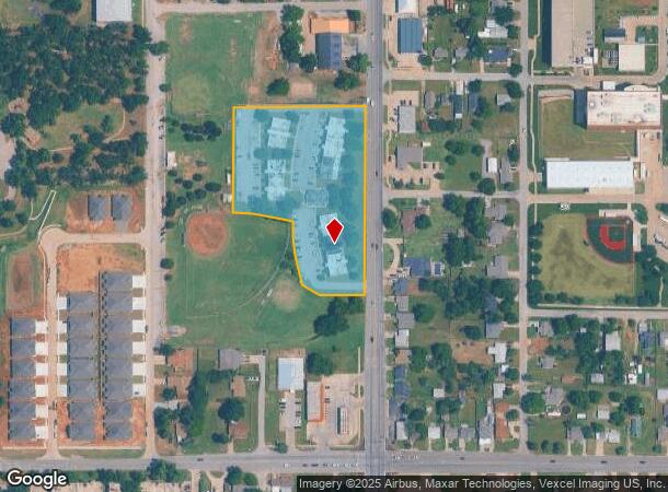
3903 N Rockwell Ave, Bethany, OK 73008


NEARBY LISTINGS FOR SALE OR LEASE
Property Detail
3903 N Rockwell Ave
Oklahoma City, OK
Forrest Highland
172620900
FORREST HIGHLAND 000 000 A PT OF LOTS 2 3 & 4 BEG 250FT S & 17FT W OF NE/C OF LOT 4 TH S545FT W220FT N225FT W208FT N386FT E145FT S66FT E283FT TOBEG
Commercialnec
Oklahoma
X
Oklahoma
40109C0145H
2,4
2023
4.50 AC
2024
West Oklahoma City
106704
Oklahoma City
67,118 SF
DEMOGRAPHICS near 3903 N Rockwell Ave
1 Mile
3 Mile
5 Mile
2024 Total Population
10,993
90,104
186,067
2029 Population
11,287
93,547
195,948
Pop Growth 2024-2029
+ 2.67%
+ 3.82%
+ 5.31%
Average Age
37
37
38
2024 Total Households
4,119
35,785
76,291
HH Growth 2024-2029
+ 2.79%
+ 3.89%
+ 5.06%
Median Household Inc
$52,137
$48,432
$53,999
Avg Household Size
2.40
2.40
2.40
2024 Avg HH Vehicles
2.00
2.00
2.00
Median Home Value
$154,067
$154,096
$168,259
Median Year Built
1962
1969
1971
Nearby Places
Map Layers
Map Styles
 Street
 Aerial
- Restaurants
- Banks
- Shops
- Fitness
- Groceries
PUBLIC TRANSPORTATION
AIRPORT
Will Rogers World
DRIVE
WALK
Distance
Will Rogers World
23 min
10.9 mi
Freight Ports
Tulsa Port Of Catoosa
DRIVE
WALK
Distance
Tulsa Port Of Catoosa
139 min
127.3 mi
SALE & LEASE HISTORY
LISTING DATE
SALE/LEASE

Dec 14, 2023
For Sale
Nearby Properties
Address
Land Use
TOTAL SIZE
Lot Size
Zoning
Address
Land Use
TOTAL SIZE
Lot Size
Zoning
44,519 SF
3.39 AC
SPUD
Address
Land Use
TOTAL SIZE
Lot Size
Zoning
90,059 SF
14.99 AC
O-2
Address
Land Use
TOTAL SIZE
Lot Size
Zoning
641,860 SF
62.12 AC
R-4
Address
Land Use
TOTAL SIZE
Lot Size
Zoning
21,111 SF
2.57 AC
R-4
Address
Land Use
TOTAL SIZE
Lot Size
Zoning
213,085 SF
3.64 AC
Address
Land Use
TOTAL SIZE
Lot Size
Zoning
29,274 SF
0.93 AC
C-3
Address
Land Use
TOTAL SIZE
Lot Size
Zoning
69,370 SF
O-2
Address
Land Use
TOTAL SIZE
Lot Size
Zoning
294,820 SF
12.17 AC
Address
Land Use
TOTAL SIZE
Lot Size
Zoning
259,024 SF
28.32 AC
R-4
Address
Land Use
TOTAL SIZE
Lot Size
Zoning
342,342 SF
27.20 AC
R-4
Address
Land Use
TOTAL SIZE
Lot Size
Zoning
182,590 SF
11.35 AC
R-4
Address
Land Use
TOTAL SIZE
Lot Size
Zoning
245,768 SF
15.93 AC
Address
Land Use
TOTAL SIZE
Lot Size
Zoning
217,512 SF
8.79 AC
Address
Land Use
TOTAL SIZE
Lot Size
Zoning
225,084 SF
18.41 AC
Address
Land Use
TOTAL SIZE
Lot Size
Zoning
197,019 SF
8.69 AC
R-4
Address
Land Use
TOTAL SIZE
Lot Size
Zoning
225,720 SF
9.60 AC
PUD
Address
Land Use
TOTAL SIZE
Lot Size
Zoning
182,948 SF
10 AC
Address
Land Use
TOTAL SIZE
Lot Size
Zoning
165,745 SF
13.89 AC
C-3
Address
Land Use
TOTAL SIZE
Lot Size
Zoning
217,328 SF
11.52 AC
I-3
Address
Land Use
TOTAL SIZE
Lot Size
Zoning
1,865 SF
32.08 AC
Address
Land Use
TOTAL SIZE
Lot Size
Zoning
146,710 SF
8.76 AC
O-2
Address
Land Use
TOTAL SIZE
Lot Size
Zoning
33,173 SF
50.74 AC
Address
Land Use
TOTAL SIZE
Lot Size
Zoning
161,199 SF
6.03 AC
PUD
Address
Land Use
TOTAL SIZE
Lot Size
Zoning
276,106 SF
18.37 AC
R-4
Address
Land Use
TOTAL SIZE
Lot Size
Zoning
156,016 SF
11.04 AC
PUD
Address
Land Use
TOTAL SIZE
Lot Size
Zoning
184,960 SF
9.11 AC
R-4
Address
Land Use
TOTAL SIZE
Lot Size
Zoning
163,284 SF
6.76 AC
R-4
Address
Land Use
TOTAL SIZE
Lot Size
Zoning
19,050 SF
1.17 AC
C-3
Address
Land Use
TOTAL SIZE
Lot Size
Zoning
6,148 SF
2.50 AC
R-1
Address
Land Use
TOTAL SIZE
Lot Size
Zoning
116,154 SF
3.31 AC
R-4
The World's #1 Commercial Real Estate Marketplace
Connect with us
© 2025 CoStar Group
The information above has been obtained from sources believed reliable. While we do not doubt its accuracy we have not verified it and make no guarantee, warranty or representation about it. It is your responsibility to independently confirm its accuracy and completeness. Any projections, opinions, assumptions, or estimates used are for example only and do not represent the current or future performance of the property. The value of this transaction to you depends on tax and other factors which should be evaluated by your tax, financial, and legal advisors. You and your advisors should conduct a careful, independent investigation of the property to determine to your satisfaction the suitability of the property for your needs.