Property Record
39047 S Highway 77, Tucson, AZ 85739
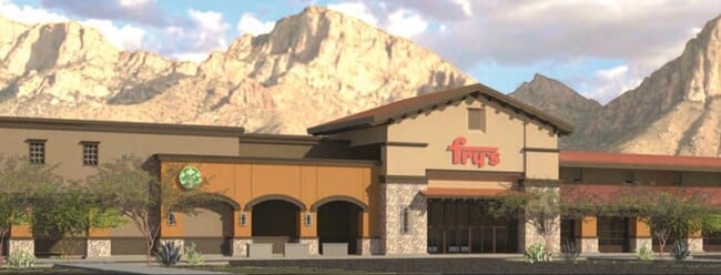
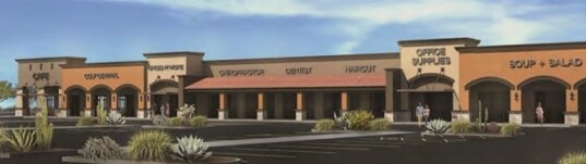
NEARBY LISTINGS FOR SALE OR LEASE
Property Detail
39047 S Highway 77
Phoenix-Mesa-Scottsdale, AZ
Eagle Crest Ranch
305-31-371C
A PORTION OF TRACT B IN EAGLE CREST RANCH TRACTS A THROUGH N IN C AB C, SLD 173 ALL IN SEC 32-T10S-R14E, BEG AT THE SW CORNER OF TR ACT B TH N10D W-544.08 TH N79D E-200.84 TH N74D E-106.54 TH ALONG NON-TANG CRV TO THE LEFT WITH RADIUS OF 3245.00 AND
Commercialacreage
Pinal
X
Arizona
04019C0495L
7.93 AC
2024
Outlying Pinal County
2025
Phoenix
0006041003
DEMOGRAPHICS near 39047 S Highway 77
1 Mile
3 Mile
5 Mile
2024 Total Population
2,241
13,306
26,379
2029 Population
2,761
15,488
30,460
Pop Growth 2024-2029
+ 23.20%
+ 16.40%
+ 15.47%
Average Age
50
56
61
2024 Total Households
952
6,097
12,828
HH Growth 2024-2029
+ 23.11%
+ 17.32%
+ 15.89%
Median Household Inc
$96,180
$75,835
$80,254
Avg Household Size
2.30
2.10
2.00
2024 Avg HH Vehicles
2.00
2.00
2.00
Median Home Value
$374,123
$378,474
$397,531
Median Year Built
2006
2000
1997
Nearby Places
Map Layers
Map Styles
 Street
 Aerial
- Restaurants
- Banks
- Shops
- Fitness
- Groceries
PUBLIC TRANSPORTATION
AIRPORT
Tucson International
DRIVE
WALK
Distance
Tucson International
53 min
30.8 mi
Freight Ports
Port of San Diego
DRIVE
WALK
Distance
Port of San Diego
446 min
406.2 mi
SALE & LEASE HISTORY
LISTING DATE
SALE/LEASE

Nov 16, 2021
For Lease
Nearby Properties
Address
Land Use
TOTAL SIZE
Lot Size
Zoning
Address
Land Use
TOTAL SIZE
Lot Size
Zoning
130,127 SF
175.94 AC
SP
Address
Land Use
TOTAL SIZE
Lot Size
Zoning
30,340 SF
5.17 AC
CB1
Address
Land Use
TOTAL SIZE
Lot Size
Zoning
22,734 SF
4.16 AC
CB1
Address
Land Use
TOTAL SIZE
Lot Size
Zoning
66,253 SF
7.07 AC
CB1
Address
Land Use
TOTAL SIZE
Lot Size
Zoning
38,076 SF
8.86 AC
GR1
Address
Land Use
TOTAL SIZE
Lot Size
Zoning
21,734 SF
4.68 AC
Address
Land Use
TOTAL SIZE
Lot Size
Zoning
Address
Land Use
TOTAL SIZE
Lot Size
Zoning
576 SF
3.99 AC
GR1
Address
Land Use
TOTAL SIZE
Lot Size
Zoning
1,750 SF
1.14 AC
GR1
Address
Land Use
TOTAL SIZE
Lot Size
Zoning
16.46 AC
CB1
Address
Land Use
TOTAL SIZE
Lot Size
Zoning
4,994 SF
0.36 AC
CB2
Address
Land Use
TOTAL SIZE
Lot Size
Zoning
2,664 SF
1.10 AC
CB2
Address
Land Use
TOTAL SIZE
Lot Size
Zoning
19,598 SF
3.25 AC
CB2
Address
Land Use
TOTAL SIZE
Lot Size
Zoning
52,500 SF
3.25 AC
CB2
Address
Land Use
TOTAL SIZE
Lot Size
Zoning
1,152 SF
2.32 AC
GR1
Address
Land Use
TOTAL SIZE
Lot Size
Zoning
2,542 SF
9.09 AC
Address
Land Use
TOTAL SIZE
Lot Size
Zoning
9,100 SF
1.09 AC
Address
Land Use
TOTAL SIZE
Lot Size
Zoning
20,304 SF
1.76 AC
CB2
Address
Land Use
TOTAL SIZE
Lot Size
Zoning
10.30 AC
CB1
Address
Land Use
TOTAL SIZE
Lot Size
Zoning
105 SF
3.32 AC
GR1
Address
Land Use
TOTAL SIZE
Lot Size
Zoning
3,137 SF
1.12 AC
CB1
Address
Land Use
TOTAL SIZE
Lot Size
Zoning
17,002 SF
1.73 AC
CB1
Address
Land Use
TOTAL SIZE
Lot Size
Zoning
5,310 SF
137.94 AC
CR3
Address
Land Use
TOTAL SIZE
Lot Size
Zoning
3,957 SF
0.80 AC
CB1
Address
Land Use
TOTAL SIZE
Lot Size
Zoning
3,562 SF
0.92 AC
CB1
Address
Land Use
TOTAL SIZE
Lot Size
Zoning
4,606 SF
2.25 AC
CB2
Address
Land Use
TOTAL SIZE
Lot Size
Zoning
3,165 SF
1.17 AC
CB2
Address
Land Use
TOTAL SIZE
Lot Size
Zoning
15,596 SF
4.81 AC
GR1
The World's #1 Commercial Real Estate Marketplace
Connect with us
© 2025 CoStar Group
The information above has been obtained from sources believed reliable. While we do not doubt its accuracy we have not verified it and make no guarantee, warranty or representation about it. It is your responsibility to independently confirm its accuracy and completeness. Any projections, opinions, assumptions, or estimates used are for example only and do not represent the current or future performance of the property. The value of this transaction to you depends on tax and other factors which should be evaluated by your tax, financial, and legal advisors. You and your advisors should conduct a careful, independent investigation of the property to determine to your satisfaction the suitability of the property for your needs.