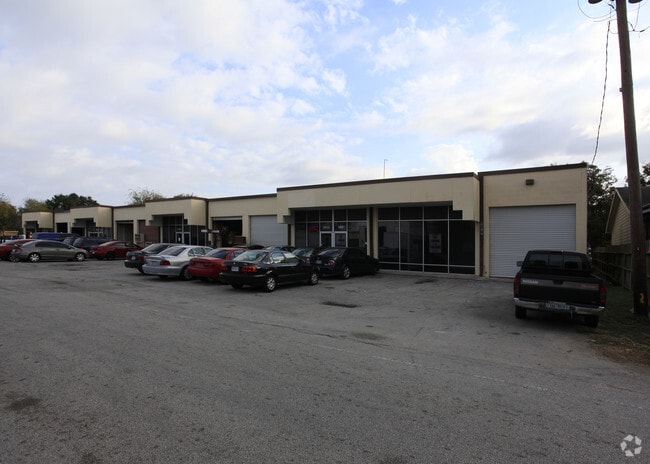
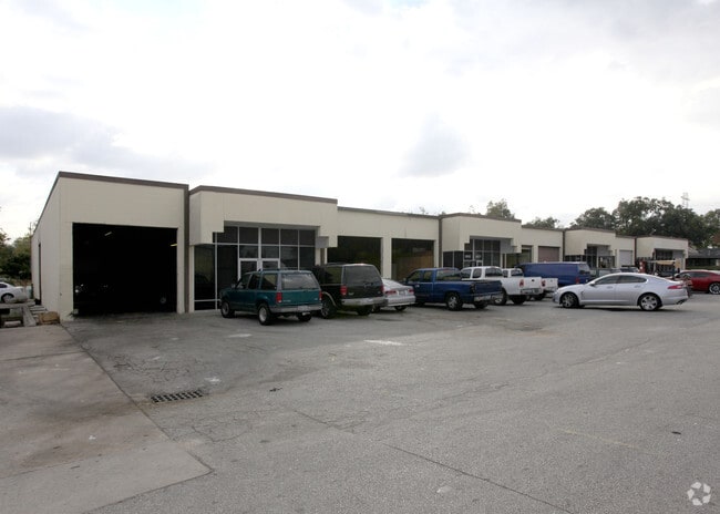
Property Record
3909 Artdale St, Houston, TX 77063

NEARBY LISTINGS FOR SALE OR LEASE
Property Detail
3909 Artdale St
Houston-Pasadena-The Woodlands, TX
Jeanetta Courts
0720970050012
LTS 12 THRU 16 BLK 5 JEANETTA COURTS
Warehouse
Harris
X
Texas
48157C0175L
12-16
2024
0.82 AC
2025
Southwest Outer Loop
432200
Houston
21,800 SF
DEMOGRAPHICS near 3909 Artdale St
1 Mile
3 Mile
5 Mile
2024 Total Population
32,956
248,031
583,465
2029 Population
33,716
254,727
598,923
Pop Growth 2024-2029
+ 2.31%
+ 2.70%
+ 2.65%
Average Age
34
35
37
2024 Total Households
13,661
100,286
234,941
HH Growth 2024-2029
+ 2.10%
+ 2.67%
+ 2.69%
Median Household Inc
$37,590
$41,596
$51,072
Avg Household Size
2.30
2.40
2.40
2024 Avg HH Vehicles
1.00
1.00
1.00
Median Home Value
$187,349
$254,884
$346,829
Median Year Built
1978
1978
1979
Nearby Places
Map Layers
Map Styles
 Street
 Aerial
- Restaurants
- Banks
- Shops
- Fitness
- Groceries
PUBLIC TRANSPORTATION
AIRPORT
William P Hobby
DRIVE
WALK
Distance
William P Hobby
36 min
21.6 mi
George Bush Intcntl/Houston
DRIVE
WALK
Distance
George Bush Intcntl/Houston
40 min
31.1 mi
Freight Ports
Port of Houston
DRIVE
WALK
Distance
Port of Houston
32 min
21.0 mi
SALE & LEASE HISTORY
LISTING DATE
SALE/LEASE

Sep 24, 2016
For Lease
Nov 16, 2017
For Lease
Nearby Properties
Address
Land Use
TOTAL SIZE
Lot Size
Zoning
Address
Land Use
TOTAL SIZE
Lot Size
Zoning
2,198,376 SF
14.18 AC
Address
Land Use
TOTAL SIZE
Lot Size
Zoning
1,020,766 SF
3.08 AC
Address
Land Use
TOTAL SIZE
Lot Size
Zoning
1,082,545 SF
7.22 AC
Address
Land Use
TOTAL SIZE
Lot Size
Zoning
1,053,492 SF
9.34 AC
Address
Land Use
TOTAL SIZE
Lot Size
Zoning
878,129 SF
11.69 AC
Address
Land Use
TOTAL SIZE
Lot Size
Zoning
794,526 SF
21.25 AC
Address
Land Use
TOTAL SIZE
Lot Size
Zoning
1,172,310 SF
8.17 AC
Address
Land Use
TOTAL SIZE
Lot Size
Zoning
686,506 SF
1.56 AC
Address
Land Use
TOTAL SIZE
Lot Size
Zoning
702,286 SF
15.67 AC
Address
Land Use
TOTAL SIZE
Lot Size
Zoning
561,732 SF
6.10 AC
Address
Land Use
TOTAL SIZE
Lot Size
Zoning
385,587 SF
3.08 AC
Address
Land Use
TOTAL SIZE
Lot Size
Zoning
967,728 SF
7.40 AC
Address
Land Use
TOTAL SIZE
Lot Size
Zoning
1,612,349 SF
54.03 AC
Address
Land Use
TOTAL SIZE
Lot Size
Zoning
511,262 SF
6.60 AC
Address
Land Use
TOTAL SIZE
Lot Size
Zoning
972,984 SF
30.18 AC
Address
Land Use
TOTAL SIZE
Lot Size
Zoning
361,954 SF
14.43 AC
Address
Land Use
TOTAL SIZE
Lot Size
Zoning
807,423 SF
30.01 AC
Address
Land Use
TOTAL SIZE
Lot Size
Zoning
649,992 SF
19.81 AC
Address
Land Use
TOTAL SIZE
Lot Size
Zoning
413,734 SF
6.22 AC
Address
Land Use
TOTAL SIZE
Lot Size
Zoning
380,423 SF
15.14 AC
Address
Land Use
TOTAL SIZE
Lot Size
Zoning
769,005 SF
20.46 AC
Address
Land Use
TOTAL SIZE
Lot Size
Zoning
771,720 SF
19.28 AC
Address
Land Use
TOTAL SIZE
Lot Size
Zoning
383,540 SF
4.43 AC
Address
Land Use
TOTAL SIZE
Lot Size
Zoning
598,127 SF
4.14 AC
Address
Land Use
TOTAL SIZE
Lot Size
Zoning
340,136 SF
13.34 AC
Address
Land Use
TOTAL SIZE
Lot Size
Zoning
362,473 SF
15.65 AC
Address
Land Use
TOTAL SIZE
Lot Size
Zoning
539,308 SF
21 AC
Address
Land Use
TOTAL SIZE
Lot Size
Zoning
473,207 SF
15.50 AC
Address
Land Use
TOTAL SIZE
Lot Size
Zoning
360,715 SF
4.04 AC
Address
Land Use
TOTAL SIZE
Lot Size
Zoning
997,813 SF
5.25 AC
The World's #1 Commercial Real Estate Marketplace
Connect with us
© 2026 CoStar Group
The information above has been obtained from sources believed reliable. While we do not doubt its accuracy we have not verified it and make no guarantee, warranty or representation about it. It is your responsibility to independently confirm its accuracy and completeness. Any projections, opinions, assumptions, or estimates used are for example only and do not represent the current or future performance of the property. The value of this transaction to you depends on tax and other factors which should be evaluated by your tax, financial, and legal advisors. You and your advisors should conduct a careful, independent investigation of the property to determine to your satisfaction the suitability of the property for your needs.