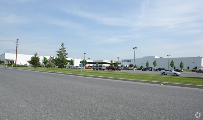
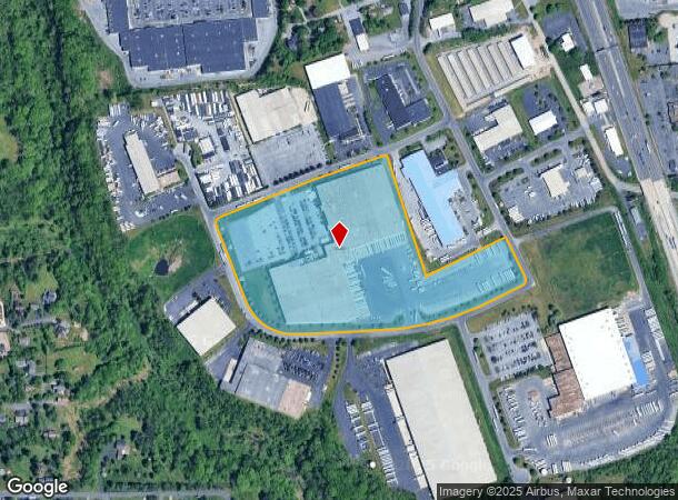
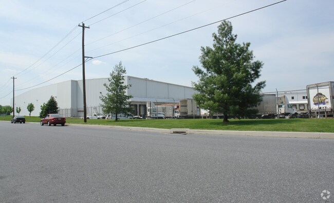
Property Record
3905 Corey Rd, Harrisburg, PA 17109
NEARBY LISTINGS FOR SALE OR LEASE
Property Detail
3905 Corey Rd
62-040-066
Union Square Indl Park Ph 01
Warehouse
Dauphin
X
Pennsylvania
42043C0339D
20.38 AC
2025
Harrisburg Area East
2025
Philadelphia
022100
Harrisburg-Carlisle, PA
233,427 SF
DEMOGRAPHICS near 3905 Corey Rd
1 Mile
3 Mile
5 Mile
2024 Total Population
9,250
96,264
195,085
2029 Population
9,449
98,282
200,577
Pop Growth 2024-2029
+ 2.15%
+ 2.10%
+ 2.82%
Average Age
42
38
39
2024 Total Households
4,099
37,759
80,870
HH Growth 2024-2029
+ 2.27%
+ 2.14%
+ 2.98%
Median Household Inc
$57,876
$55,254
$63,756
Avg Household Size
2.20
2.40
2.30
2024 Avg HH Vehicles
1.00
1.00
2.00
Median Home Value
$168,302
$155,821
$181,039
Median Year Built
1963
1958
1964
Nearby Places
Map Layers
Map Styles
 Street
 Aerial
- Restaurants
- Banks
- Shops
- Fitness
- Groceries
PUBLIC TRANSPORTATION
COMMUTER RAIL
DRIVE
WALK
Distance
10 min
4.4 mi
DRIVE
WALK
Distance
19 min
9.8 mi
AIRPORT
Harrisburg International
DRIVE
WALK
Distance
Harrisburg International
17 min
9.7 mi
Freight Ports
Port Newark Container Terminal
DRIVE
WALK
Distance
Port Newark Container Terminal
125 min
84.0 mi
Nearby Properties
Address
Land Use
TOTAL SIZE
Lot Size
Zoning
Address
Land Use
TOTAL SIZE
Lot Size
Zoning
210,464 SF
28.80 AC
Address
Land Use
TOTAL SIZE
Lot Size
Zoning
15,480 SF
17.80 AC
Address
Land Use
TOTAL SIZE
Lot Size
Zoning
365,162 SF
19.11 AC
Address
Land Use
TOTAL SIZE
Lot Size
Zoning
74,032 SF
74.81 AC
Address
Land Use
TOTAL SIZE
Lot Size
Zoning
122,301 SF
32.30 AC
Address
Land Use
TOTAL SIZE
Lot Size
Zoning
570,800 SF
1.29 AC
Address
Land Use
TOTAL SIZE
Lot Size
Zoning
47,022 SF
47.55 AC
Address
Land Use
TOTAL SIZE
Lot Size
Zoning
Address
Land Use
TOTAL SIZE
Lot Size
Zoning
172,289 SF
86.54 AC
Address
Land Use
TOTAL SIZE
Lot Size
Zoning
130,542 SF
28.94 AC
Address
Land Use
TOTAL SIZE
Lot Size
Zoning
9,188 SF
46.70 AC
Address
Land Use
TOTAL SIZE
Lot Size
Zoning
91,929 SF
45.10 AC
Address
Land Use
TOTAL SIZE
Lot Size
Zoning
2,913 SF
24.28 AC
Address
Land Use
TOTAL SIZE
Lot Size
Zoning
125,255 SF
26.65 AC
Address
Land Use
TOTAL SIZE
Lot Size
Zoning
284,737 SF
28.16 AC
Address
Land Use
TOTAL SIZE
Lot Size
Zoning
5,588 SF
9.29 AC
Address
Land Use
TOTAL SIZE
Lot Size
Zoning
192,390 SF
43.19 AC
Address
Land Use
TOTAL SIZE
Lot Size
Zoning
247,216 SF
46.91 AC
Address
Land Use
TOTAL SIZE
Lot Size
Zoning
27,632 SF
59.50 AC
Address
Land Use
TOTAL SIZE
Lot Size
Zoning
2,000 SF
21.13 AC
Address
Land Use
TOTAL SIZE
Lot Size
Zoning
242,534 SF
47.26 AC
Address
Land Use
TOTAL SIZE
Lot Size
Zoning
2,129 SF
19.90 AC
Address
Land Use
TOTAL SIZE
Lot Size
Zoning
112,388 SF
38.01 AC
Address
Land Use
TOTAL SIZE
Lot Size
Zoning
226,101 SF
46.29 AC
Address
Land Use
TOTAL SIZE
Lot Size
Zoning
82,881 SF
16.90 AC
Address
Land Use
TOTAL SIZE
Lot Size
Zoning
1,744 SF
21.79 AC
Address
Land Use
TOTAL SIZE
Lot Size
Zoning
24,567 SF
15.33 AC
Address
Land Use
TOTAL SIZE
Lot Size
Zoning
2,823 SF
36.87 AC
Address
Land Use
TOTAL SIZE
Lot Size
Zoning
207,012 SF
24.50 AC
Address
Land Use
TOTAL SIZE
Lot Size
Zoning
139,381 SF
42.61 AC
The World's #1 Commercial Real Estate Marketplace
Connect with us
© 2026 CoStar Group
The information above has been obtained from sources believed reliable. While we do not doubt its accuracy we have not verified it and make no guarantee, warranty or representation about it. It is your responsibility to independently confirm its accuracy and completeness. Any projections, opinions, assumptions, or estimates used are for example only and do not represent the current or future performance of the property. The value of this transaction to you depends on tax and other factors which should be evaluated by your tax, financial, and legal advisors. You and your advisors should conduct a careful, independent investigation of the property to determine to your satisfaction the suitability of the property for your needs.