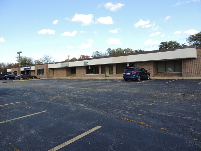
Property Record
3906 N Main St, Rockford, IL 61103


NEARBY LISTINGS FOR SALE OR LEASE
Property Detail
3906 N Main St
Rockford, IL
North Main Professional Park
11-02-280-011
NORTH MAIN PROFESSIONAL PARK PT E 1/2SEC 2-44-1 LOT 1
Officebuilding
Winnebago
X
Illinois
17201C0254E
1
2024
1.45 AC
2024
I-39 Corr/Winnebago Cnty
003605
Chicago
9,591 SF
DEMOGRAPHICS near 3906 N Main St
1 Mile
3 Mile
5 Mile
2024 Total Population
7,452
61,530
149,860
2029 Population
7,294
60,732
148,303
Pop Growth 2024-2029
(2.12%)
(1.30%)
(1.04%)
Average Age
42
40
40
2024 Total Households
3,227
25,842
61,137
HH Growth 2024-2029
(2.29%)
(1.38%)
(1.13%)
Median Household Inc
$43,980
$47,795
$48,603
Avg Household Size
2.20
2.30
2.30
2024 Avg HH Vehicles
2.00
2.00
2.00
Median Home Value
$97,850
$113,170
$121,288
Median Year Built
1963
1961
1962
Nearby Places
Map Layers
Map Styles
 Street
 Aerial
- Restaurants
- Banks
- Shops
- Fitness
- Groceries
PUBLIC TRANSPORTATION
AIRPORT
Chicago/Rockford International
DRIVE
WALK
Distance
Chicago/Rockford International
26 min
12.0 mi
SALE & LEASE HISTORY
LISTING DATE
SALE/LEASE

Sep 25, 2016
For Lease
Oct 22, 2019
For Lease
May 05, 2020
For Sale
Nearby Properties
Address
Land Use
TOTAL SIZE
Lot Size
Zoning
Address
Land Use
TOTAL SIZE
Lot Size
Zoning
212,200 SF
21 AC
C3
Address
Land Use
TOTAL SIZE
Lot Size
Zoning
256,236 SF
29.33 AC
R3
Address
Land Use
TOTAL SIZE
Lot Size
Zoning
216,540 SF
22 AC
C3
Address
Land Use
TOTAL SIZE
Lot Size
Zoning
106,145 SF
8.54 AC
R3
Address
Land Use
TOTAL SIZE
Lot Size
Zoning
51,580 SF
6.13 AC
Address
Land Use
TOTAL SIZE
Lot Size
Zoning
676,780 SF
32.88 AC
IG
Address
Land Use
TOTAL SIZE
Lot Size
Zoning
182,391 SF
17.90 AC
R3
Address
Land Use
TOTAL SIZE
Lot Size
Zoning
114,176 SF
4.94 AC
R4
Address
Land Use
TOTAL SIZE
Lot Size
Zoning
117,360 SF
1.52 AC
R4
Address
Land Use
TOTAL SIZE
Lot Size
Zoning
Address
Land Use
TOTAL SIZE
Lot Size
Zoning
151,517 SF
7.52 AC
R3
Address
Land Use
TOTAL SIZE
Lot Size
Zoning
140,085 SF
14.90 AC
Address
Land Use
TOTAL SIZE
Lot Size
Zoning
373,791 SF
25.40 AC
IL
Address
Land Use
TOTAL SIZE
Lot Size
Zoning
Address
Land Use
TOTAL SIZE
Lot Size
Zoning
78,968 SF
13.65 AC
R2
Address
Land Use
TOTAL SIZE
Lot Size
Zoning
13.45 AC
Address
Land Use
TOTAL SIZE
Lot Size
Zoning
58,526 SF
134.42 AC
RE
Address
Land Use
TOTAL SIZE
Lot Size
Zoning
645,384 SF
25.22 AC
I1
Address
Land Use
TOTAL SIZE
Lot Size
Zoning
160,937 SF
10 AC
CR
Address
Land Use
TOTAL SIZE
Lot Size
Zoning
57,888 SF
12.37 AC
R2
Address
Land Use
TOTAL SIZE
Lot Size
Zoning
243,057 SF
21.38 AC
C2
Address
Land Use
TOTAL SIZE
Lot Size
Zoning
60,479 SF
117 AC
R1
Address
Land Use
TOTAL SIZE
Lot Size
Zoning
113,175 SF
5 AC
R3
Address
Land Use
TOTAL SIZE
Lot Size
Zoning
82,582 SF
7.92 AC
CR
Address
Land Use
TOTAL SIZE
Lot Size
Zoning
119,108 SF
3.06 AC
R3
Address
Land Use
TOTAL SIZE
Lot Size
Zoning
44,213 SF
12.04 AC
R2
Address
Land Use
TOTAL SIZE
Lot Size
Zoning
6.89 AC
RE
Address
Land Use
TOTAL SIZE
Lot Size
Zoning
63,952 SF
10.70 AC
R2
Address
Land Use
TOTAL SIZE
Lot Size
Zoning
83,110 SF
5.30 AC
R3
Address
Land Use
TOTAL SIZE
Lot Size
Zoning
12.75 AC
I1
The World's #1 Commercial Real Estate Marketplace
Connect with us
© 2026 CoStar Group
The information above has been obtained from sources believed reliable. While we do not doubt its accuracy we have not verified it and make no guarantee, warranty or representation about it. It is your responsibility to independently confirm its accuracy and completeness. Any projections, opinions, assumptions, or estimates used are for example only and do not represent the current or future performance of the property. The value of this transaction to you depends on tax and other factors which should be evaluated by your tax, financial, and legal advisors. You and your advisors should conduct a careful, independent investigation of the property to determine to your satisfaction the suitability of the property for your needs.