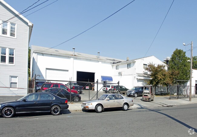
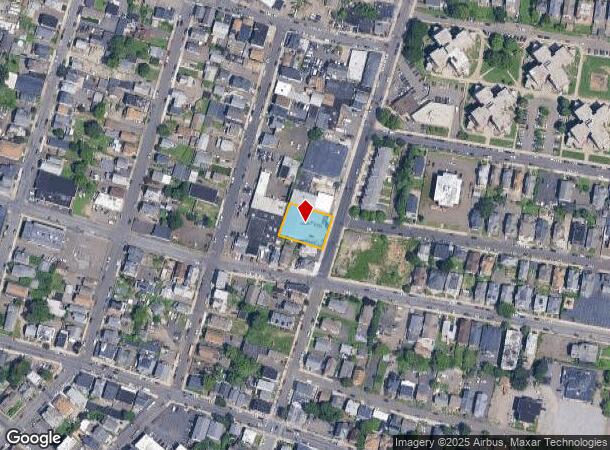
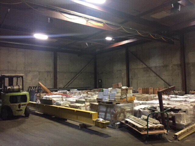
Property Record
391 Harral Ave, Bridgeport, CT 06604
NEARBY LISTINGS FOR SALE OR LEASE
Property Detail
391 Harral Ave
BRID-001038-000012
Fairfield
Industrialgeneral
Connecticut
X
12
09001C0437G
0.31 AC
2025
Bridgeport
2025
Westchester/So Connecticut
071300
Bridgeport-Stamford-Norwalk, CT
7,994 SF
DEMOGRAPHICS near 391 Harral Ave
1 Mile
3 Mile
5 Mile
2024 Total Population
40,548
178,198
267,487
2029 Population
40,130
178,188
267,844
Pop Growth 2024-2029
(1.03%)
(0.01%)
+ 0.13%
Average Age
36
38
39
2024 Total Households
14,459
65,021
95,846
HH Growth 2024-2029
(1.21%)
(0.05%)
+ 0.08%
Median Household Inc
$35,949
$53,905
$69,267
Avg Household Size
2.60
2.60
2.60
2024 Avg HH Vehicles
1.00
2.00
2.00
Median Home Value
$203,747
$250,380
$316,649
Median Year Built
1948
1952
1954
Nearby Places
Map Layers
Map Styles
 Street
 Aerial
- Restaurants
- Banks
- Shops
- Fitness
- Groceries
PUBLIC TRANSPORTATION
COMMUTER RAIL
Bridgeport Station (New Haven Line - Shore Line East, Shore Line East - Shore Line East)
DRIVE
WALK
Distance
Bridgeport Station (New Haven Line - Shore Line East, Shore Line East - Shore Line East)
2 min
1.0 mi
Fairfield Metro (New Haven - Metro-North Railroad)
DRIVE
WALK
Distance
Fairfield Metro (New Haven - Metro-North Railroad)
7 min
3.4 mi
AIRPORT
Tweed/New Haven
DRIVE
WALK
Distance
Tweed/New Haven
38 min
23.0 mi
Long Island MacArthur
DRIVE
WALK
Distance
Long Island MacArthur
110 min
35.2 mi
Westchester County
DRIVE
WALK
Distance
Westchester County
52 min
35.7 mi
Freight Ports
Port of New Haven
DRIVE
WALK
Distance
Port of New Haven
33 min
20.2 mi
SALE & LEASE HISTORY
LISTING DATE
SALE/LEASE

Jan 10, 2019
For Lease
Nearby Properties
Address
Land Use
TOTAL SIZE
Lot Size
Zoning
Address
Land Use
TOTAL SIZE
Lot Size
Zoning
Address
Land Use
TOTAL SIZE
Lot Size
Zoning
22.85 AC
Address
Land Use
TOTAL SIZE
Lot Size
Zoning
23.95 AC
RB
Address
Land Use
TOTAL SIZE
Lot Size
Zoning
145,000 SF
15.70 AC
ILI
Address
Land Use
TOTAL SIZE
Lot Size
Zoning
356,837 SF
8.87 AC
RA
Address
Land Use
TOTAL SIZE
Lot Size
Zoning
111 AC
RA
Address
Land Use
TOTAL SIZE
Lot Size
Zoning
120,955 SF
9.37 AC
RA
Address
Land Use
TOTAL SIZE
Lot Size
Zoning
335,633 SF
39.70 AC
R3
Address
Land Use
TOTAL SIZE
Lot Size
Zoning
4.14 AC
MUEM
Address
Land Use
TOTAL SIZE
Lot Size
Zoning
1,183 SF
2.33 AC
DID
Address
Land Use
TOTAL SIZE
Lot Size
Zoning
178,265 SF
6.92 AC
Address
Land Use
TOTAL SIZE
Lot Size
Zoning
83,122 SF
4.39 AC
Address
Land Use
TOTAL SIZE
Lot Size
Zoning
288,875 SF
1.57 AC
MUEM
Address
Land Use
TOTAL SIZE
Lot Size
Zoning
146,351 SF
8.86 AC
Address
Land Use
TOTAL SIZE
Lot Size
Zoning
497,430 SF
4.16 AC
DCB
Address
Land Use
TOTAL SIZE
Lot Size
Zoning
23 AC
RC
Address
Land Use
TOTAL SIZE
Lot Size
Zoning
162,376 SF
7.82 AC
Address
Land Use
TOTAL SIZE
Lot Size
Zoning
10.66 AC
ORR
Address
Land Use
TOTAL SIZE
Lot Size
Zoning
10.28 AC
DID
Address
Land Use
TOTAL SIZE
Lot Size
Zoning
260,992 SF
4.19 AC
ILI
Address
Land Use
TOTAL SIZE
Lot Size
Zoning
585,480 SF
3.66 AC
Address
Land Use
TOTAL SIZE
Lot Size
Zoning
493,114 SF
2.20 AC
DCB
Address
Land Use
TOTAL SIZE
Lot Size
Zoning
23.70 AC
RB
Address
Land Use
TOTAL SIZE
Lot Size
Zoning
22.43 AC
R3
Address
Land Use
TOTAL SIZE
Lot Size
Zoning
92,318 SF
5.33 AC
Address
Land Use
TOTAL SIZE
Lot Size
Zoning
115,006 SF
2.51 AC
DCD
Address
Land Use
TOTAL SIZE
Lot Size
Zoning
368,000 SF
18.69 AC
D-17
Address
Land Use
TOTAL SIZE
Lot Size
Zoning
216,972 SF
2.53 AC
DCB
Address
Land Use
TOTAL SIZE
Lot Size
Zoning
13.15 AC
ORR
Address
Land Use
TOTAL SIZE
Lot Size
Zoning
225,264 SF
28.22 AC
MC
The World's #1 Commercial Real Estate Marketplace
Connect with us
© 2025 CoStar Group
The information above has been obtained from sources believed reliable. While we do not doubt its accuracy we have not verified it and make no guarantee, warranty or representation about it. It is your responsibility to independently confirm its accuracy and completeness. Any projections, opinions, assumptions, or estimates used are for example only and do not represent the current or future performance of the property. The value of this transaction to you depends on tax and other factors which should be evaluated by your tax, financial, and legal advisors. You and your advisors should conduct a careful, independent investigation of the property to determine to your satisfaction the suitability of the property for your needs.