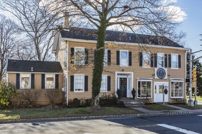
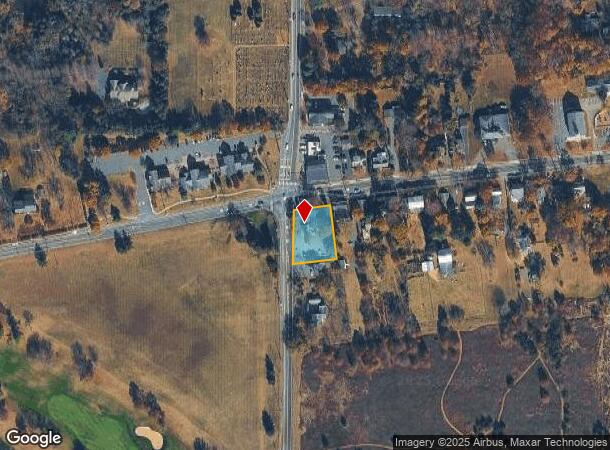
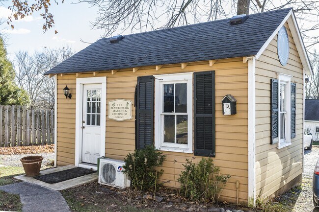
Property Record
391 Route 518, Skillman, NJ 08558

NEARBY LISTINGS FOR SALE OR LEASE
-
-
View all Skillman listings for sale on LoopNet.com
Property Detail
391 Route 518
13-32002-0000-00001
Somerset
Vacantlandnec
New Jersey
X
1
34035C0237E
0.39 AC
2024
Princeton North
2025
Northern New Jersey
054201
Newark, NJ-PA
DEMOGRAPHICS near 391 Route 518
1 Mile
3 Mile
5 Mile
2024 Total Population
1,304
13,209
52,042
2029 Population
1,304
13,285
52,027
Pop Growth 2024-2029
0.00%
+ 0.58%
(0.03%)
Average Age
42
41
41
2024 Total Households
434
4,423
18,684
HH Growth 2024-2029
0.00%
+ 0.47%
(0.15%)
Median Household Inc
$243,116
$229,425
$183,631
Avg Household Size
2.90
2.90
2.70
2024 Avg HH Vehicles
2.00
2.00
2.00
Median Home Value
$795,555
$760,704
$736,831
Median Year Built
1990
1992
1983
Nearby Places
Map Layers
Map Styles
 Street
 Aerial
- Restaurants
- Banks
- Shops
- Fitness
- Groceries
PUBLIC TRANSPORTATION
COMMUTER RAIL
Princeton (Princeton Branch - NJ Transit Commuter Rail (NJ Transit))
DRIVE
WALK
Distance
Princeton (Princeton Branch - NJ Transit Commuter Rail (NJ Transit))
13 min
6.2 mi
Princeton Junction (Northeast Corridor Line - NJ Transit Commuter Rail (NJ Transit), Princeton Branch - NJ Transit Commuter Rail (NJ Transit))
DRIVE
WALK
Distance
Princeton Junction (Northeast Corridor Line - NJ Transit Commuter Rail (NJ Transit), Princeton Branch - NJ Transit Commuter Rail (NJ Transit))
20 min
8.7 mi
AIRPORT
Trenton Mercer
DRIVE
WALK
Distance
Trenton Mercer
27 min
13.9 mi
Freight Ports
New York Container Terminal
DRIVE
WALK
Distance
New York Container Terminal
56 min
36.9 mi
SALE & LEASE HISTORY
LISTING DATE
SALE/LEASE

Oct 29, 2019
For Sale
Nearby Properties
Address
Land Use
TOTAL SIZE
Lot Size
Zoning
Address
Land Use
TOTAL SIZE
Lot Size
Zoning
75.25 AC
Address
Land Use
TOTAL SIZE
Lot Size
Zoning
159.96 AC
LM
Address
Land Use
TOTAL SIZE
Lot Size
Zoning
30 AC
E4
Address
Land Use
TOTAL SIZE
Lot Size
Zoning
27.04 AC
R1
Address
Land Use
TOTAL SIZE
Lot Size
Zoning
17.45 AC
HC
Address
Land Use
TOTAL SIZE
Lot Size
Zoning
5 AC
REO2
Address
Land Use
TOTAL SIZE
Lot Size
Zoning
4.09 AC
Address
Land Use
TOTAL SIZE
Lot Size
Zoning
9.92 AC
S2
Address
Land Use
TOTAL SIZE
Lot Size
Zoning
17.04 AC
HC
Address
Land Use
TOTAL SIZE
Lot Size
Zoning
247.02 AC
Address
Land Use
TOTAL SIZE
Lot Size
Zoning
15,176 SF
35.60 AC
RAB
Address
Land Use
TOTAL SIZE
Lot Size
Zoning
40.80 AC
MCRZ
Address
Land Use
TOTAL SIZE
Lot Size
Zoning
18.65 AC
REO2
Address
Land Use
TOTAL SIZE
Lot Size
Zoning
71.60 AC
R1
Address
Land Use
TOTAL SIZE
Lot Size
Zoning
10.39 AC
Address
Land Use
TOTAL SIZE
Lot Size
Zoning
Address
Land Use
TOTAL SIZE
Lot Size
Zoning
Address
Land Use
TOTAL SIZE
Lot Size
Zoning
59.86 AC
R1
Address
Land Use
TOTAL SIZE
Lot Size
Zoning
35.25 AC
R1
Address
Land Use
TOTAL SIZE
Lot Size
Zoning
2,316 SF
245.52 AC
MR
Address
Land Use
TOTAL SIZE
Lot Size
Zoning
207.69 AC
Address
Land Use
TOTAL SIZE
Lot Size
Zoning
12.11 AC
Address
Land Use
TOTAL SIZE
Lot Size
Zoning
44.04 AC
REO1
Address
Land Use
TOTAL SIZE
Lot Size
Zoning
29.80 AC
HC
Address
Land Use
TOTAL SIZE
Lot Size
Zoning
2,688 SF
183.68 AC
R1
Address
Land Use
TOTAL SIZE
Lot Size
Zoning
Address
Land Use
TOTAL SIZE
Lot Size
Zoning
11,690 SF
6 AC
RA
Address
Land Use
TOTAL SIZE
Lot Size
Zoning
63.37 AC
REO2
Address
Land Use
TOTAL SIZE
Lot Size
Zoning
6.53 AC
REO3
Address
Land Use
TOTAL SIZE
Lot Size
Zoning
2,083 SF
175.35 AC
The World's #1 Commercial Real Estate Marketplace
Connect with us
© 2025 CoStar Group
The information above has been obtained from sources believed reliable. While we do not doubt its accuracy we have not verified it and make no guarantee, warranty or representation about it. It is your responsibility to independently confirm its accuracy and completeness. Any projections, opinions, assumptions, or estimates used are for example only and do not represent the current or future performance of the property. The value of this transaction to you depends on tax and other factors which should be evaluated by your tax, financial, and legal advisors. You and your advisors should conduct a careful, independent investigation of the property to determine to your satisfaction the suitability of the property for your needs.