Property Record
3910 Sw 170Th Ave, Beaverton, OR 97078

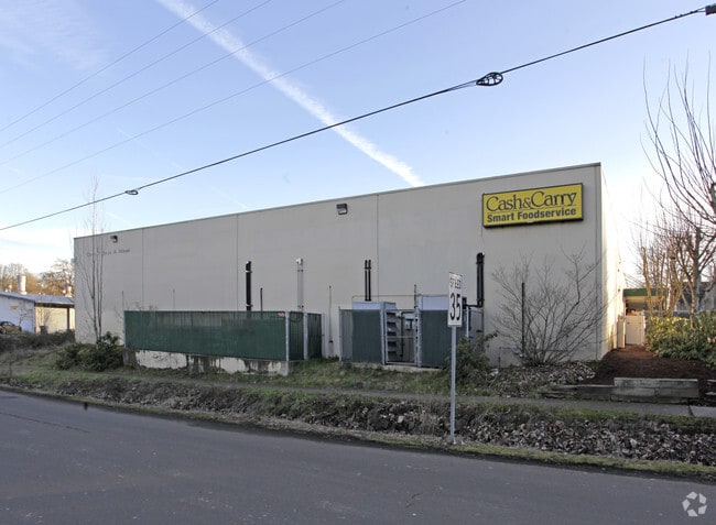

Property Detail
3910 Sw 170Th Ave
R0149609
JOHNSON EST ADD TO BEAV-REED ACR, LOT PT 243, ACRES 1.28
Commercialbuilding
WASHINGTON
IND
Oregon
B and X Area of moderate flood hazard, usually the area between the limits of the 100-year and 500-year floods.
243
2024
1.28 AC
2026
Sunset Corridor/Hillsboro
031703
Portland
20,000 SF
Portland-Vancouver-Hillsboro, OR-WA
NEARBY LISTINGS FOR SALE OR LEASE
DEMOGRAPHICS near 3910 Sw 170Th Ave
1 mile
3 mile
5 mile
2024 Total Population
20,404
160,534
360,276
2029 Population
20,702
162,462
364,585
Pop Growth 2024-2029
+ 1.46%
+ 1.20%
+ 1.20%
Average Age
36
39
40
2024 Total Households
7,513
60,816
140,060
HH Growth 2024-2029
+ 1.58%
+ 1.36%
+ 1.31%
Median Household Inc
$80,540
$97,027
$106,869
Avg Household Size
2.60
2.60
2.50
2024 Avg HH Vehicles
2.00
2.00
2.00
Median Home Value
$477,189
$563,948
$644,330
Median Year Built
1992
1986
1991
Nearby Places
Map Layers
Map Styles
 Street
 Aerial
Transit
 Traffic
 Biking
Places
Listings with unknown addresses are not visible on the map
- Restaurants
- Banks
- Shops
- Fitness
- Groceries
PUBLIC TRANSPORTATION
COMMUTER RAIL
Beaverton Transit Center (West Side Express) (Westside Express Service - Tri-County Metropolitan Transportation District of Oregon Rail (TriMet Rail))
Drive
Walk
Distance
Beaverton Transit Center (West Side Express) (Westside Express Service - Tri-County Metropolitan Transportation District of Oregon Rail (TriMet Rail))
6 min
2.7 mi
Hall/Nimbus (Westside Express Service - Tri-County Metropolitan Transportation District of Oregon Rail (TriMet Rail))
Drive
Walk
Distance
Hall/Nimbus (Westside Express Service - Tri-County Metropolitan Transportation District of Oregon Rail (TriMet Rail))
10 min
5.1 mi
AIRPORT
Portland International
Drive
Walk
Distance
Portland International
37 min
23.0 mi
Freight Ports
Port of Portland
Drive
Walk
Distance
Port of Portland
21 min
12.0 mi
SALE & LEASE HISTORY
LISTING DATE
SALE/LEASE

Aug 12, 2024
For Sale
Nearby Properties
Address
Land Use
TOTAL SIZE
Lot Size
Zoning
Address
Land Use
TOTAL SIZE
Lot Size
Zoning
0.05 AC
IND
Address
Land Use
TOTAL SIZE
Lot Size
Zoning
2,936,291 SF
72.49 AC
TO:EMP
Address
Land Use
TOTAL SIZE
Lot Size
Zoning
0.08 AC
IND
Address
Land Use
TOTAL SIZE
Lot Size
Zoning
58.68 AC
IND
Address
Land Use
TOTAL SIZE
Lot Size
Zoning
373,884 SF
153.56 AC
UC-RP
Address
Land Use
TOTAL SIZE
Lot Size
Zoning
716,311 SF
75.07 AC
TO:EMP
Address
Land Use
TOTAL SIZE
Lot Size
Zoning
303,158 SF
18.18 AC
R10
Address
Land Use
TOTAL SIZE
Lot Size
Zoning
194.52 AC
R1
Address
Land Use
TOTAL SIZE
Lot Size
Zoning
1,031,421 SF
22.20 AC
SC-HDR
Address
Land Use
TOTAL SIZE
Lot Size
Zoning
461,858 SF
36.37 AC
CS
Address
Land Use
TOTAL SIZE
Lot Size
Zoning
37.66 AC
IND
Address
Land Use
TOTAL SIZE
Lot Size
Zoning
704,877 SF
18.72 AC
OI-NC
Address
Land Use
TOTAL SIZE
Lot Size
Zoning
8,967 SF
13.12 AC
GC
Address
Land Use
TOTAL SIZE
Lot Size
Zoning
281,695 SF
7.41 AC
SC-HDR
Address
Land Use
TOTAL SIZE
Lot Size
Zoning
44.66 AC
IND
Address
Land Use
TOTAL SIZE
Lot Size
Zoning
260,677 SF
16.86 AC
INST
Address
Land Use
TOTAL SIZE
Lot Size
Zoning
152,339 SF
28.70 AC
R1
Address
Land Use
TOTAL SIZE
Lot Size
Zoning
253,727 SF
38.06 AC
OI
Address
Land Use
TOTAL SIZE
Lot Size
Zoning
37.55 AC
IND
Address
Land Use
TOTAL SIZE
Lot Size
Zoning
214,045 SF
21.70 AC
R2
Address
Land Use
TOTAL SIZE
Lot Size
Zoning
210,649 SF
15.51 AC
R-15
Address
Land Use
TOTAL SIZE
Lot Size
Zoning
8.12 AC
SFR-4.5
Address
Land Use
TOTAL SIZE
Lot Size
Zoning
18.15 AC
SC-E
Address
Land Use
TOTAL SIZE
Lot Size
Zoning
15.14 AC
MFR-3
Address
Land Use
TOTAL SIZE
Lot Size
Zoning
21.97 AC
R1
Address
Land Use
TOTAL SIZE
Lot Size
Zoning
188,509 SF
17.27 AC
UC-OR
Address
Land Use
TOTAL SIZE
Lot Size
Zoning
90,670 SF
12.17 AC
UC-MU
Address
Land Use
TOTAL SIZE
Lot Size
Zoning
159,473 SF
12.58 AC
RC-BC
Address
Land Use
TOTAL SIZE
Lot Size
Zoning
19.79 AC
R4
Address
Land Use
TOTAL SIZE
Lot Size
Zoning
19.51 AC
R-15
The World's #1 Commercial Real Estate Marketplace
Connect with us
© 2026 CoStar Group
The information above has been obtained from sources believed reliable. While we do not doubt its accuracy we have not verified it and make no guarantee, warranty or representation about it. It is your responsibility to independently confirm its accuracy and completeness. Any projections, opinions, assumptions, or estimates used are for example only and do not represent the current or future performance of the property. The value of this transaction to you depends on tax and other factors which should be evaluated by your tax, financial, and legal advisors. You and your advisors should conduct a careful, independent investigation of the property to determine to your satisfaction the suitability of the property for your needs.