Property Record
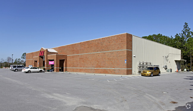
3911 E 15Th St, Panama City, FL 32404


NEARBY LISTINGS FOR SALE OR LEASE
Property Detail
3911 E 15Th St
Panama City-Panama City Beach, FL
St A B Dev Co Plat
14909-004-000
36 3S 14W ST A B DEV CO PLAT THE EAST 84 OF LOT 124 AND THE WEST 432 OF LOT 125 LESS HWY 98 R/W -1.1D- 117D ORB 2557 P 415
Storemultistory
Bay
A
Florida
12005C0361J
124,1
2024
2.99 AC
2025
Panama City
000500
Other Market Areas
18,000 SF
DEMOGRAPHICS near 3911 E 15Th St
1 mile
3 mile
5 mile
2024 Total Population
2,745
30,714
66,910
2029 Population
2,964
32,957
71,511
Pop Growth 2024-2029
+ 7.98%
+ 7.30%
+ 6.88%
Average Age
38
38
39
2024 Total Households
967
11,232
25,523
HH Growth 2024-2029
+ 8.48%
+ 7.80%
+ 7.39%
Median Household Inc
$53,218
$49,573
$55,992
Avg Household Size
2.60
2.60
2.50
2024 Avg HH Vehicles
2.00
2.00
2.00
Median Home Value
$191,443
$146,778
$190,327
Median Year Built
1986
1985
1986
Nearby Places
Map Layers
Map Styles
 Street
 Aerial
Transit
 Traffic
 Biking
Places
Listings with unknown addresses are not visible on the map
- Restaurants
- Banks
- Shops
- Fitness
- Groceries
PUBLIC TRANSPORTATION
AIRPORT
Northwest Florida Beaches International
Drive
Walk
Distance
Northwest Florida Beaches International
38 min
25.1 mi
Nearby Properties
Address
Land Use
TOTAL SIZE
Lot Size
Zoning
Address
Land Use
TOTAL SIZE
Lot Size
Zoning
226,068 SF
12.80 AC
Address
Land Use
TOTAL SIZE
Lot Size
Zoning
415,651 SF
266 AC
BC13
Address
Land Use
TOTAL SIZE
Lot Size
Zoning
55,300 SF
10.91 AC
PC12
Address
Land Use
TOTAL SIZE
Lot Size
Zoning
424,813 SF
30 AC
Address
Land Use
TOTAL SIZE
Lot Size
Zoning
Address
Land Use
TOTAL SIZE
Lot Size
Zoning
Address
Land Use
TOTAL SIZE
Lot Size
Zoning
115,472 SF
9.10 AC
Address
Land Use
TOTAL SIZE
Lot Size
Zoning
118,302 SF
8 AC
PC05
Address
Land Use
TOTAL SIZE
Lot Size
Zoning
126,234 SF
20.02 AC
PI
Address
Land Use
TOTAL SIZE
Lot Size
Zoning
46,706 SF
2.18 AC
PC09
Address
Land Use
TOTAL SIZE
Lot Size
Zoning
60,670 SF
15 AC
Address
Land Use
TOTAL SIZE
Lot Size
Zoning
189,909 SF
27.77 AC
PC14
Address
Land Use
TOTAL SIZE
Lot Size
Zoning
93,125 SF
12.04 AC
PI
Address
Land Use
TOTAL SIZE
Lot Size
Zoning
56,928 SF
6.80 AC
PC09
Address
Land Use
TOTAL SIZE
Lot Size
Zoning
46,176 SF
1.36 AC
PC09
Address
Land Use
TOTAL SIZE
Lot Size
Zoning
34,664 SF
19.20 AC
PC09
Address
Land Use
TOTAL SIZE
Lot Size
Zoning
181,571 SF
22.29 AC
CLWY04
Address
Land Use
TOTAL SIZE
Lot Size
Zoning
107,778 SF
10 AC
Address
Land Use
TOTAL SIZE
Lot Size
Zoning
63,324 SF
2.24 AC
PC09
Address
Land Use
TOTAL SIZE
Lot Size
Zoning
126,164 SF
9.81 AC
R5
Address
Land Use
TOTAL SIZE
Lot Size
Zoning
43,110 SF
2.54 AC
PC09
Address
Land Use
TOTAL SIZE
Lot Size
Zoning
74,914 SF
14.23 AC
BC02
Address
Land Use
TOTAL SIZE
Lot Size
Zoning
39,628 SF
4.45 AC
CLWY04
Address
Land Use
TOTAL SIZE
Lot Size
Zoning
45,836 SF
8.99 AC
BC05
Address
Land Use
TOTAL SIZE
Lot Size
Zoning
40,264 SF
2 AC
CLWY04
Address
Land Use
TOTAL SIZE
Lot Size
Zoning
43,564 SF
9.33 AC
C2
Address
Land Use
TOTAL SIZE
Lot Size
Zoning
42,456 SF
3.90 AC
CLWY04
Address
Land Use
TOTAL SIZE
Lot Size
Zoning
45,503 SF
4.83 AC
BC14
Address
Land Use
TOTAL SIZE
Lot Size
Zoning
45,403 SF
2.65 AC
CLWY04
Address
Land Use
TOTAL SIZE
Lot Size
Zoning
48,576 SF
5.20 AC
CLWY23
The World's #1 Commercial Real Estate Marketplace
Connect with us
© 2026 CoStar Group
The information above has been obtained from sources believed reliable. While we do not doubt its accuracy we have not verified it and make no guarantee, warranty or representation about it. It is your responsibility to independently confirm its accuracy and completeness. Any projections, opinions, assumptions, or estimates used are for example only and do not represent the current or future performance of the property. The value of this transaction to you depends on tax and other factors which should be evaluated by your tax, financial, and legal advisors. You and your advisors should conduct a careful, independent investigation of the property to determine to your satisfaction the suitability of the property for your needs.