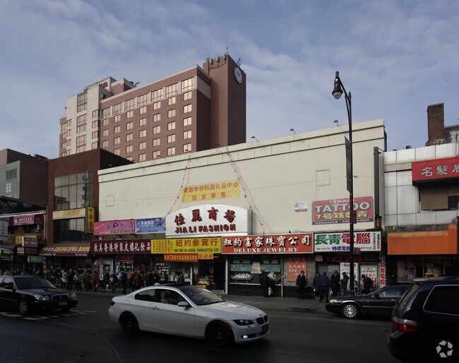
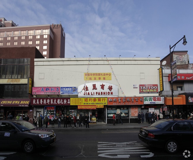
Property Record
3912 Main St, Flushing, NY 11354


Property Detail
3912 Main St
04976-0003
Queens
Storebuilding
New York
C4-2
3
B and X Area of moderate flood hazard, usually the area between the limits of the 100-year and 500-year floods.
0.34 AC
2024
Northeast Queens
2025
Long Island (New York)
087100
New York-Jersey City-White Plains, NY-NJ
27,000 SF
NEARBY LISTINGS FOR SALE OR LEASE
DEMOGRAPHICS near 3912 Main St
1 mile
3 mile
5 mile
2025 Total Population
127,471
747,800
1,615,146
2030 Population
129,893
741,782
1,593,141
Pop Growth 2025-2030
+ 1.90%
(0.80%)
(1.36%)
Average Age
46
43
42
2025 Total Households
45,985
256,903
565,412
HH Growth 2025-2030
+ 1.52%
(0.89%)
(1.59%)
Median Household Inc
$50,175
$73,626
$77,901
Avg Household Size
2.60
2.80
2.70
2025 Avg HH Vehicles
1.00
1.00
1.00
Median Home Value
$488,818
$669,366
$707,131
Median Year Built
1964
1955
1953
Nearby Places
Map Layers
Map Styles
 Street
 Aerial
Layers
 Traffic
 Biking
Places
Listings with unknown addresses are not visible on the map
- Restaurants
- Banks
- Shops
- Fitness
- Groceries
PUBLIC TRANSPORTATION
TRANSIT/SUBWAY
Flushing-Main Street (7 - New York MTA Subway (The Subway))
Drive
Walk
Distance
Flushing-Main Street (7 - New York MTA Subway (The Subway))
1 min
1 min
0.0 mi
Mets-Willets Point (7 - New York MTA Subway (The Subway))
Drive
Walk
Distance
Mets-Willets Point (7 - New York MTA Subway (The Subway))
3 min
17 min
0.9 mi
COMMUTER RAIL
Flushing-Main Street Station (Port Washington Branch - Long Island Rail Road)
Drive
Walk
Distance
Flushing-Main Street Station (Port Washington Branch - Long Island Rail Road)
1 min
5 min
0.2 mi
Murray Hill Station (Port Washington Branch - Long Island Rail Road)
Drive
Walk
Distance
Murray Hill Station (Port Washington Branch - Long Island Rail Road)
5 min
18 min
0.9 mi
AIRPORT
LaGuardia
Drive
Walk
Distance
LaGuardia
11 min
3.9 mi
John F Kennedy International
Drive
Walk
Distance
John F Kennedy International
18 min
11.2 mi
Newark Liberty International
Drive
Walk
Distance
Newark Liberty International
41 min
25.3 mi
SALE & LEASE HISTORY
LISTING DATE
SALE/LEASE

Sep 24, 2016
For Sale
Mar 17, 2017
For Lease
Mar 17, 2017
For Sale
Nearby Properties
Address
Land Use
TOTAL SIZE
Lot Size
Zoning
Address
Land Use
TOTAL SIZE
Lot Size
Zoning
2,078,606 SF
58.93 AC
R4
Address
Land Use
TOTAL SIZE
Lot Size
Zoning
1,258,350 SF
410.24 AC
PARK
Address
Land Use
TOTAL SIZE
Lot Size
Zoning
772,163 SF
5.24 AC
C4-5X
Address
Land Use
TOTAL SIZE
Lot Size
Zoning
1,292,074 SF
C4-2F
Address
Land Use
TOTAL SIZE
Lot Size
Zoning
234,891 SF
3.17 AC
C4-5X
Address
Land Use
TOTAL SIZE
Lot Size
Zoning
1,516,458 SF
5.97 AC
R7-1
Address
Land Use
TOTAL SIZE
Lot Size
Zoning
15,000 SF
255.27 AC
PARK
Address
Land Use
TOTAL SIZE
Lot Size
Zoning
4,050 SF
113.40 AC
PARK
Address
Land Use
TOTAL SIZE
Lot Size
Zoning
4,800 SF
80.10 AC
PARK
Address
Land Use
TOTAL SIZE
Lot Size
Zoning
332,266 SF
12.57 AC
M2-1
Address
Land Use
TOTAL SIZE
Lot Size
Zoning
1,186,778 SF
31.45 AC
R4
Address
Land Use
TOTAL SIZE
Lot Size
Zoning
344,116 SF
0.92 AC
R7-1
Address
Land Use
TOTAL SIZE
Lot Size
Zoning
577,654 SF
5.38 AC
R6
Address
Land Use
TOTAL SIZE
Lot Size
Zoning
521,944 SF
16.68 AC
R4
Address
Land Use
TOTAL SIZE
Lot Size
Zoning
360,000 SF
5.88 AC
C4-2
Address
Land Use
TOTAL SIZE
Lot Size
Zoning
248,200 SF
1.25 AC
R6
Address
Land Use
TOTAL SIZE
Lot Size
Zoning
377,896 SF
11.36 AC
R3-2
Address
Land Use
TOTAL SIZE
Lot Size
Zoning
250,577 SF
23.17 AC
M2-1
Address
Land Use
TOTAL SIZE
Lot Size
Zoning
266,195 SF
4.59 AC
C4-2
Address
Land Use
TOTAL SIZE
Lot Size
Zoning
272,081 SF
4.59 AC
C4-2
Address
Land Use
TOTAL SIZE
Lot Size
Zoning
281,416 SF
2.57 AC
C4-2
Address
Land Use
TOTAL SIZE
Lot Size
Zoning
382,302 SF
6.23 AC
R2A
Address
Land Use
TOTAL SIZE
Lot Size
Zoning
614,916 SF
28.10 AC
R4
Address
Land Use
TOTAL SIZE
Lot Size
Zoning
2,828 SF
78.05 AC
PARK
Address
Land Use
TOTAL SIZE
Lot Size
Zoning
192,200 SF
9.70 AC
R4
Address
Land Use
TOTAL SIZE
Lot Size
Zoning
454,631 SF
24.61 AC
M1-1
Address
Land Use
TOTAL SIZE
Lot Size
Zoning
4,279,575 SF
144.16 AC
PARK
Address
Land Use
TOTAL SIZE
Lot Size
Zoning
443,492 SF
27.75 AC
M1-1
Address
Land Use
TOTAL SIZE
Lot Size
Zoning
207,407 SF
3.73 AC
R6B
Address
Land Use
TOTAL SIZE
Lot Size
Zoning
454,645 SF
0.95 AC
C4-4
The World's #1 Commercial Real Estate Marketplace
Connect with us
© 2026 CoStar Group
The information above has been obtained from sources believed reliable. While we do not doubt its accuracy we have not verified it and make no guarantee, warranty or representation about it. It is your responsibility to independently confirm its accuracy and completeness. Any projections, opinions, assumptions, or estimates used are for example only and do not represent the current or future performance of the property. The value of this transaction to you depends on tax and other factors which should be evaluated by your tax, financial, and legal advisors. You and your advisors should conduct a careful, independent investigation of the property to determine to your satisfaction the suitability of the property for your needs.